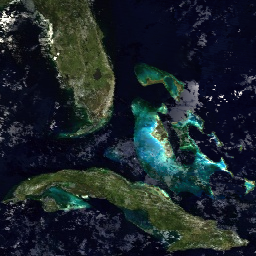
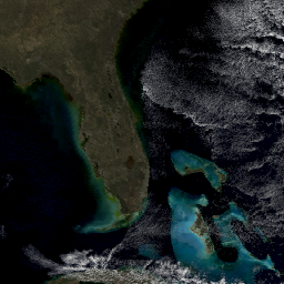
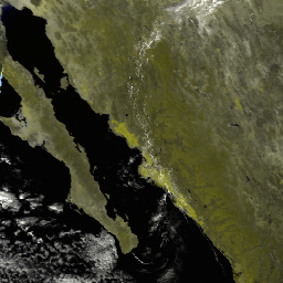
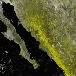
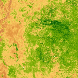
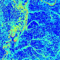
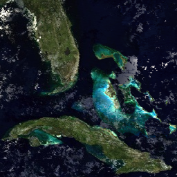
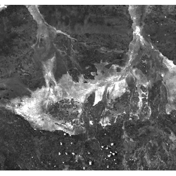
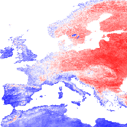
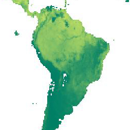
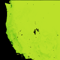
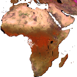
 Modis数据集
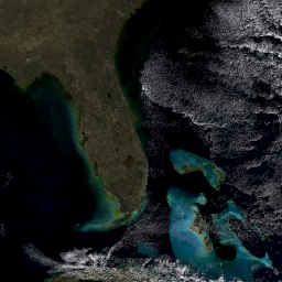
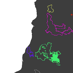
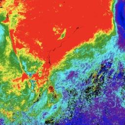
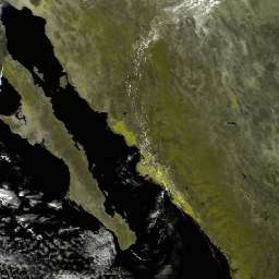
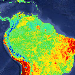
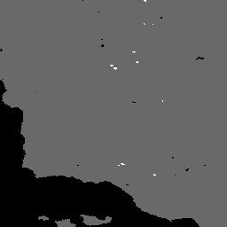
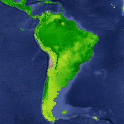
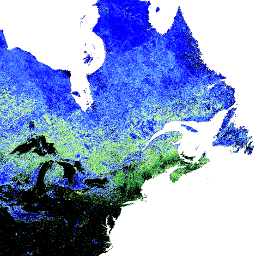
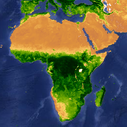
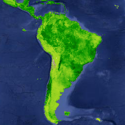
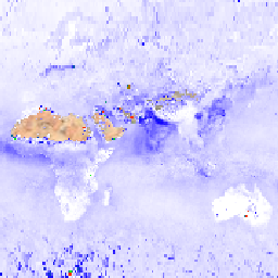
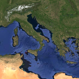
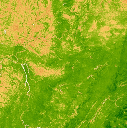
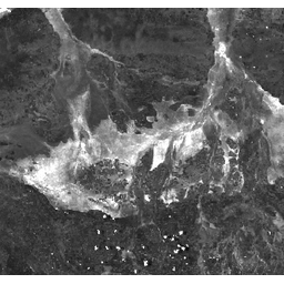
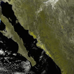
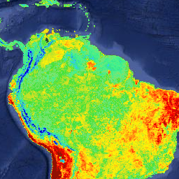
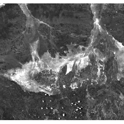
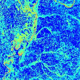
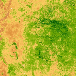
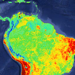
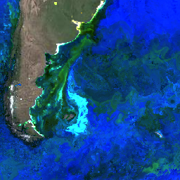
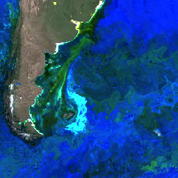
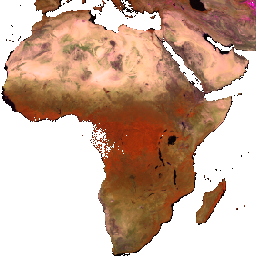
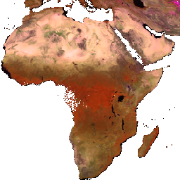
MOD09GA.006 Terra Surface Reflectance Daily Global 1km and 500m
NASA LP DAAC at the USGS EROS Center
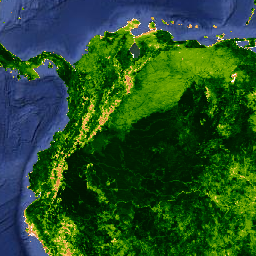
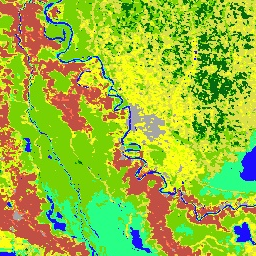
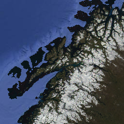
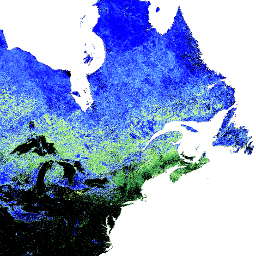
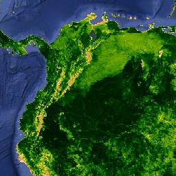
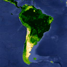
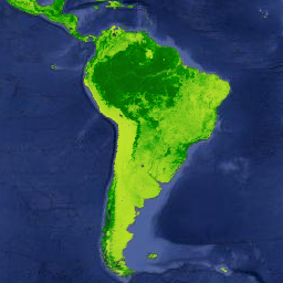
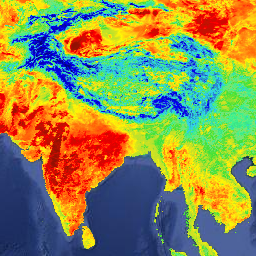
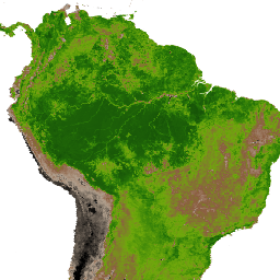
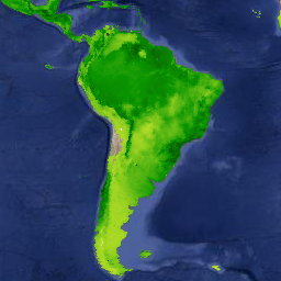
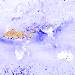
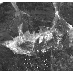
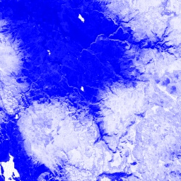
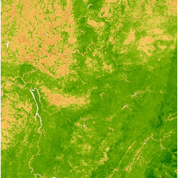
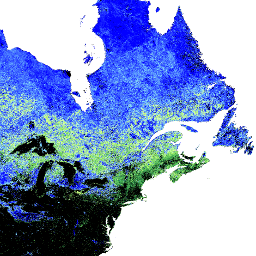
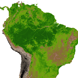
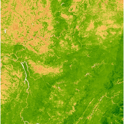
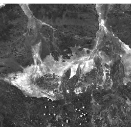
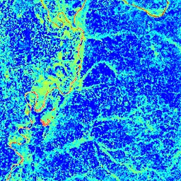
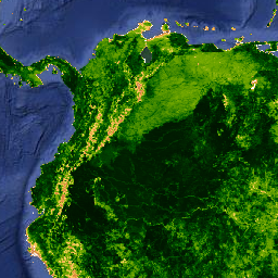
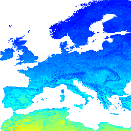
MOD13A1.005 Vegetation Indices 16-Day L3 Global 500m deprecated
NASA LP DAAC at the USGS EROS Center
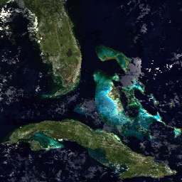
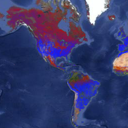
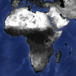
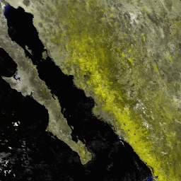
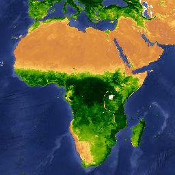
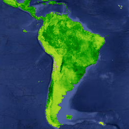
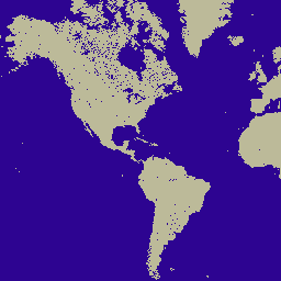
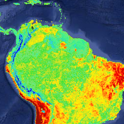
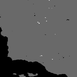
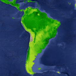
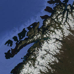
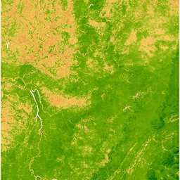
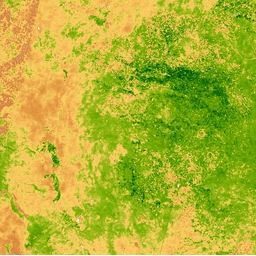
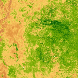
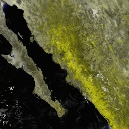
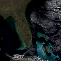
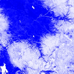
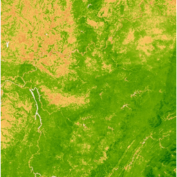
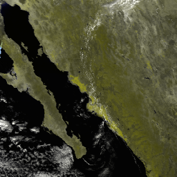
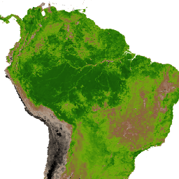
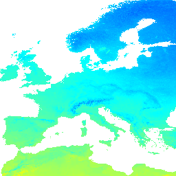
MYD09A1.005 Surface Reflectance 8-Day L3 Global 500m deprecated
NASA LP DAAC at the USGS EROS Center

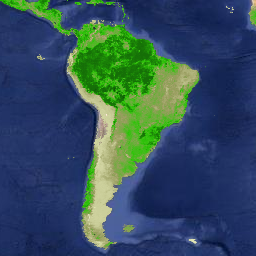
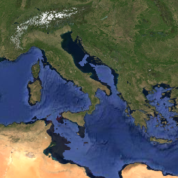
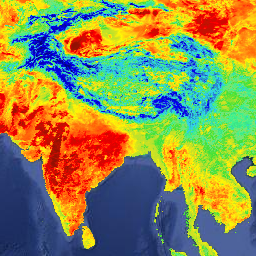
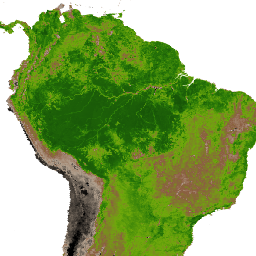
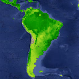
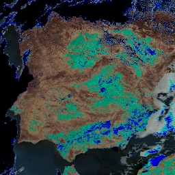
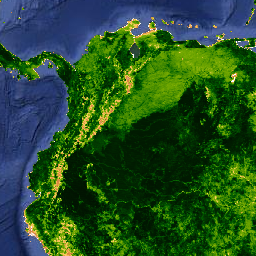
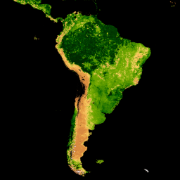
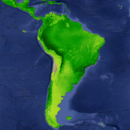
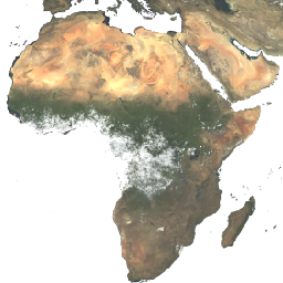
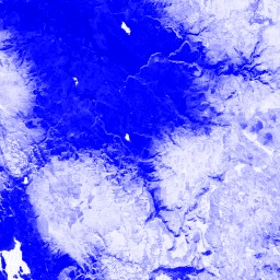
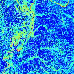
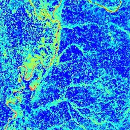
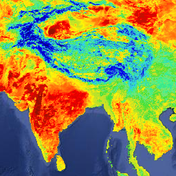
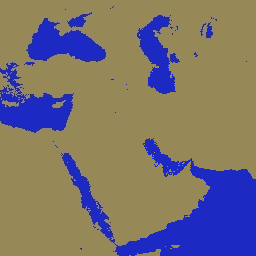
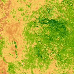
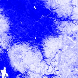
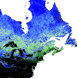
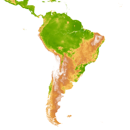
MYD09Q1.005 Surface Reflectance 8-Day L3 Global 250m deprecated
NASA LP DAAC at the USGS EROS Center
- img: https://pics.landcover100.com/pics/image/87aaBB.png
  link: https://developers.google.com/earth-engine/datasets/catalog/ESA_CCI_FireCCI_5_1#terms-of-use
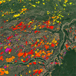
  name: FireCCI51 MODIS Fire_cci Burned Area Pixel Product, Version 5.1
  desc: European Space Agency (ESA) Climate Change Initiative (CCI) Programme, Fire ECV
  author: burn, c3s, cci, climate_change, copernicus, esa, fire, firecci, firecci51, fragmentation, gcos, geophysical, global, human_modification, landcover, landscape_gradient, modis, monthly, stressors
- img: https://pics.landcover100.com/pics/image/105aaBB.png
  link: https://developers.google.com/earth-engine/datasets/catalog/FIRMS#terms-of-use
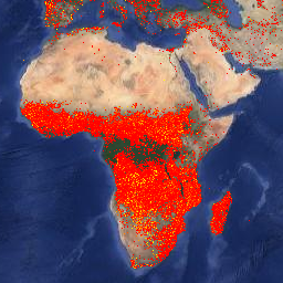
  name: FIRMS Fire Information for Resource Management System
  desc: NASA / LANCE / EOSDIS
  author: eosdis, fire, firms, geophysical, hotspot, lance, modis, nasa, thermal
- img: https://pics.landcover100.com/pics/image/106aaBB.png
  link: https://developers.google.com/earth-engine/datasets/catalog/FORMA_FORMA_500m#terms-of-use
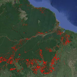
  name: FORMA Global Forest Watch Deforestation Alerts, 500m deprecated
  desc: Global Forest Watch, World Resources Institute
  author: alerts, deforestation, forest, forma, geophysical, gfw, modis, nasa, wri
- img: https://pics.landcover100.com/pics/image/193aaBB.png
  link: https://developers.google.com/earth-engine/datasets/catalog/JRC_GWIS_GlobFire_v2_DailyPerimeters#terms-of-use
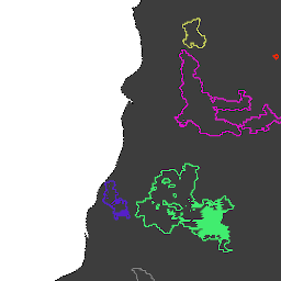
  name: GlobFire Daily Fire Event Detection Based on MCD64A1
  desc: European Commission, Joint Research Centre, Global Wildfire Information System
  author: area, burnt, disaster, fire, globfire, mcd64a1, modis-derived, wildfire
- img: https://pics.landcover100.com/pics/image/194aaBB.png
  link: https://spdx.org/licenses/CC-BY-4.0.html
  name: GlobFire Final Fire Event Detection Based on MCD64A1
  desc: European Commission, Joint Research Centre, Global Wildfire Information System
  author: area, burnt, disaster, fire, globfire, mcd64a1, modis-derived, wildfire
- img: https://pics.landcover100.com/pics/image/516aaBB.png
  link: https://developers.google.com/earth-engine/datasets/catalog/MODIS_006_MCD12Q1#terms-of-use
  name: MCD12Q1.006 MODIS Land Cover Type Yearly Global 500m
  desc: NASA LP DAAC at the USGS EROS Center
  author: landcover, mcd12q1, modis, nasa, usgs, yearly
- img: https://pics.landcover100.com/pics/image/517aaBB.png
  link: https://developers.google.com/earth-engine/datasets/catalog/MODIS_006_MCD12Q2#terms-of-use
  name: MCD12Q2.006 Land Cover Dynamics Yearly Global 500m
  desc: NASA LP DAAC at the USGS EROS Center
  author: evi, global, mcd12q2, modis, onset_greenness, phenology, usgs, yearly
- img: https://pics.landcover100.com/pics/image/518aaBB.png
  link: https://developers.google.com/earth-engine/datasets/catalog/MODIS_006_MCD15A3H#terms-of-use
  name: MCD15A3H.006 MODIS Leaf Area Index/FPAR 4-Day Global 500m
  desc: NASA LP DAAC at the USGS EROS Center
  author: 4-day, fpar, global, lai, mcd115a3h, modis, nasa, usgs, vegetation
- img: https://pics.landcover100.com/pics/image/519aaBB.png
  link: https://developers.google.com/earth-engine/datasets/catalog/MODIS_006_MCD19A2_GRANULES#terms-of-use
  name: MCD19A2.006 Terra & Aqua MAIAC Land Aerosol Optical Depth Daily 1km
  desc: NASA LP DAAC at the USGS EROS Center
  author: aerosol, aod, aqua, daily, global, maiac, mcd19a2, modis, nasa, terra, usgs
- img: https://pics.landcover100.com/pics/image/520aaBB.png
  link: https://developers.google.com/earth-engine/datasets/catalog/MODIS_006_MCD43A1#terms-of-use
  name: MCD43A1.006 MODIS BRDF-Albedo Model Parameters Daily 500m
  desc: NASA LP DAAC at the USGS EROS Center
  author: albedo, brdf, daily, global, mcd43a1, modis, nasa, reflectance, usgs
- img: https://pics.landcover100.com/pics/image/521aaBB.png
  link: https://developers.google.com/earth-engine/datasets/catalog/MODIS_006_MCD43A2#terms-of-use
  name: MCD43A2.006 MODIS BRDF-Albedo Quality Daily 500m
  desc: NASA LP DAAC at the USGS EROS Center
  author: albedo, brdf, daily, global, mcd43a2, modis, nasa, quality, reflectance, usgs
- img: https://pics.landcover100.com/pics/image/522aaBB.png
  link: https://developers.google.com/earth-engine/datasets/catalog/MODIS_006_MCD43A3#terms-of-use
  name: MCD43A3.006 MODIS Albedo Daily 500m
  desc: NASA LP DAAC at the USGS EROS Center
  author: albedo, black_sky, daily, global, mcd43a3, modis, nasa, usgs, white_sky
- img: https://pics.landcover100.com/pics/image/523aaBB.png
  link: https://developers.google.com/earth-engine/datasets/catalog/MODIS_006_MCD43A4#terms-of-use
  name: MCD43A4.006 MODIS Nadir BRDF-Adjusted Reflectance Daily 500m
  desc: NASA LP DAAC at the USGS EROS Center
  author: albedo, brdf, daily, global, mcd43a4, modis, nasa, reflectance, usgs
- img: https://pics.landcover100.com/pics/image/524aaBB.png
  link: https://developers.google.com/earth-engine/datasets/catalog/MODIS_006_MCD43C3#terms-of-use
  name: MCD43C3.00C BRDF/Albedo Daily L3 0.05 Deg CMG
  desc: NASA LP DAAC at the USGS EROS Center
  author: albedo, black_sky, brdf, daily, global, mcd43c3, modis, nasa, usgs, white_sky
- img: https://pics.landcover100.com/pics/image/525aaBB.png
  link: https://developers.google.com/earth-engine/datasets/catalog/MODIS_006_MCD64A1#terms-of-use
  name: MCD64A1.006 MODIS Burned Area Monthly Global 500m
  desc: NASA LP DAAC at the USGS EROS Center
  author: burn, fire, geophysical, global, mcd64a1, modis, monthly, nasa, usgs
- img: https://pics.landcover100.com/pics/image/526aaBB.png
  link: https://developers.google.com/earth-engine/datasets/catalog/MODIS_006_MOD08_M3#terms-of-use
  name: MOD08_M3.006 Terra Aerosol Cloud Water Vapor Ozone Monthly Global Product 1Deg CMG deprecated
  desc: NASA LAADS DAAC at NASA Goddard Space Flight Center
  author: atmosphere, geophysical, global, mod08, mod08_m3, modis, monthly, nasa, temperature, terra, usgs
- img: https://pics.landcover100.com/pics/image/527aaBB.png
  link: https://developers.google.com/earth-engine/datasets/catalog/MODIS_006_MOD09A1#terms-of-use
  name: MOD09A1.006 Terra Surface Reflectance 8-Day Global 500m
  desc: NASA LP DAAC at the USGS EROS Center
  author: 8-day, global, mod09a1, modis, nasa, sr, surface_reflectance, terra, usgs
- img: https://pics.landcover100.com/pics/image/528aaBB.png
  link: https://developers.google.com/earth-engine/datasets/catalog/MODIS_006_MOD09GA#terms-of-use
  name: MOD09GA.006 Terra Surface Reflectance Daily Global 1km and 500m
  desc: NASA LP DAAC at the USGS EROS Center
  author: daily, global, mod09ga, modis, nasa, sr, surface_reflectance, terra, usgs
- img: https://pics.landcover100.com/pics/image/529aaBB.png
  link: https://developers.google.com/earth-engine/datasets/catalog/MODIS_006_MOD09GQ#terms-of-use
  name: MOD09GQ.006 Terra Surface Reflectance Daily Global 250m
  desc: NASA LP DAAC at the USGS EROS Center
  author: daily, global, mod09gq, modis, nasa, sr, surface_reflectance, terra, usgs
- img: https://pics.landcover100.com/pics/image/530aaBB.png
  link: https://developers.google.com/earth-engine/datasets/catalog/MODIS_006_MOD09Q1#terms-of-use
  name: MOD09Q1.006 Terra Surface Reflectance 8-Day Global 250m
  desc: NASA LP DAAC at the USGS EROS Center
  author: 8-day, global, mod09q1, modis, nasa, sr, surface_reflectance, terra, usgs
- img: https://pics.landcover100.com/pics/image/531aaBB.png
  link: https://developers.google.com/earth-engine/datasets/catalog/MODIS_006_MOD10A1#terms-of-use
  name: MOD10A1.006 Terra Snow Cover Daily Global 500m
  desc: NASA NSIDC DAAC at CIRES
  author: albedo, daily, geophysical, global, mod10a1, modis, nasa, nsidc, snow, terra
- img: https://pics.landcover100.com/pics/image/532aaBB.png
  link: https://developers.google.com/earth-engine/datasets/catalog/MODIS_006_MOD11A1#terms-of-use
  name: MOD11A1.006 Terra Land Surface Temperature and Emissivity Daily Global 1km
  desc: NASA LP DAAC at the USGS EROS Center
  author: daily, emissivity, global, lst, mod11a1, modis, nasa, surface_temperature, terra, usgs
- img: https://pics.landcover100.com/pics/image/533aaBB.png
  link: https://developers.google.com/earth-engine/datasets/catalog/MODIS_006_MOD11A2#terms-of-use
  name: MOD11A2.006 Terra Land Surface Temperature and Emissivity 8-Day Global 1km
  desc: NASA LP DAAC at the USGS EROS Center
  author: 8-day, emissivity, global, lst, mod11a2, modis, nasa, surface_temperature, terra, usgs
- img: https://pics.landcover100.com/pics/image/534aaBB.png
  link: https://developers.google.com/earth-engine/datasets/catalog/MODIS_006_MOD13A1#terms-of-use
  name: MOD13A1.006 Terra Vegetation Indices 16-Day Global 500m
  desc: NASA LP DAAC at the USGS EROS Center
  author: 16-day, evi, global, mod13a1, modis, nasa, ndvi, terra, usgs, vegetation
- img: https://pics.landcover100.com/pics/image/535aaBB.png
  link: https://developers.google.com/earth-engine/datasets/catalog/MODIS_006_MOD13A2#terms-of-use
  name: MOD13A2.006 Terra Vegetation Indices 16-Day Global 1km
  desc: NASA LP DAAC at the USGS EROS Center
  author: 16-day, evi, global, mod13a2, modis, nasa, ndvi, terra, usgs, vegetation
- img: https://pics.landcover100.com/pics/image/536aaBB.png
  link: https://developers.google.com/earth-engine/datasets/catalog/MODIS_006_MOD13Q1#terms-of-use
  name: MOD13Q1.006 Terra Vegetation Indices 16-Day Global 250m
  desc: NASA LP DAAC at the USGS EROS Center
  author: 16-day, evi, global, mod13q1, modis, nasa, ndvi, terra, usgs, vegetation
- img: https://pics.landcover100.com/pics/image/537aaBB.png
  link: https://developers.google.com/earth-engine/datasets/catalog/MODIS_006_MOD14A1#terms-of-use
  name: MOD14A1.006 Terra Thermal Anomalies & Fire Daily Global 1km
  desc: NASA LP DAAC at the USGS EROS Center
  author: daily, fire, global, mod14a1, modis, nasa, terra, usgs
- img: https://pics.landcover100.com/pics/image/538aaBB.png
  link: https://developers.google.com/earth-engine/datasets/catalog/MODIS_006_MOD14A2#terms-of-use
  name: MOD14A2.006 Terra Thermal Anomalies & Fire 8-Day Global 1km
  desc: NASA LP DAAC at the USGS EROS Center
  author: 8-day, fire, global, mod14a2, modis, nasa, terra, usgs
- img: https://pics.landcover100.com/pics/image/539aaBB.png
  link: https://developers.google.com/earth-engine/datasets/catalog/MODIS_006_MOD15A2H#terms-of-use
  name: MOD15A2H.006 Terra Leaf Area Index/FPAR 8-Day Global 500m
  desc: NASA LP DAAC at the USGS EROS Center
  author: 8-day, fpar, global, lai, mod15a2h, modis, nasa, terra, usgs
- img: https://pics.landcover100.com/pics/image/540aaBB.png
  link: https://developers.google.com/earth-engine/datasets/catalog/MODIS_006_MOD16A2#terms-of-use
  name: MOD16A2.006 Terra Net Evapotranspiration 8-Day Global 500m
  desc: NASA LP DAAC at the USGS EROS Center
  author: 8-day, evapotranspiration, global, mod16a2, modis, nasa
- img: https://pics.landcover100.com/pics/image/541aaBB.png
  link: https://developers.google.com/earth-engine/datasets/catalog/MODIS_006_MOD17A2H#terms-of-use
  name: MOD17A2H.006 Terra Gross Primary Productivity 8-Day Global 500M 500m
  desc: NASA LP DAAC at the USGS EROS Center
  author: 8-day, global, gpp, mod17a2, modis, nasa, photosynthesis, productivity, psn, terra, usgs
- img: https://pics.landcover100.com/pics/image/542aaBB.png
  link: https://developers.google.com/earth-engine/datasets/catalog/MODIS_006_MOD17A3H#terms-of-use
  name: MOD17A3H.006 Terra Net Primary Production Yearly Global 500m deprecated
  desc: NASA LP DAAC at the USGS EROS Center
  author: global, gpp, mod17a3, modis, nasa, npp, photosynthesis, productivity, psn, terra, usgs, yearly
- img: https://pics.landcover100.com/pics/image/543aaBB.png
  link: https://developers.google.com/earth-engine/datasets/catalog/MODIS_006_MOD17A3HGF#terms-of-use
  name: MOD17A3HGF.006 Terra Net Primary Production  Gap-Filled Yearly Global 500m
  desc: NASA LP DAAC at the USGS EROS Center
  author: global, gpp, mod17a3, mod17a3gf, modis, nasa, npp, photosynthesis, productivity, psn, terra, usgs, yearly
- img: https://pics.landcover100.com/pics/image/544aaBB.png
  link: https://developers.google.com/earth-engine/datasets/catalog/MODIS_006_MOD44B#terms-of-use
  name: MOD44B.006 Terra Vegetation Continuous Fields Yearly Global 250m
  desc: NASA LP DAAC at the USGS EROS Center
  author: annual, geophysical, global, mod44b, modis, nasa, terra, tree_cover, vegetation
- img: https://pics.landcover100.com/pics/image/545aaBB.png
  link: https://developers.google.com/earth-engine/datasets/catalog/MODIS_006_MOD44W#terms-of-use
  name: MOD44W.006 Terra Land Water Mask Derived From MODIS and SRTM Yearly Global 250m
  desc: NASA LP DAAC at the USGS EROS Center
  author: geophysical, mod44w, modis, nasa, srtm, usgs, water_mask
- img: https://pics.landcover100.com/pics/image/546aaBB.png
  link: https://developers.google.com/earth-engine/datasets/catalog/MODIS_006_MODOCGA#terms-of-use
  name: MODOCGA.006 Terra Ocean Reflectance Daily Global 1km
  desc: NASA LP DAAC at the USGS EROS Center
  author: daily, global, modis, modocga, nasa, ocean, reflectance, sr, terra, usgs
- img: https://pics.landcover100.com/pics/image/547aaBB.png
  link: https://developers.google.com/earth-engine/datasets/catalog/MODIS_006_MYD08_M3#terms-of-use
  name: MYD08_M3.006 Aqua Aerosol Cloud Water Vapor Ozone Monthly Global Product 1Deg CMG deprecated
  desc: NASA LAADS DAAC at NASA Goddard Space Flight Center
  author: aqua, atmosphere, geophysical, global, modis, monthly, myd08, myd08_m3, nasa, temperature, usgs
- img: https://pics.landcover100.com/pics/image/548aaBB.png
  link: https://developers.google.com/earth-engine/datasets/catalog/MODIS_006_MYD09A1#terms-of-use
  name: MYD09A1.006 Aqua Surface Reflectance 8-Day Global 500m
  desc: NASA LP DAAC at the USGS EROS Center
  author: 8-day, aqua, global, modis, myd09a1, nasa, sr, surface_reflectance, usgs
- img: https://pics.landcover100.com/pics/image/549aaBB.png
  link: https://developers.google.com/earth-engine/datasets/catalog/MODIS_006_MYD09GA#terms-of-use
  name: MYD09GA.006 Aqua Surface Reflectance Daily Global 1km and 500m
  desc: NASA LP DAAC at the USGS EROS Center
  author: aqua, daily, global, modis, myd09ga, nasa, sr, surface_reflectance, usgs
- img: https://pics.landcover100.com/pics/image/550aaBB.png
  link: https://developers.google.com/earth-engine/datasets/catalog/MODIS_006_MYD09GQ#terms-of-use
  name: MYD09GQ.006 Aqua Surface Reflectance Daily Global 250m
  desc: NASA LP DAAC at the USGS EROS Center
  author: aqua, daily, global, modis, myd09gq, nasa, sr, surface_reflectance, usgs
- img: https://pics.landcover100.com/pics/image/551aaBB.png
  link: https://developers.google.com/earth-engine/datasets/catalog/MODIS_006_MYD09Q1#terms-of-use
  name: MYD09Q1.006 Aqua Surface Reflectance 8-Day Global 250m
  desc: NASA LP DAAC at the USGS EROS Center
  author: 8-day, aqua, global, modis, myd09q1, nasa, sr, surface_reflectance, usgs
- img: https://pics.landcover100.com/pics/image/552aaBB.png
  link: https://developers.google.com/earth-engine/datasets/catalog/MODIS_006_MYD10A1#terms-of-use
  name: MYD10A1.006 Aqua Snow Cover Daily Global 500m
  desc: NASA NSIDC DAAC at CIRES
  author: albedo, aqua, daily, geophysical, global, modis, myd10a1, nasa, nsidc, snow
- img: https://pics.landcover100.com/pics/image/553aaBB.png
  link: https://developers.google.com/earth-engine/datasets/catalog/MODIS_006_MYD11A1#terms-of-use
  name: MYD11A1.006 Aqua Land Surface Temperature and Emissivity Daily Global 1km
  desc: NASA LP DAAC at the USGS EROS Center
  author: aqua, daily, emissivity, global, lst, modis, myd11a1, nasa, surface_temperature, usgs
- img: https://pics.landcover100.com/pics/image/554aaBB.png
  link: https://developers.google.com/earth-engine/datasets/catalog/MODIS_006_MYD11A2#terms-of-use
  name: MYD11A2.006 Aqua Land Surface Temperature and Emissivity 8-Day Global 1km
  desc: NASA LP DAAC at the USGS EROS Center
  author: 8-day, aqua, emissivity, global, lst, modis, myd11a2, nasa, surface_temperature, usgs
- img: https://pics.landcover100.com/pics/image/555aaBB.png
  link: https://developers.google.com/earth-engine/datasets/catalog/MODIS_006_MYD13A1#terms-of-use
  name: MYD13A1.006 Aqua Vegetation Indices 16-Day Global 500m
  desc: NASA LP DAAC at the USGS EROS Center
  author: 16-day, aqua, evi, global, modis, myd13a1, nasa, ndvi, usgs, vegetation
- img: https://pics.landcover100.com/pics/image/556aaBB.png
  link: https://developers.google.com/earth-engine/datasets/catalog/MODIS_006_MYD13A2#terms-of-use
  name: MYD13A2.006 Aqua Vegetation Indices 16-Day Global 1km
  desc: NASA LP DAAC at the USGS EROS Center
  author: 16-day, aqua, evi, global, modis, myd13a2, nasa, ndvi, usgs, vegetation
- img: https://pics.landcover100.com/pics/image/557aaBB.png
  link: https://developers.google.com/earth-engine/datasets/catalog/MODIS_006_MYD13Q1#terms-of-use
  name: MYD13Q1.006 Aqua Vegetation Indices 16-Day Global 250m
  desc: NASA LP DAAC at the USGS EROS Center
  author: 16-day, aqua, evi, global, modis, myd13q1, nasa, ndvi, usgs, vegetation
- img: https://pics.landcover100.com/pics/image/558aaBB.png
  link: https://developers.google.com/earth-engine/datasets/catalog/MODIS_006_MYD14A1#terms-of-use
  name: MYD14A1.006 Aqua Thermal Anomalies & Fire Daily Global 1km
  desc: NASA LP DAAC at the USGS EROS Center
  author: aqua, daily, fire, global, modis, myd14a1, nasa, usgs
- img: https://pics.landcover100.com/pics/image/559aaBB.png
  link: https://developers.google.com/earth-engine/datasets/catalog/MODIS_006_MYD14A2#terms-of-use
  name: MYD14A2.006 Aqua Thermal Anomalies & Fire 8-Day Global 1km
  desc: NASA LP DAAC at the USGS EROS Center
  author: 8-day, aqua, fire, global, modis, myd14a2, nasa, usgs
- img: https://pics.landcover100.com/pics/image/560aaBB.png
  link: https://developers.google.com/earth-engine/datasets/catalog/MODIS_006_MYD15A2H#terms-of-use
  name: MYD15A2H.006 Aqua Leaf Area Index/FPAR 8-Day Global 500m
  desc: NASA LP DAAC at the USGS EROS Center
  author: 8-day, aqua, fpar, global, lai, modis, myd15a2h, nasa, usgs
- img: https://pics.landcover100.com/pics/image/561aaBB.png
  link: https://developers.google.com/earth-engine/datasets/catalog/MODIS_006_MYD17A2H#terms-of-use
  name: MYD17A2H.006 Aqua Gross Primary Productivity 8-Day Global 500M 500m
  desc: NASA LP DAAC at the USGS EROS Center
  author: 8-day, aqua, global, gpp, modis, myd17a2, nasa, photosynthesis, productivity, psn, usgs
- img: https://pics.landcover100.com/pics/image/562aaBB.png
  link: https://developers.google.com/earth-engine/datasets/catalog/MODIS_006_MYD17A3H#terms-of-use
  name: MYD17A3H.006 Aqua Net Primary Production Yearly Global 500m deprecated
  desc: NASA LP DAAC at the USGS EROS Center
  author: aqua, global, gpp, modis, myd17a3, nasa, npp, photosynthesis, productivity, psn, usgs, yearly
- img: https://pics.landcover100.com/pics/image/563aaBB.png
  link: https://developers.google.com/earth-engine/datasets/catalog/MODIS_006_MYD17A3HGF#terms-of-use
  name: MYD17A3HGF.006 Aqua Net Primary Production  Gap-Filled Yearly Global 500m
  desc: NASA LP DAAC at the USGS EROS Center
  author: aqua, global, gpp, modis, myd17a3, myd17a3gf, nasa, npp, photosynthesis, productivity, psn, usgs, yearly
- img: https://pics.landcover100.com/pics/image/564aaBB.png
  link: https://developers.google.com/earth-engine/datasets/catalog/MODIS_006_MYDOCGA#terms-of-use
  name: MYDOCGA.006 Aqua Ocean Reflectance Daily Global 1km
  desc: NASA LP DAAC at the USGS EROS Center
  author: aqua, daily, global, modis, mydocga, nasa, ocean, reflectance, sr, usgs
- img: https://pics.landcover100.com/pics/image/565aaBB.png
  link: https://developers.google.com/earth-engine/datasets/catalog/MODIS_055_MOD17A3#terms-of-use
  name: MOD17A3.055 Terra Net Primary Production Yearly Global 1km deprecated
  desc: NASA LP DAAC at the USGS EROS Center
  author: global, gpp, mod17a3, modis, npp, photosynthesis, productivity, psn, terra, yearly
- img: https://pics.landcover100.com/pics/image/566aaBB.png
  link: https://developers.google.com/earth-engine/datasets/catalog/MODIS_061_MOD08_M3#terms-of-use
  name: MOD08_M3.061 Terra Atmosphere Monthly Global Product
  desc: NASA LAADS DAAC at NASA Goddard Space Flight Center
  author: atmosphere, geophysical, global, mod08, mod08_m3, modis, monthly, nasa, temperature, terra, usgs
- img: https://pics.landcover100.com/pics/image/567aaBB.png
  link: https://developers.google.com/earth-engine/datasets/catalog/MODIS_061_MYD08_M3#terms-of-use
  name: MYD08_M3.061 Aqua Atmosphere Monthly Global Product
  desc: NASA LAADS DAAC at NASA Goddard Space Flight Center
  author: aqua, atmosphere, geophysical, global, modis, monthly, myd08, myd08_m3, nasa, temperature, usgs
- img: https://pics.landcover100.com/pics/image/568aaBB.png
  link: https://developers.google.com/earth-engine/datasets/catalog/MODIS_MCD43A1#terms-of-use
  name: MCD43A1.005 BRDF-Albedo Model Parameters 16-Day L3 Global 500m deprecated
  desc: NASA LP DAAC at the USGS EROS Center
  author: 16-day, albedo, brdf, global, mcd43a1, modis, reflectance, usgs
- img: https://pics.landcover100.com/pics/image/569aaBB.png
  link: https://developers.google.com/earth-engine/datasets/catalog/MODIS_MCD43A2#terms-of-use
  name: MCD43A2.005 BRDF-Albedo Quality 16-Day Global 500m deprecated
  desc: NASA LP DAAC at the USGS EROS Center
  author: 16-day, albedo, brdf, global, mcd43a2, modis, quality, reflectance, usgs
- img: https://pics.landcover100.com/pics/image/570aaBB.png
  link: https://developers.google.com/earth-engine/datasets/catalog/MODIS_MCD43A4#terms-of-use
  name: MCD43A4.005 BRDF-Adjusted Reflectance 16-Day Global 500m deprecated
  desc: NASA LP DAAC at the USGS EROS Center
  author: 16-day, brdf, global, mcd43a4, modis, nbar, reflectance, surface_reflectance, usgs
- img: https://pics.landcover100.com/pics/image/571aaBB.png
  link: https://developers.google.com/earth-engine/datasets/catalog/MODIS_MCD43A4_006_BAI#terms-of-use
  name: MODIS Combined 16-Day BAI
  desc: Google
  author: bai, modis, usgs
- img: https://pics.landcover100.com/pics/image/572aaBB.png
  link: https://developers.google.com/earth-engine/datasets/catalog/MODIS_MCD43A4_006_EVI#terms-of-use
  name: MODIS Combined 16-Day EVI
  desc: Google
  author: evi, modis, usgs
- img: https://pics.landcover100.com/pics/image/573aaBB.png
  link: https://developers.google.com/earth-engine/datasets/catalog/MODIS_MCD43A4_006_NDSI#terms-of-use
  name: MODIS Combined 16-Day NDSI
  desc: Google
  author: modis, ndsi, usgs
- img: https://pics.landcover100.com/pics/image/574aaBB.png
  link: https://developers.google.com/earth-engine/datasets/catalog/MODIS_MCD43A4_006_NDVI#terms-of-use
  name: MODIS Combined 16-Day NDVI
  desc: Google
  author: modis, ndvi, usgs
- img: https://pics.landcover100.com/pics/image/575aaBB.png
  link: https://developers.google.com/earth-engine/datasets/catalog/MODIS_MCD43A4_006_NDWI#terms-of-use
  name: MODIS Combined 16-Day NDWI
  desc: Google
  author: modis, ndwi, usgs
- img: https://pics.landcover100.com/pics/image/576aaBB.png
  link: https://developers.google.com/earth-engine/datasets/catalog/MODIS_MCD43A4_BAI#terms-of-use
  name: MODIS Combined 16-Day BAI deprecated
  desc: Google
  author: bai, modis, usgs
- img: https://pics.landcover100.com/pics/image/577aaBB.png
  link: https://developers.google.com/earth-engine/datasets/catalog/MODIS_MCD43A4_EVI#terms-of-use
  name: MODIS Combined 16-Day EVI deprecated
  desc: Google
  author: evi, modis, usgs
- img: https://pics.landcover100.com/pics/image/578aaBB.png
  link: https://developers.google.com/earth-engine/datasets/catalog/MODIS_MCD43A4_NDSI#terms-of-use
  name: MODIS Combined 16-Day NDSI deprecated
  desc: Google
  author: modis, ndsi, usgs
- img: https://pics.landcover100.com/pics/image/579aaBB.png
  link: https://developers.google.com/earth-engine/datasets/catalog/MODIS_MCD43A4_NDVI#terms-of-use
  name: MODIS Combined 16-Day NDVI deprecated
  desc: Google
  author: modis, ndvi, usgs
- img: https://pics.landcover100.com/pics/image/580aaBB.png
  link: https://developers.google.com/earth-engine/datasets/catalog/MODIS_MCD43A4_NDWI#terms-of-use
  name: MODIS Combined 16-Day NDWI deprecated
  desc: Google
  author: modis, ndwi, usgs
- img: https://pics.landcover100.com/pics/image/581aaBB.png
  link: https://developers.google.com/earth-engine/datasets/catalog/MODIS_MOD09A1#terms-of-use
  name: MOD09A1.005 Surface Reflectance 8-Day Global 500m deprecated
  desc: NASA LP DAAC at the USGS EROS Center
  author: 8-day, global, mod09a1, modis, surface_reflectance, terra
- img: https://pics.landcover100.com/pics/image/582aaBB.png
  link: https://developers.google.com/earth-engine/datasets/catalog/MODIS_MOD09GA#terms-of-use
  name: MOD09GA.005 Terra Surface Reflectance Daily L2G Global 1km and 500m deprecated
  desc: NASA LP DAAC at the USGS EROS Center
  author: daily, global, mod09ga, modis, surface_reflectance, terra, usgs
- img: https://pics.landcover100.com/pics/image/583aaBB.png
  link: https://developers.google.com/earth-engine/datasets/catalog/MODIS_MOD09GA_006_BAI#terms-of-use
  name: MODIS Terra Daily BAI
  desc: Google
  author: bai, modis, usgs
- img: https://pics.landcover100.com/pics/image/584aaBB.png
  link: https://developers.google.com/earth-engine/datasets/catalog/MODIS_MOD09GA_006_EVI#terms-of-use
  name: MODIS Terra Daily EVI
  desc: Google
  author: evi, modis, usgs
- img: https://pics.landcover100.com/pics/image/585aaBB.png
  link: https://developers.google.com/earth-engine/datasets/catalog/MODIS_MOD09GA_006_NDSI#terms-of-use
  name: MODIS Terra Daily NDSI
  desc: Google
  author: modis, ndsi, usgs
- img: https://pics.landcover100.com/pics/image/586aaBB.png
  link: https://developers.google.com/earth-engine/datasets/catalog/MODIS_MOD09GA_006_NDVI#terms-of-use
  name: MODIS Terra Daily NDVI
  desc: Google
  author: modis, ndvi, usgs
- img: https://pics.landcover100.com/pics/image/587aaBB.png
  link: https://developers.google.com/earth-engine/datasets/catalog/MODIS_MOD09GA_006_NDWI#terms-of-use
  name: MODIS Terra Daily NDWI
  desc: Google
  author: modis, ndwi, usgs
- img: https://pics.landcover100.com/pics/image/588aaBB.png
  link: https://developers.google.com/earth-engine/datasets/catalog/MODIS_MOD09GA_BAI#terms-of-use
  name: MODIS Terra Daily BAI deprecated
  desc: Google
  author: bai, modis, usgs
- img: https://pics.landcover100.com/pics/image/589aaBB.png
  link: https://developers.google.com/earth-engine/datasets/catalog/MODIS_MOD09GA_EVI#terms-of-use
  name: MODIS Terra Daily EVI deprecated
  desc: Google
  author: evi, modis, usgs
- img: https://pics.landcover100.com/pics/image/590aaBB.png
  link: https://developers.google.com/earth-engine/datasets/catalog/MODIS_MOD09GA_NDSI#terms-of-use
  name: MODIS Terra Daily NDSI deprecated
  desc: Google
  author: modis, ndsi, usgs
- img: https://pics.landcover100.com/pics/image/591aaBB.png
  link: https://developers.google.com/earth-engine/datasets/catalog/MODIS_MOD09GA_NDVI#terms-of-use
  name: MODIS Terra Daily NDVI deprecated
  desc: Google
  author: modis, ndvi, usgs
- img: https://pics.landcover100.com/pics/image/592aaBB.png
  link: https://developers.google.com/earth-engine/datasets/catalog/MODIS_MOD09GA_NDWI#terms-of-use
  name: MODIS Terra Daily NDWI deprecated
  desc: Google
  author: modis, ndwi, usgs
- img: https://pics.landcover100.com/pics/image/593aaBB.png
  link: https://developers.google.com/earth-engine/datasets/catalog/MODIS_MOD09GQ#terms-of-use
  name: MOD09GQ.005 Terra Surface Reflectance Daily L2G Global 250m deprecated
  desc: NASA LP DAAC at the USGS EROS Center
  author: daily, global, mod09gq, modis, surface_reflectance, terra, usgs
- img: https://pics.landcover100.com/pics/image/594aaBB.png
  link: https://developers.google.com/earth-engine/datasets/catalog/MODIS_MOD09Q1#terms-of-use
  name: MOD09Q1.005 Surface Reflectance 8-Day Global 250m deprecated
  desc: NASA LP DAAC at the USGS EROS Center
  author: 8-day, global, mod09q1, modis, surface_reflectance, terra
- img: https://pics.landcover100.com/pics/image/595aaBB.png
  link: https://developers.google.com/earth-engine/datasets/catalog/MODIS_MOD10A1#terms-of-use
  name: MOD10A1.005 Terra Snow Cover Daily Global 500m deprecated
  desc: NSIDC
  author: albedo, daily, geophysical, global, mod10a1, modis, nsidc, snow, terra
- img: https://pics.landcover100.com/pics/image/596aaBB.png
  link: https://developers.google.com/earth-engine/datasets/catalog/MODIS_MOD11A1#terms-of-use
  name: MOD11A1.005 Terra Land Surface Temperature and Emissivity Daily Global 1 km Grid SIN deprecated
  desc: NASA LP DAAC at the USGS EROS Center
  author: daily, emissivity, global, lst, mod11a1, modis, surface_temperature, terra
- img: https://pics.landcover100.com/pics/image/597aaBB.png
  link: https://developers.google.com/earth-engine/datasets/catalog/MODIS_MOD11A2#terms-of-use
  name: MOD11A2.005 Land Surface Temperature and Emissivity 8-Day Global 1km deprecated
  desc: NASA LP DAAC at the USGS EROS Center
  author: 8-day, emissivity, global, lst, mod11a2, modis, surface_temperature, terra
- img: https://pics.landcover100.com/pics/image/598aaBB.png
  link: https://developers.google.com/earth-engine/datasets/catalog/MODIS_MOD13A1#terms-of-use
  name: MOD13A1.005 Vegetation Indices 16-Day L3 Global 500m deprecated
  desc: NASA LP DAAC at the USGS EROS Center
  author: 16-day, evi, global, mod13a1, modis, ndvi, terra, vegetation
- img: https://pics.landcover100.com/pics/image/599aaBB.png
  link: https://developers.google.com/earth-engine/datasets/catalog/MODIS_MOD13Q1#terms-of-use
  name: MOD13Q1.005 Vegetation Indices 16-Day Global 250m deprecated
  desc: NASA LP DAAC at the USGS EROS Center
  author: 16-day, evi, global, mod13q1, modis, ndvi, terra, vegetation
- img: https://pics.landcover100.com/pics/image/600aaBB.png
  link: https://developers.google.com/earth-engine/datasets/catalog/MODIS_MOD44W_MOD44W_005_2000_02_24#terms-of-use
  name: MOD44W.005 Land Water Mask Derived From MODIS and SRTM
  desc: NASA LP DAAC at the USGS EROS Center
  author: geophysical, mod44w, modis, srtm, water_mask
- img: https://pics.landcover100.com/pics/image/601aaBB.png
  link: https://developers.google.com/earth-engine/datasets/catalog/MODIS_MYD09A1#terms-of-use
  name: MYD09A1.005 Surface Reflectance 8-Day L3 Global 500m deprecated
  desc: NASA LP DAAC at the USGS EROS Center
  author: 8-day, aqua, global, modis, myd09a1, surface_reflectance
- img: https://pics.landcover100.com/pics/image/602aaBB.png
  link: https://developers.google.com/earth-engine/datasets/catalog/MODIS_MYD09GA#terms-of-use
  name: MYD09GA.005 Aqua Surface Reflectance Daily L2G Global 1km and 500m deprecated
  desc: NASA LP DAAC at the USGS EROS Center
  author: aqua, daily, global, modis, myd09ga, surface_reflectance, usgs
- img: https://pics.landcover100.com/pics/image/603aaBB.png
  link: https://developers.google.com/earth-engine/datasets/catalog/MODIS_MYD09GA_006_BAI#terms-of-use
  name: MODIS Aqua Daily BAI
  desc: Google
  author: bai, modis, usgs
- img: https://pics.landcover100.com/pics/image/604aaBB.png
  link: https://developers.google.com/earth-engine/datasets/catalog/MODIS_MYD09GA_006_EVI#terms-of-use
  name: MODIS Aqua Daily EVI
  desc: Google
  author: evi, modis, usgs
- img: https://pics.landcover100.com/pics/image/605aaBB.png
  link: https://developers.google.com/earth-engine/datasets/catalog/MODIS_MYD09GA_006_NDSI#terms-of-use
  name: MODIS Aqua Daily NDSI
  desc: Google
  author: modis, ndsi, usgs
- img: https://pics.landcover100.com/pics/image/606aaBB.png
  link: https://developers.google.com/earth-engine/datasets/catalog/MODIS_MYD09GA_006_NDVI#terms-of-use
  name: MODIS Aqua Daily NDVI
  desc: Google
  author: modis, ndvi, usgs
- img: https://pics.landcover100.com/pics/image/607aaBB.png
  link: https://developers.google.com/earth-engine/datasets/catalog/MODIS_MYD09GA_006_NDWI#terms-of-use
  name: MODIS Aqua Daily NDWI
  desc: Google
  author: modis, ndwi, usgs
- img: https://pics.landcover100.com/pics/image/608aaBB.png
  link: https://developers.google.com/earth-engine/datasets/catalog/MODIS_MYD09GA_BAI#terms-of-use
  name: MODIS Aqua Daily BAI deprecated
  desc: Google
  author: bai, modis, usgs
- img: https://pics.landcover100.com/pics/image/609aaBB.png
  link: https://developers.google.com/earth-engine/datasets/catalog/MODIS_MYD09GA_EVI#terms-of-use
  name: MODIS Aqua Daily EVI deprecated
  desc: Google
  author: evi, modis, usgs
- img: https://pics.landcover100.com/pics/image/610aaBB.png
  link: https://developers.google.com/earth-engine/datasets/catalog/MODIS_MYD09GA_NDSI#terms-of-use
  name: MODIS Aqua Daily NDSI deprecated
  desc: Google
  author: modis, ndsi, usgs
- img: https://pics.landcover100.com/pics/image/611aaBB.png
  link: https://developers.google.com/earth-engine/datasets/catalog/MODIS_MYD09GA_NDVI#terms-of-use
  name: MODIS Aqua Daily NDVI deprecated
  desc: Google
  author: modis, ndvi, usgs
- img: https://pics.landcover100.com/pics/image/612aaBB.png
  link: https://developers.google.com/earth-engine/datasets/catalog/MODIS_MYD09GA_NDWI#terms-of-use
  name: MODIS Aqua Daily NDWI deprecated
  desc: Google
  author: modis, ndwi, usgs
- img: https://pics.landcover100.com/pics/image/613aaBB.png
  link: https://developers.google.com/earth-engine/datasets/catalog/MODIS_MYD09GQ#terms-of-use
  name: MYD09GQ.005 Aqua Surface Reflectance Daily L2G Global 250m deprecated
  desc: NASA LP DAAC at the USGS EROS Center
  author: aqua, daily, global, modis, myd09gq, surface_reflectance, usgs
- img: https://pics.landcover100.com/pics/image/614aaBB.png
  link: https://developers.google.com/earth-engine/datasets/catalog/MODIS_MYD09Q1#terms-of-use
  name: MYD09Q1.005 Surface Reflectance 8-Day L3 Global 250m deprecated
  desc: NASA LP DAAC at the USGS EROS Center
  author: 8-day, aqua, global, modis, myd09q1, surface_reflectance
- img: https://pics.landcover100.com/pics/image/615aaBB.png
  link: https://developers.google.com/earth-engine/datasets/catalog/MODIS_MYD10A1#terms-of-use
  name: MYD10A1.005 Aqua Snow Cover Daily Global 500m deprecated
  desc: NSIDC
  author: albedo, aqua, daily, geophysical, global, modis, myd10a1, nsidc, snow
- img: https://pics.landcover100.com/pics/image/616aaBB.png
  link: https://developers.google.com/earth-engine/datasets/catalog/MODIS_MYD11A1#terms-of-use
  name: MYD11A1.005 Land Surface Temperature and Emissivity Daily Global 1 km Grid SIN deprecated
  desc: NASA LP DAAC at the USGS EROS Center
  author: aqua, daily, emissivity, global, lst, modis, myd11a1, surface_temperature
- img: https://pics.landcover100.com/pics/image/617aaBB.png
  link: https://developers.google.com/earth-engine/datasets/catalog/MODIS_MYD11A2#terms-of-use
  name: MYD11A2.005 Land Surface Temperature and Emissivity 8-Day L3 Global 1km deprecated
  desc: NASA LP DAAC at the USGS EROS Center
  author: 8-day, aqua, emissivity, global, lst, modis, myd11a2, surface_temperature
- img: https://pics.landcover100.com/pics/image/618aaBB.png
  link: https://developers.google.com/earth-engine/datasets/catalog/MODIS_MYD13A1#terms-of-use
  name: MYD13A1.005 Vegetation Indices 16-Day L3 Global 500m deprecated
  desc: NASA LP DAAC at the USGS EROS Center
  author: 16-day, aqua, evi, global, modis, myd13a1, ndvi, vegetation
- img: https://pics.landcover100.com/pics/image/619aaBB.png
  link: https://developers.google.com/earth-engine/datasets/catalog/MODIS_MYD13Q1#terms-of-use
  name: MYD13Q1.005 Vegetation Indices 16-Day Global 250m deprecated
  desc: NASA LP DAAC at the USGS EROS Center
  author: 16-day, aqua, evi, global, modis, myd13q1, ndvi, vegetation
- img: https://pics.landcover100.com/pics/image/620aaBB.png
  link: https://developers.google.com/earth-engine/datasets/catalog/MODIS_NTSG_MOD16A2_105#terms-of-use
  name: MOD16A2 MODIS Global Terrestrial Evapotranspiration 8-Day Global 1km
  desc: Numerical Terradynamic Simulation Group, The University of Montana
  author: 8-day, evapotranspiration, global, mod16a2, modis
- img: https://pics.landcover100.com/pics/image/641aaBB.png
  link: https://developers.google.com/earth-engine/datasets/catalog/NASA_OCEANDATA_MODIS-Aqua_L3SMI#terms-of-use
  name: Ocean Color SMI Standard Mapped Image MODIS Aqua Data
  desc: NASA OB.DAAC at NASA Goddard Space Flight Center
  author: biology, chlorophyll, climate, modis, nasa, ocean, oceandata, reflectance, sst, temperature, weather
- img: https://pics.landcover100.com/pics/image/642aaBB.png
  link: https://developers.google.com/earth-engine/datasets/catalog/NASA_OCEANDATA_MODIS-Terra_L3SMI#terms-of-use
  name: Ocean Color SMI Standard Mapped Image MODIS Terra Data
  desc: NASA OB.DAAC at NASA Goddard Space Flight Center
  author: biology, chlorophyll, climate, modis, nasa, ocean, oceandata, reflectance, sst, temperature, weather
- img: https://pics.landcover100.com/pics/image/701aaBB.png
  link: https://developers.google.com/earth-engine/datasets/catalog/OpenLandMap_CLM_CLM_LST_MOD11A2-DAYNIGHT_M_v01#terms-of-use
  name: OpenLandMap Long-term Land Surface Temperature Monthly Day-Night Difference
  desc: EnvirometriX Ltd
  author: day, envirometrix, lst, mod11a2, modis, monthly, night, opengeohub, openlandmap
- img: https://pics.landcover100.com/pics/image/702aaBB.png
  link: https://developers.google.com/earth-engine/datasets/catalog/OpenLandMap_CLM_CLM_LST_MOD11A2-DAY_M_v01#terms-of-use
  name: OpenLandMap Long-term Land Surface Temperature Daytime Monthly Median
  desc: EnvirometriX Ltd
  author: envirometrix, lst, mod11a2, modis, monthly, opengeohub, openlandmap
- img: https://pics.landcover100.com/pics/image/703aaBB.png
  link: https://developers.google.com/earth-engine/datasets/catalog/OpenLandMap_CLM_CLM_LST_MOD11A2-DAY_SD_v01#terms-of-use
  name: OpenLandMap Long-term Land Surface Temperature Daytime Monthly Standard Deviation
  desc: EnvirometriX Ltd
  author: envirometrix, lst, mod11a2, modis, monthly, opengeohub, openlandmap
- img: https://pics.landcover100.com/pics/image/729aaBB.png
  link: https://developers.google.com/earth-engine/datasets/catalog/SNU_ESL_BESS_Rad_v1#terms-of-use
  name: Breathing Earth System Simulator (BESS) Radiation v1
  desc: Seoul National University (SNU)
  author: GPP, PAR, evapotranspiration, modis-derived, radiation, shortwave
- img: https://pics.landcover100.com/pics/image/768aaBB.png
  link: https://developers.google.com/earth-engine/datasets/catalog/UMT_NTSG_v2_MODIS_GPP#terms-of-use
  name: MODIS Gross Primary Production CONUS
  desc: University of Montana Numerical Terradynamic Simulation Group (NTSG)
  author: 8-day, conus, gpp, gridmet_derived, mod09q1, mod17, modis, nlcd_derived, photosynthesis, production, productivity
- img: https://pics.landcover100.com/pics/image/769aaBB.png
  link: https://developers.google.com/earth-engine/datasets/catalog/UMT_NTSG_v2_MODIS_NPP#terms-of-use
  name: MODIS Net Primary Production CONUS
  desc: University of Montana Numerical Terradynamic Simulation Group (NTSG)
  author: conus, gridmet_derived, mod09q1, mod17, modis, nlcd_derived, npp, photosynthesis, production, productivity, yearly
- img: https://pics.landcover100.com/pics/image/817aaBB.png
  link: https://developers.google.com/earth-engine/datasets/catalog/WHBU_NBAR_1YEAR#terms-of-use
  name: MODIS 1-year Nadir BRDF-Adjusted Reflectance (NBAR) Mosaic
  desc: Baccini, A. (Woods Hole Research Center), Sulla-Menashe, D. (Boston University)
  author: albedo, bu, mcd43a4, modis_derived, nbar, reflectance, whrc
- img: https://pics.landcover100.com/pics/image/818aaBB.png
  link: https://developers.google.com/earth-engine/datasets/catalog/WHBU_NBAR_2YEAR#terms-of-use
  name: MODIS 2-year Nadir BRDF-Adjusted Reflectance (NBAR) Mosaic
  desc: Baccini, A. (Woods Hole Research Center), Sulla-Menashe, D. (Boston University)
  author: albedo, bu, mcd43a4, modis_derived, nbar, reflectance, whrc
- img: https://pics.landcover100.com/pics/image/819aaBB.png
  link: https://developers.google.com/earth-engine/datasets/catalog/WHBU_NBAR_3YEAR#terms-of-use
  name: MODIS 3-year Nadir BRDF-Adjusted Reflectance (NBAR) Mosaic
  desc: Baccini, A. (Woods Hole Research Center), Sulla-Menashe, D. (Boston University)
  author: albedo, bu, mcd43a4, modis_derived, nbar, reflectance, whrc
- img: https://pics.landcover100.com/pics/image/823aaBB.png
  link: https://developers.google.com/earth-engine/datasets/catalog/WRI_GFW_FORMA_alerts#terms-of-use
  name: FORMA Alerts
  desc: World Resources Institute / Global Forest Watch
  author: daily, deforestation, forests, forma, gfw, modis, monitoring, wri
- img: https://pics.landcover100.com/pics/image/824aaBB.png
  link: https://developers.google.com/earth-engine/datasets/catalog/WRI_GFW_FORMA_raw_output_firms#terms-of-use
  name: FORMA Raw Output FIRMS
  desc: World Resources Institute / Global Forest Watch
  author: daily, deforestation, forests, forma, gfw, modis, monitoring, wri
- img: https://pics.landcover100.com/pics/image/825aaBB.png
  link: https://developers.google.com/earth-engine/datasets/catalog/WRI_GFW_FORMA_raw_output_ndvi#terms-of-use
  name: FORMA Raw Output NDVI
  desc: World Resources Institute / Global Forest Watch
  author: daily, deforestation, forests, forma, gfw, modis, monitoring, wri
- img: https://pics.landcover100.com/pics/image/826aaBB.png
  link: https://developers.google.com/earth-engine/datasets/catalog/WRI_GFW_FORMA_thresholds#terms-of-use
  name: FORMA Alert Thresholds
  desc: World Resources Institute / Global Forest Watch
  author: daily, deforestation, forests, forma, gfw, modis, monitoring, wri
- img: https://pics.landcover100.com/pics/image/827aaBB.png
  link: https://developers.google.com/earth-engine/datasets/catalog/WRI_GFW_FORMA_vegetation_tstats#terms-of-use
  name: FORMA Vegetation T-Statistics
  desc: World Resources Institute / Global Forest Watch
  author: daily, deforestation, forests, forma, gfw, modis, monitoring, wri
# 简要信息
| title | provider | tags | asset_url |
|---|---|---|---|
| FireCCI51: MODIS Fire_cci Burned Area Pixel Product, Version 5.1 | European Space Agency (ESA) Climate Change Initiative (CCI) Programme, Fire ECV | burn, c3s, cci, climate_change, copernicus, esa, fire, firecci, firecci51, fragmentation, gcos, geophysical, global, human_modification, landcover, landscape_gradient, modis, monthly, stressors | https://developers.google.com/earth-engine/datasets/catalog/ESA_CCI_FireCCI_5_1#terms-of-use |
| FIRMS: Fire Information for Resource Management System | NASA / LANCE / EOSDIS | eosdis, fire, firms, geophysical, hotspot, lance, modis, nasa, thermal | https://developers.google.com/earth-engine/datasets/catalog/FIRMS#terms-of-use |
| FORMA Global Forest Watch Deforestation Alerts, 500m [deprecated] | Global Forest Watch, World Resources Institute | alerts, deforestation, forest, forma, geophysical, gfw, modis, nasa, wri | https://developers.google.com/earth-engine/datasets/catalog/FORMA_FORMA_500m#terms-of-use |
| GlobFire Daily Fire Event Detection Based on MCD64A1 | European Commission, Joint Research Centre, Global Wildfire Information System | area, burnt, disaster, fire, globfire, mcd64a1, modis-derived, wildfire | https://developers.google.com/earth-engine/datasets/catalog/JRC_GWIS_GlobFire_v2_DailyPerimeters#terms-of-use |
| GlobFire Final Fire Event Detection Based on MCD64A1 | European Commission, Joint Research Centre, Global Wildfire Information System | area, burnt, disaster, fire, globfire, mcd64a1, modis-derived, wildfire | https://spdx.org/licenses/CC-BY-4.0.html |
| MCD12Q1.006 MODIS Land Cover Type Yearly Global 500m | NASA LP DAAC at the USGS EROS Center | landcover, mcd12q1, modis, nasa, usgs, yearly | https://developers.google.com/earth-engine/datasets/catalog/MODIS_006_MCD12Q1#terms-of-use |
| MCD12Q2.006 Land Cover Dynamics Yearly Global 500m | NASA LP DAAC at the USGS EROS Center | evi, global, mcd12q2, modis, onset_greenness, phenology, usgs, yearly | https://developers.google.com/earth-engine/datasets/catalog/MODIS_006_MCD12Q2#terms-of-use |
| MCD15A3H.006 MODIS Leaf Area Index/FPAR 4-Day Global 500m | NASA LP DAAC at the USGS EROS Center | 4-day, fpar, global, lai, mcd115a3h, modis, nasa, usgs, vegetation | https://developers.google.com/earth-engine/datasets/catalog/MODIS_006_MCD15A3H#terms-of-use |
| MCD19A2.006: Terra & Aqua MAIAC Land Aerosol Optical Depth Daily 1km | NASA LP DAAC at the USGS EROS Center | aerosol, aod, aqua, daily, global, maiac, mcd19a2, modis, nasa, terra, usgs | https://developers.google.com/earth-engine/datasets/catalog/MODIS_006_MCD19A2_GRANULES#terms-of-use |
| MCD43A1.006 MODIS BRDF-Albedo Model Parameters Daily 500m | NASA LP DAAC at the USGS EROS Center | albedo, brdf, daily, global, mcd43a1, modis, nasa, reflectance, usgs | https://developers.google.com/earth-engine/datasets/catalog/MODIS_006_MCD43A1#terms-of-use |
| MCD43A2.006 MODIS BRDF-Albedo Quality Daily 500m | NASA LP DAAC at the USGS EROS Center | albedo, brdf, daily, global, mcd43a2, modis, nasa, quality, reflectance, usgs | https://developers.google.com/earth-engine/datasets/catalog/MODIS_006_MCD43A2#terms-of-use |
| MCD43A3.006 MODIS Albedo Daily 500m | NASA LP DAAC at the USGS EROS Center | albedo, black_sky, daily, global, mcd43a3, modis, nasa, usgs, white_sky | https://developers.google.com/earth-engine/datasets/catalog/MODIS_006_MCD43A3#terms-of-use |
| MCD43A4.006 MODIS Nadir BRDF-Adjusted Reflectance Daily 500m | NASA LP DAAC at the USGS EROS Center | albedo, brdf, daily, global, mcd43a4, modis, nasa, reflectance, usgs | https://developers.google.com/earth-engine/datasets/catalog/MODIS_006_MCD43A4#terms-of-use |
| MCD43C3.00C BRDF/Albedo Daily L3 0.05 Deg CMG | NASA LP DAAC at the USGS EROS Center | albedo, black_sky, brdf, daily, global, mcd43c3, modis, nasa, usgs, white_sky | https://developers.google.com/earth-engine/datasets/catalog/MODIS_006_MCD43C3#terms-of-use |
| MCD64A1.006 MODIS Burned Area Monthly Global 500m | NASA LP DAAC at the USGS EROS Center | burn, fire, geophysical, global, mcd64a1, modis, monthly, nasa, usgs | https://developers.google.com/earth-engine/datasets/catalog/MODIS_006_MCD64A1#terms-of-use |
| MOD08_M3.006 Terra Aerosol Cloud Water Vapor Ozone Monthly Global Product 1Deg CMG [deprecated] | NASA LAADS DAAC at NASA Goddard Space Flight Center | atmosphere, geophysical, global, mod08, mod08_m3, modis, monthly, nasa, temperature, terra, usgs | https://developers.google.com/earth-engine/datasets/catalog/MODIS_006_MOD08_M3#terms-of-use |
| MOD09A1.006 Terra Surface Reflectance 8-Day Global 500m | NASA LP DAAC at the USGS EROS Center | 8-day, global, mod09a1, modis, nasa, sr, surface_reflectance, terra, usgs | https://developers.google.com/earth-engine/datasets/catalog/MODIS_006_MOD09A1#terms-of-use |
| MOD09GA.006 Terra Surface Reflectance Daily Global 1km and 500m | NASA LP DAAC at the USGS EROS Center | daily, global, mod09ga, modis, nasa, sr, surface_reflectance, terra, usgs | https://developers.google.com/earth-engine/datasets/catalog/MODIS_006_MOD09GA#terms-of-use |
| MOD09GQ.006 Terra Surface Reflectance Daily Global 250m | NASA LP DAAC at the USGS EROS Center | daily, global, mod09gq, modis, nasa, sr, surface_reflectance, terra, usgs | https://developers.google.com/earth-engine/datasets/catalog/MODIS_006_MOD09GQ#terms-of-use |
| MOD09Q1.006 Terra Surface Reflectance 8-Day Global 250m | NASA LP DAAC at the USGS EROS Center | 8-day, global, mod09q1, modis, nasa, sr, surface_reflectance, terra, usgs | https://developers.google.com/earth-engine/datasets/catalog/MODIS_006_MOD09Q1#terms-of-use |
| MOD10A1.006 Terra Snow Cover Daily Global 500m | NASA NSIDC DAAC at CIRES | albedo, daily, geophysical, global, mod10a1, modis, nasa, nsidc, snow, terra | https://developers.google.com/earth-engine/datasets/catalog/MODIS_006_MOD10A1#terms-of-use |
| MOD11A1.006 Terra Land Surface Temperature and Emissivity Daily Global 1km | NASA LP DAAC at the USGS EROS Center | daily, emissivity, global, lst, mod11a1, modis, nasa, surface_temperature, terra, usgs | https://developers.google.com/earth-engine/datasets/catalog/MODIS_006_MOD11A1#terms-of-use |
| MOD11A2.006 Terra Land Surface Temperature and Emissivity 8-Day Global 1km | NASA LP DAAC at the USGS EROS Center | 8-day, emissivity, global, lst, mod11a2, modis, nasa, surface_temperature, terra, usgs | https://developers.google.com/earth-engine/datasets/catalog/MODIS_006_MOD11A2#terms-of-use |
| MOD13A1.006 Terra Vegetation Indices 16-Day Global 500m | NASA LP DAAC at the USGS EROS Center | 16-day, evi, global, mod13a1, modis, nasa, ndvi, terra, usgs, vegetation | https://developers.google.com/earth-engine/datasets/catalog/MODIS_006_MOD13A1#terms-of-use |
| MOD13A2.006 Terra Vegetation Indices 16-Day Global 1km | NASA LP DAAC at the USGS EROS Center | 16-day, evi, global, mod13a2, modis, nasa, ndvi, terra, usgs, vegetation | https://developers.google.com/earth-engine/datasets/catalog/MODIS_006_MOD13A2#terms-of-use |
| MOD13Q1.006 Terra Vegetation Indices 16-Day Global 250m | NASA LP DAAC at the USGS EROS Center | 16-day, evi, global, mod13q1, modis, nasa, ndvi, terra, usgs, vegetation | https://developers.google.com/earth-engine/datasets/catalog/MODIS_006_MOD13Q1#terms-of-use |
| MOD14A1.006: Terra Thermal Anomalies & Fire Daily Global 1km | NASA LP DAAC at the USGS EROS Center | daily, fire, global, mod14a1, modis, nasa, terra, usgs | https://developers.google.com/earth-engine/datasets/catalog/MODIS_006_MOD14A1#terms-of-use |
| MOD14A2.006: Terra Thermal Anomalies & Fire 8-Day Global 1km | NASA LP DAAC at the USGS EROS Center | 8-day, fire, global, mod14a2, modis, nasa, terra, usgs | https://developers.google.com/earth-engine/datasets/catalog/MODIS_006_MOD14A2#terms-of-use |
| MOD15A2H.006: Terra Leaf Area Index/FPAR 8-Day Global 500m | NASA LP DAAC at the USGS EROS Center | 8-day, fpar, global, lai, mod15a2h, modis, nasa, terra, usgs | https://developers.google.com/earth-engine/datasets/catalog/MODIS_006_MOD15A2H#terms-of-use |
| MOD16A2.006: Terra Net Evapotranspiration 8-Day Global 500m | NASA LP DAAC at the USGS EROS Center | 8-day, evapotranspiration, global, mod16a2, modis, nasa | https://developers.google.com/earth-engine/datasets/catalog/MODIS_006_MOD16A2#terms-of-use |
| MOD17A2H.006: Terra Gross Primary Productivity 8-Day Global 500M 500m | NASA LP DAAC at the USGS EROS Center | 8-day, global, gpp, mod17a2, modis, nasa, photosynthesis, productivity, psn, terra, usgs | https://developers.google.com/earth-engine/datasets/catalog/MODIS_006_MOD17A2H#terms-of-use |
| MOD17A3H.006: Terra Net Primary Production Yearly Global 500m [deprecated] | NASA LP DAAC at the USGS EROS Center | global, gpp, mod17a3, modis, nasa, npp, photosynthesis, productivity, psn, terra, usgs, yearly | https://developers.google.com/earth-engine/datasets/catalog/MODIS_006_MOD17A3H#terms-of-use |
| MOD17A3HGF.006: Terra Net Primary Production Gap-Filled Yearly Global 500m | NASA LP DAAC at the USGS EROS Center | global, gpp, mod17a3, mod17a3gf, modis, nasa, npp, photosynthesis, productivity, psn, terra, usgs, yearly | https://developers.google.com/earth-engine/datasets/catalog/MODIS_006_MOD17A3HGF#terms-of-use |
| MOD44B.006 Terra Vegetation Continuous Fields Yearly Global 250m | NASA LP DAAC at the USGS EROS Center | annual, geophysical, global, mod44b, modis, nasa, terra, tree_cover, vegetation | https://developers.google.com/earth-engine/datasets/catalog/MODIS_006_MOD44B#terms-of-use |
| MOD44W.006 Terra Land Water Mask Derived From MODIS and SRTM Yearly Global 250m | NASA LP DAAC at the USGS EROS Center | geophysical, mod44w, modis, nasa, srtm, usgs, water_mask | https://developers.google.com/earth-engine/datasets/catalog/MODIS_006_MOD44W#terms-of-use |
| MODOCGA.006 Terra Ocean Reflectance Daily Global 1km | NASA LP DAAC at the USGS EROS Center | daily, global, modis, modocga, nasa, ocean, reflectance, sr, terra, usgs | https://developers.google.com/earth-engine/datasets/catalog/MODIS_006_MODOCGA#terms-of-use |
| MYD08_M3.006 Aqua Aerosol Cloud Water Vapor Ozone Monthly Global Product 1Deg CMG [deprecated] | NASA LAADS DAAC at NASA Goddard Space Flight Center | aqua, atmosphere, geophysical, global, modis, monthly, myd08, myd08_m3, nasa, temperature, usgs | https://developers.google.com/earth-engine/datasets/catalog/MODIS_006_MYD08_M3#terms-of-use |
| MYD09A1.006 Aqua Surface Reflectance 8-Day Global 500m | NASA LP DAAC at the USGS EROS Center | 8-day, aqua, global, modis, myd09a1, nasa, sr, surface_reflectance, usgs | https://developers.google.com/earth-engine/datasets/catalog/MODIS_006_MYD09A1#terms-of-use |
| MYD09GA.006 Aqua Surface Reflectance Daily Global 1km and 500m | NASA LP DAAC at the USGS EROS Center | aqua, daily, global, modis, myd09ga, nasa, sr, surface_reflectance, usgs | https://developers.google.com/earth-engine/datasets/catalog/MODIS_006_MYD09GA#terms-of-use |
| MYD09GQ.006 Aqua Surface Reflectance Daily Global 250m | NASA LP DAAC at the USGS EROS Center | aqua, daily, global, modis, myd09gq, nasa, sr, surface_reflectance, usgs | https://developers.google.com/earth-engine/datasets/catalog/MODIS_006_MYD09GQ#terms-of-use |
| MYD09Q1.006 Aqua Surface Reflectance 8-Day Global 250m | NASA LP DAAC at the USGS EROS Center | 8-day, aqua, global, modis, myd09q1, nasa, sr, surface_reflectance, usgs | https://developers.google.com/earth-engine/datasets/catalog/MODIS_006_MYD09Q1#terms-of-use |
| MYD10A1.006 Aqua Snow Cover Daily Global 500m | NASA NSIDC DAAC at CIRES | albedo, aqua, daily, geophysical, global, modis, myd10a1, nasa, nsidc, snow | https://developers.google.com/earth-engine/datasets/catalog/MODIS_006_MYD10A1#terms-of-use |
| MYD11A1.006 Aqua Land Surface Temperature and Emissivity Daily Global 1km | NASA LP DAAC at the USGS EROS Center | aqua, daily, emissivity, global, lst, modis, myd11a1, nasa, surface_temperature, usgs | https://developers.google.com/earth-engine/datasets/catalog/MODIS_006_MYD11A1#terms-of-use |
| MYD11A2.006 Aqua Land Surface Temperature and Emissivity 8-Day Global 1km | NASA LP DAAC at the USGS EROS Center | 8-day, aqua, emissivity, global, lst, modis, myd11a2, nasa, surface_temperature, usgs | https://developers.google.com/earth-engine/datasets/catalog/MODIS_006_MYD11A2#terms-of-use |
| MYD13A1.006 Aqua Vegetation Indices 16-Day Global 500m | NASA LP DAAC at the USGS EROS Center | 16-day, aqua, evi, global, modis, myd13a1, nasa, ndvi, usgs, vegetation | https://developers.google.com/earth-engine/datasets/catalog/MODIS_006_MYD13A1#terms-of-use |
| MYD13A2.006 Aqua Vegetation Indices 16-Day Global 1km | NASA LP DAAC at the USGS EROS Center | 16-day, aqua, evi, global, modis, myd13a2, nasa, ndvi, usgs, vegetation | https://developers.google.com/earth-engine/datasets/catalog/MODIS_006_MYD13A2#terms-of-use |
| MYD13Q1.006 Aqua Vegetation Indices 16-Day Global 250m | NASA LP DAAC at the USGS EROS Center | 16-day, aqua, evi, global, modis, myd13q1, nasa, ndvi, usgs, vegetation | https://developers.google.com/earth-engine/datasets/catalog/MODIS_006_MYD13Q1#terms-of-use |
| MYD14A1.006: Aqua Thermal Anomalies & Fire Daily Global 1km | NASA LP DAAC at the USGS EROS Center | aqua, daily, fire, global, modis, myd14a1, nasa, usgs | https://developers.google.com/earth-engine/datasets/catalog/MODIS_006_MYD14A1#terms-of-use |
| MYD14A2.006: Aqua Thermal Anomalies & Fire 8-Day Global 1km | NASA LP DAAC at the USGS EROS Center | 8-day, aqua, fire, global, modis, myd14a2, nasa, usgs | https://developers.google.com/earth-engine/datasets/catalog/MODIS_006_MYD14A2#terms-of-use |
| MYD15A2H.006: Aqua Leaf Area Index/FPAR 8-Day Global 500m | NASA LP DAAC at the USGS EROS Center | 8-day, aqua, fpar, global, lai, modis, myd15a2h, nasa, usgs | https://developers.google.com/earth-engine/datasets/catalog/MODIS_006_MYD15A2H#terms-of-use |
| MYD17A2H.006: Aqua Gross Primary Productivity 8-Day Global 500M 500m | NASA LP DAAC at the USGS EROS Center | 8-day, aqua, global, gpp, modis, myd17a2, nasa, photosynthesis, productivity, psn, usgs | https://developers.google.com/earth-engine/datasets/catalog/MODIS_006_MYD17A2H#terms-of-use |
| MYD17A3H.006: Aqua Net Primary Production Yearly Global 500m [deprecated] | NASA LP DAAC at the USGS EROS Center | aqua, global, gpp, modis, myd17a3, nasa, npp, photosynthesis, productivity, psn, usgs, yearly | https://developers.google.com/earth-engine/datasets/catalog/MODIS_006_MYD17A3H#terms-of-use |
| MYD17A3HGF.006: Aqua Net Primary Production Gap-Filled Yearly Global 500m | NASA LP DAAC at the USGS EROS Center | aqua, global, gpp, modis, myd17a3, myd17a3gf, nasa, npp, photosynthesis, productivity, psn, usgs, yearly | https://developers.google.com/earth-engine/datasets/catalog/MODIS_006_MYD17A3HGF#terms-of-use |
| MYDOCGA.006 Aqua Ocean Reflectance Daily Global 1km | NASA LP DAAC at the USGS EROS Center | aqua, daily, global, modis, mydocga, nasa, ocean, reflectance, sr, usgs | https://developers.google.com/earth-engine/datasets/catalog/MODIS_006_MYDOCGA#terms-of-use |
| MOD17A3.055: Terra Net Primary Production Yearly Global 1km [deprecated] | NASA LP DAAC at the USGS EROS Center | global, gpp, mod17a3, modis, npp, photosynthesis, productivity, psn, terra, yearly | https://developers.google.com/earth-engine/datasets/catalog/MODIS_055_MOD17A3#terms-of-use |
| MOD08_M3.061 Terra Atmosphere Monthly Global Product | NASA LAADS DAAC at NASA Goddard Space Flight Center | atmosphere, geophysical, global, mod08, mod08_m3, modis, monthly, nasa, temperature, terra, usgs | https://developers.google.com/earth-engine/datasets/catalog/MODIS_061_MOD08_M3#terms-of-use |
| MYD08_M3.061 Aqua Atmosphere Monthly Global Product | NASA LAADS DAAC at NASA Goddard Space Flight Center | aqua, atmosphere, geophysical, global, modis, monthly, myd08, myd08_m3, nasa, temperature, usgs | https://developers.google.com/earth-engine/datasets/catalog/MODIS_061_MYD08_M3#terms-of-use |
| MCD43A1.005 BRDF-Albedo Model Parameters 16-Day L3 Global 500m [deprecated] | NASA LP DAAC at the USGS EROS Center | 16-day, albedo, brdf, global, mcd43a1, modis, reflectance, usgs | https://developers.google.com/earth-engine/datasets/catalog/MODIS_MCD43A1#terms-of-use |
| MCD43A2.005 BRDF-Albedo Quality 16-Day Global 500m [deprecated] | NASA LP DAAC at the USGS EROS Center | 16-day, albedo, brdf, global, mcd43a2, modis, quality, reflectance, usgs | https://developers.google.com/earth-engine/datasets/catalog/MODIS_MCD43A2#terms-of-use |
| MCD43A4.005 BRDF-Adjusted Reflectance 16-Day Global 500m [deprecated] | NASA LP DAAC at the USGS EROS Center | 16-day, brdf, global, mcd43a4, modis, nbar, reflectance, surface_reflectance, usgs | https://developers.google.com/earth-engine/datasets/catalog/MODIS_MCD43A4#terms-of-use |
| MODIS Combined 16-Day BAI | bai, modis, usgs | https://developers.google.com/earth-engine/datasets/catalog/MODIS_MCD43A4_006_BAI#terms-of-use | |
| MODIS Combined 16-Day EVI | evi, modis, usgs | https://developers.google.com/earth-engine/datasets/catalog/MODIS_MCD43A4_006_EVI#terms-of-use | |
| MODIS Combined 16-Day NDSI | modis, ndsi, usgs | https://developers.google.com/earth-engine/datasets/catalog/MODIS_MCD43A4_006_NDSI#terms-of-use | |
| MODIS Combined 16-Day NDVI | modis, ndvi, usgs | https://developers.google.com/earth-engine/datasets/catalog/MODIS_MCD43A4_006_NDVI#terms-of-use | |
| MODIS Combined 16-Day NDWI | modis, ndwi, usgs | https://developers.google.com/earth-engine/datasets/catalog/MODIS_MCD43A4_006_NDWI#terms-of-use | |
| MODIS Combined 16-Day BAI [deprecated] | bai, modis, usgs | https://developers.google.com/earth-engine/datasets/catalog/MODIS_MCD43A4_BAI#terms-of-use | |
| MODIS Combined 16-Day EVI [deprecated] | evi, modis, usgs | https://developers.google.com/earth-engine/datasets/catalog/MODIS_MCD43A4_EVI#terms-of-use | |
| MODIS Combined 16-Day NDSI [deprecated] | modis, ndsi, usgs | https://developers.google.com/earth-engine/datasets/catalog/MODIS_MCD43A4_NDSI#terms-of-use | |
| MODIS Combined 16-Day NDVI [deprecated] | modis, ndvi, usgs | https://developers.google.com/earth-engine/datasets/catalog/MODIS_MCD43A4_NDVI#terms-of-use | |
| MODIS Combined 16-Day NDWI [deprecated] | modis, ndwi, usgs | https://developers.google.com/earth-engine/datasets/catalog/MODIS_MCD43A4_NDWI#terms-of-use | |
| MOD09A1.005 Surface Reflectance 8-Day Global 500m [deprecated] | NASA LP DAAC at the USGS EROS Center | 8-day, global, mod09a1, modis, surface_reflectance, terra | https://developers.google.com/earth-engine/datasets/catalog/MODIS_MOD09A1#terms-of-use |
| MOD09GA.005 Terra Surface Reflectance Daily L2G Global 1km and 500m [deprecated] | NASA LP DAAC at the USGS EROS Center | daily, global, mod09ga, modis, surface_reflectance, terra, usgs | https://developers.google.com/earth-engine/datasets/catalog/MODIS_MOD09GA#terms-of-use |
| MODIS Terra Daily BAI | bai, modis, usgs | https://developers.google.com/earth-engine/datasets/catalog/MODIS_MOD09GA_006_BAI#terms-of-use | |
| MODIS Terra Daily EVI | evi, modis, usgs | https://developers.google.com/earth-engine/datasets/catalog/MODIS_MOD09GA_006_EVI#terms-of-use | |
| MODIS Terra Daily NDSI | modis, ndsi, usgs | https://developers.google.com/earth-engine/datasets/catalog/MODIS_MOD09GA_006_NDSI#terms-of-use | |
| MODIS Terra Daily NDVI | modis, ndvi, usgs | https://developers.google.com/earth-engine/datasets/catalog/MODIS_MOD09GA_006_NDVI#terms-of-use | |
| MODIS Terra Daily NDWI | modis, ndwi, usgs | https://developers.google.com/earth-engine/datasets/catalog/MODIS_MOD09GA_006_NDWI#terms-of-use | |
| MODIS Terra Daily BAI [deprecated] | bai, modis, usgs | https://developers.google.com/earth-engine/datasets/catalog/MODIS_MOD09GA_BAI#terms-of-use | |
| MODIS Terra Daily EVI [deprecated] | evi, modis, usgs | https://developers.google.com/earth-engine/datasets/catalog/MODIS_MOD09GA_EVI#terms-of-use | |
| MODIS Terra Daily NDSI [deprecated] | modis, ndsi, usgs | https://developers.google.com/earth-engine/datasets/catalog/MODIS_MOD09GA_NDSI#terms-of-use | |
| MODIS Terra Daily NDVI [deprecated] | modis, ndvi, usgs | https://developers.google.com/earth-engine/datasets/catalog/MODIS_MOD09GA_NDVI#terms-of-use | |
| MODIS Terra Daily NDWI [deprecated] | modis, ndwi, usgs | https://developers.google.com/earth-engine/datasets/catalog/MODIS_MOD09GA_NDWI#terms-of-use | |
| MOD09GQ.005 Terra Surface Reflectance Daily L2G Global 250m [deprecated] | NASA LP DAAC at the USGS EROS Center | daily, global, mod09gq, modis, surface_reflectance, terra, usgs | https://developers.google.com/earth-engine/datasets/catalog/MODIS_MOD09GQ#terms-of-use |
| MOD09Q1.005 Surface Reflectance 8-Day Global 250m [deprecated] | NASA LP DAAC at the USGS EROS Center | 8-day, global, mod09q1, modis, surface_reflectance, terra | https://developers.google.com/earth-engine/datasets/catalog/MODIS_MOD09Q1#terms-of-use |
| MOD10A1.005 Terra Snow Cover Daily Global 500m [deprecated] | NSIDC | albedo, daily, geophysical, global, mod10a1, modis, nsidc, snow, terra | https://developers.google.com/earth-engine/datasets/catalog/MODIS_MOD10A1#terms-of-use |
| MOD11A1.005 Terra Land Surface Temperature and Emissivity Daily Global 1 km Grid SIN [deprecated] | NASA LP DAAC at the USGS EROS Center | daily, emissivity, global, lst, mod11a1, modis, surface_temperature, terra | https://developers.google.com/earth-engine/datasets/catalog/MODIS_MOD11A1#terms-of-use |
| MOD11A2.005 Land Surface Temperature and Emissivity 8-Day Global 1km [deprecated] | NASA LP DAAC at the USGS EROS Center | 8-day, emissivity, global, lst, mod11a2, modis, surface_temperature, terra | https://developers.google.com/earth-engine/datasets/catalog/MODIS_MOD11A2#terms-of-use |
| MOD13A1.005 Vegetation Indices 16-Day L3 Global 500m [deprecated] | NASA LP DAAC at the USGS EROS Center | 16-day, evi, global, mod13a1, modis, ndvi, terra, vegetation | https://developers.google.com/earth-engine/datasets/catalog/MODIS_MOD13A1#terms-of-use |
| MOD13Q1.005 Vegetation Indices 16-Day Global 250m [deprecated] | NASA LP DAAC at the USGS EROS Center | 16-day, evi, global, mod13q1, modis, ndvi, terra, vegetation | https://developers.google.com/earth-engine/datasets/catalog/MODIS_MOD13Q1#terms-of-use |
| MOD44W.005 Land Water Mask Derived From MODIS and SRTM | NASA LP DAAC at the USGS EROS Center | geophysical, mod44w, modis, srtm, water_mask | https://developers.google.com/earth-engine/datasets/catalog/MODIS_MOD44W_MOD44W_005_2000_02_24#terms-of-use |
| MYD09A1.005 Surface Reflectance 8-Day L3 Global 500m [deprecated] | NASA LP DAAC at the USGS EROS Center | 8-day, aqua, global, modis, myd09a1, surface_reflectance | https://developers.google.com/earth-engine/datasets/catalog/MODIS_MYD09A1#terms-of-use |
| MYD09GA.005 Aqua Surface Reflectance Daily L2G Global 1km and 500m [deprecated] | NASA LP DAAC at the USGS EROS Center | aqua, daily, global, modis, myd09ga, surface_reflectance, usgs | https://developers.google.com/earth-engine/datasets/catalog/MODIS_MYD09GA#terms-of-use |
| MODIS Aqua Daily BAI | bai, modis, usgs | https://developers.google.com/earth-engine/datasets/catalog/MODIS_MYD09GA_006_BAI#terms-of-use | |
| MODIS Aqua Daily EVI | evi, modis, usgs | https://developers.google.com/earth-engine/datasets/catalog/MODIS_MYD09GA_006_EVI#terms-of-use | |
| MODIS Aqua Daily NDSI | modis, ndsi, usgs | https://developers.google.com/earth-engine/datasets/catalog/MODIS_MYD09GA_006_NDSI#terms-of-use | |
| MODIS Aqua Daily NDVI | modis, ndvi, usgs | https://developers.google.com/earth-engine/datasets/catalog/MODIS_MYD09GA_006_NDVI#terms-of-use | |
| MODIS Aqua Daily NDWI | modis, ndwi, usgs | https://developers.google.com/earth-engine/datasets/catalog/MODIS_MYD09GA_006_NDWI#terms-of-use | |
| MODIS Aqua Daily BAI [deprecated] | bai, modis, usgs | https://developers.google.com/earth-engine/datasets/catalog/MODIS_MYD09GA_BAI#terms-of-use | |
| MODIS Aqua Daily EVI [deprecated] | evi, modis, usgs | https://developers.google.com/earth-engine/datasets/catalog/MODIS_MYD09GA_EVI#terms-of-use | |
| MODIS Aqua Daily NDSI [deprecated] | modis, ndsi, usgs | https://developers.google.com/earth-engine/datasets/catalog/MODIS_MYD09GA_NDSI#terms-of-use | |
| MODIS Aqua Daily NDVI [deprecated] | modis, ndvi, usgs | https://developers.google.com/earth-engine/datasets/catalog/MODIS_MYD09GA_NDVI#terms-of-use | |
| MODIS Aqua Daily NDWI [deprecated] | modis, ndwi, usgs | https://developers.google.com/earth-engine/datasets/catalog/MODIS_MYD09GA_NDWI#terms-of-use | |
| MYD09GQ.005 Aqua Surface Reflectance Daily L2G Global 250m [deprecated] | NASA LP DAAC at the USGS EROS Center | aqua, daily, global, modis, myd09gq, surface_reflectance, usgs | https://developers.google.com/earth-engine/datasets/catalog/MODIS_MYD09GQ#terms-of-use |
| MYD09Q1.005 Surface Reflectance 8-Day L3 Global 250m [deprecated] | NASA LP DAAC at the USGS EROS Center | 8-day, aqua, global, modis, myd09q1, surface_reflectance | https://developers.google.com/earth-engine/datasets/catalog/MODIS_MYD09Q1#terms-of-use |
| MYD10A1.005 Aqua Snow Cover Daily Global 500m [deprecated] | NSIDC | albedo, aqua, daily, geophysical, global, modis, myd10a1, nsidc, snow | https://developers.google.com/earth-engine/datasets/catalog/MODIS_MYD10A1#terms-of-use |
| MYD11A1.005 Land Surface Temperature and Emissivity Daily Global 1 km Grid SIN [deprecated] | NASA LP DAAC at the USGS EROS Center | aqua, daily, emissivity, global, lst, modis, myd11a1, surface_temperature | https://developers.google.com/earth-engine/datasets/catalog/MODIS_MYD11A1#terms-of-use |
| MYD11A2.005 Land Surface Temperature and Emissivity 8-Day L3 Global 1km [deprecated] | NASA LP DAAC at the USGS EROS Center | 8-day, aqua, emissivity, global, lst, modis, myd11a2, surface_temperature | https://developers.google.com/earth-engine/datasets/catalog/MODIS_MYD11A2#terms-of-use |
| MYD13A1.005 Vegetation Indices 16-Day L3 Global 500m [deprecated] | NASA LP DAAC at the USGS EROS Center | 16-day, aqua, evi, global, modis, myd13a1, ndvi, vegetation | https://developers.google.com/earth-engine/datasets/catalog/MODIS_MYD13A1#terms-of-use |
| MYD13Q1.005 Vegetation Indices 16-Day Global 250m [deprecated] | NASA LP DAAC at the USGS EROS Center | 16-day, aqua, evi, global, modis, myd13q1, ndvi, vegetation | https://developers.google.com/earth-engine/datasets/catalog/MODIS_MYD13Q1#terms-of-use |
| MOD16A2: MODIS Global Terrestrial Evapotranspiration 8-Day Global 1km | Numerical Terradynamic Simulation Group, The University of Montana | 8-day, evapotranspiration, global, mod16a2, modis | https://developers.google.com/earth-engine/datasets/catalog/MODIS_NTSG_MOD16A2_105#terms-of-use |
| Ocean Color SMI: Standard Mapped Image MODIS Aqua Data | NASA OB.DAAC at NASA Goddard Space Flight Center | biology, chlorophyll, climate, modis, nasa, ocean, oceandata, reflectance, sst, temperature, weather | https://developers.google.com/earth-engine/datasets/catalog/NASA_OCEANDATA_MODIS-Aqua_L3SMI#terms-of-use |
| Ocean Color SMI: Standard Mapped Image MODIS Terra Data | NASA OB.DAAC at NASA Goddard Space Flight Center | biology, chlorophyll, climate, modis, nasa, ocean, oceandata, reflectance, sst, temperature, weather | https://developers.google.com/earth-engine/datasets/catalog/NASA_OCEANDATA_MODIS-Terra_L3SMI#terms-of-use |
| OpenLandMap Long-term Land Surface Temperature Monthly Day-Night Difference | EnvirometriX Ltd | day, envirometrix, lst, mod11a2, modis, monthly, night, opengeohub, openlandmap | https://developers.google.com/earth-engine/datasets/catalog/OpenLandMap_CLM_CLM_LST_MOD11A2-DAYNIGHT_M_v01#terms-of-use |
| OpenLandMap Long-term Land Surface Temperature Daytime Monthly Median | EnvirometriX Ltd | envirometrix, lst, mod11a2, modis, monthly, opengeohub, openlandmap | https://developers.google.com/earth-engine/datasets/catalog/OpenLandMap_CLM_CLM_LST_MOD11A2-DAY_M_v01#terms-of-use |
| OpenLandMap Long-term Land Surface Temperature Daytime Monthly Standard Deviation | EnvirometriX Ltd | envirometrix, lst, mod11a2, modis, monthly, opengeohub, openlandmap | https://developers.google.com/earth-engine/datasets/catalog/OpenLandMap_CLM_CLM_LST_MOD11A2-DAY_SD_v01#terms-of-use |
| Breathing Earth System Simulator (BESS) Radiation v1 | Seoul National University (SNU) | GPP, PAR, evapotranspiration, modis-derived, radiation, shortwave | https://developers.google.com/earth-engine/datasets/catalog/SNU_ESL_BESS_Rad_v1#terms-of-use |
| MODIS Gross Primary Production CONUS | University of Montana Numerical Terradynamic Simulation Group (NTSG) | 8-day, conus, gpp, gridmet_derived, mod09q1, mod17, modis, nlcd_derived, photosynthesis, production, productivity | https://developers.google.com/earth-engine/datasets/catalog/UMT_NTSG_v2_MODIS_GPP#terms-of-use |
| MODIS Net Primary Production CONUS | University of Montana Numerical Terradynamic Simulation Group (NTSG) | conus, gridmet_derived, mod09q1, mod17, modis, nlcd_derived, npp, photosynthesis, production, productivity, yearly | https://developers.google.com/earth-engine/datasets/catalog/UMT_NTSG_v2_MODIS_NPP#terms-of-use |
| MODIS 1-year Nadir BRDF-Adjusted Reflectance (NBAR) Mosaic | Baccini, A. (Woods Hole Research Center), Sulla-Menashe, D. (Boston University) | albedo, bu, mcd43a4, modis_derived, nbar, reflectance, whrc | https://developers.google.com/earth-engine/datasets/catalog/WHBU_NBAR_1YEAR#terms-of-use |
| MODIS 2-year Nadir BRDF-Adjusted Reflectance (NBAR) Mosaic | Baccini, A. (Woods Hole Research Center), Sulla-Menashe, D. (Boston University) | albedo, bu, mcd43a4, modis_derived, nbar, reflectance, whrc | https://developers.google.com/earth-engine/datasets/catalog/WHBU_NBAR_2YEAR#terms-of-use |
| MODIS 3-year Nadir BRDF-Adjusted Reflectance (NBAR) Mosaic | Baccini, A. (Woods Hole Research Center), Sulla-Menashe, D. (Boston University) | albedo, bu, mcd43a4, modis_derived, nbar, reflectance, whrc | https://developers.google.com/earth-engine/datasets/catalog/WHBU_NBAR_3YEAR#terms-of-use |
| FORMA Alerts | World Resources Institute / Global Forest Watch | daily, deforestation, forests, forma, gfw, modis, monitoring, wri | https://developers.google.com/earth-engine/datasets/catalog/WRI_GFW_FORMA_alerts#terms-of-use |
| FORMA Raw Output FIRMS | World Resources Institute / Global Forest Watch | daily, deforestation, forests, forma, gfw, modis, monitoring, wri | https://developers.google.com/earth-engine/datasets/catalog/WRI_GFW_FORMA_raw_output_firms#terms-of-use |
| FORMA Raw Output NDVI | World Resources Institute / Global Forest Watch | daily, deforestation, forests, forma, gfw, modis, monitoring, wri | https://developers.google.com/earth-engine/datasets/catalog/WRI_GFW_FORMA_raw_output_ndvi#terms-of-use |
| FORMA Alert Thresholds | World Resources Institute / Global Forest Watch | daily, deforestation, forests, forma, gfw, modis, monitoring, wri | https://developers.google.com/earth-engine/datasets/catalog/WRI_GFW_FORMA_thresholds#terms-of-use |
| FORMA Vegetation T-Statistics | World Resources Institute / Global Forest Watch | daily, deforestation, forests, forma, gfw, modis, monitoring, wri | https://developers.google.com/earth-engine/datasets/catalog/WRI_GFW_FORMA_vegetation_tstats#terms-of-use |
有问题,我来改改 (opens new window)
上次更新: 2022/10/17, 19:07:36

