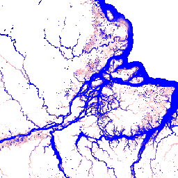
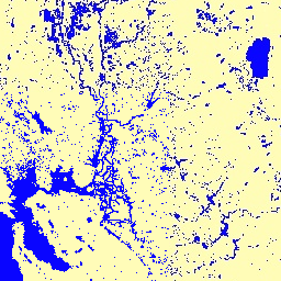
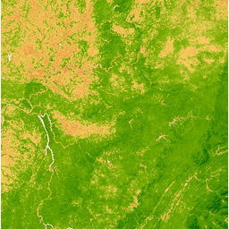
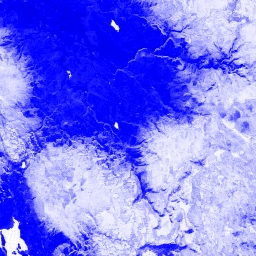
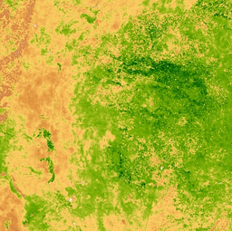
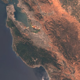
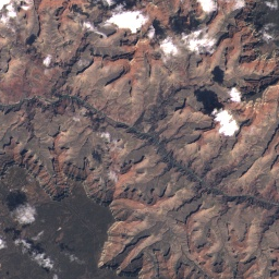
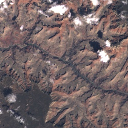
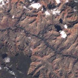
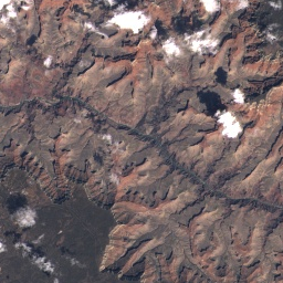
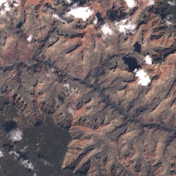
 Landsat数据集
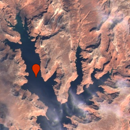
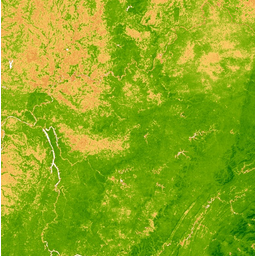
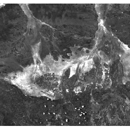
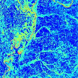
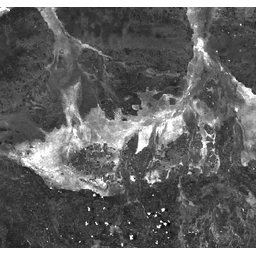
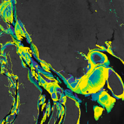
- img: https://pics.landcover100.com/pics/image/77aaBB.png
  link: https://developers.google.com/earth-engine/datasets/catalog/DLR_WSF_WSF2015_v1#terms-of-use
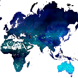
  name: World Settlement Footprint 2015
  desc: Deutsches Zentrum für Luft- und Raumfahrt (DLR)
  author: landcover, landsat-derived, sentinel1-derived, settlement, urban
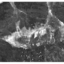
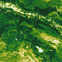
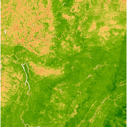
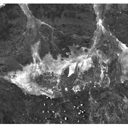
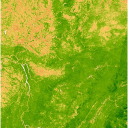
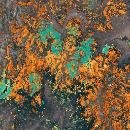
- img: https://pics.landcover100.com/pics/image/109aaBB.png
  link: https://developers.google.com/earth-engine/datasets/catalog/GLCF_GLS_TCC#terms-of-use
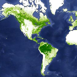
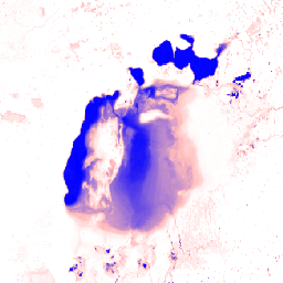
  name: GLCF:Landsat Tree Cover Continuous Fields deprecated
  desc: NASA LP DAAC at the USGS EROS Center
  author: forest, glcf, landsat_derived, nasa, umd
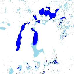
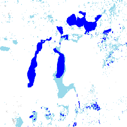
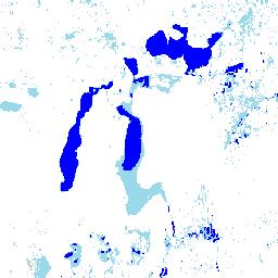
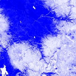
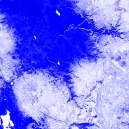
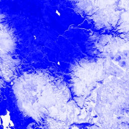
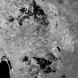
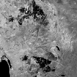
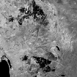
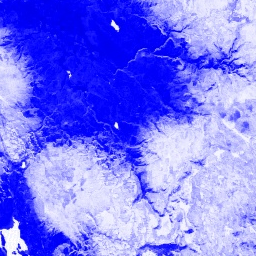
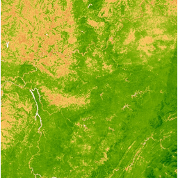
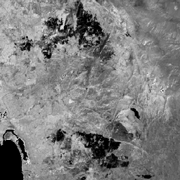
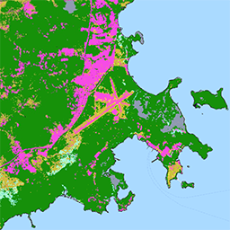
- img: https://pics.landcover100.com/pics/image/110aaBB.png
  link: https://developers.google.com/earth-engine/datasets/catalog/GLCF_GLS_WATER#terms-of-use
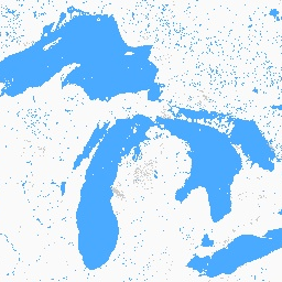
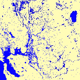
  name: GLCF:Landsat Global Inland Water
  desc: NASA LP DAAC at the USGS EROS Center
  author: glcf, landsat_derived, nasa, umd, water
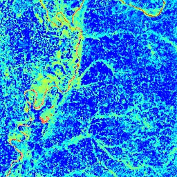
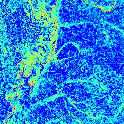
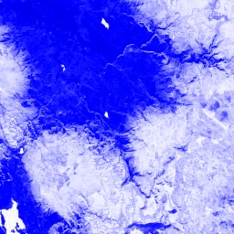
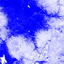
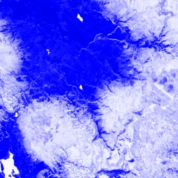
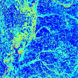
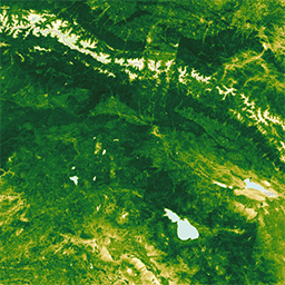
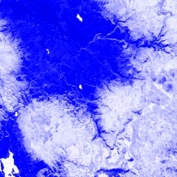
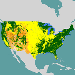
- img: https://pics.landcover100.com/pics/image/170aaBB.png
  link: https://developers.google.com/earth-engine/datasets/catalog/JRC_GHSL_P2016_BUILT_LDSMT_GLOBE_V1#terms-of-use
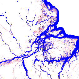
  name: GHSL:Global Human Settlement Layers, Built-Up Grid 1975-1990-2000-2015 (P2016)
  desc: EC JRC
  author: built, builtup, jrc, landsat_derived, multitemporal
- img: https://pics.landcover100.com/pics/image/173aaBB.png
  link: https://developers.google.com/earth-engine/datasets/catalog/JRC_GSW1_0_GlobalSurfaceWater#terms-of-use
  name: JRC Global Surface Water Mapping Layers, v1.0 deprecated
  desc: EC JRC / Google
  author: geophysical, google, jrc, landsat_derived, surface, water
- img: https://pics.landcover100.com/pics/image/174aaBB.png
  link: https://developers.google.com/earth-engine/datasets/catalog/JRC_GSW1_0_Metadata#terms-of-use
  name: JRC Global Surface Water Metadata, v1.0 deprecated
  desc: EC JRC / Google
  author: geophysical, google, jrc, landsat_derived, surface, water
- img: https://pics.landcover100.com/pics/image/175aaBB.png
  link: https://developers.google.com/earth-engine/datasets/catalog/JRC_GSW1_0_MonthlyHistory#terms-of-use
  name: JRC Monthly Water History, v1.0 deprecated
  desc: EC JRC / Google
  author: geophysical, google, history, jrc, landsat_derived, monthly, surface, water
- img: https://pics.landcover100.com/pics/image/176aaBB.png
  link: https://developers.google.com/earth-engine/datasets/catalog/JRC_GSW1_0_MonthlyRecurrence#terms-of-use
  name: JRC Monthly Water Recurrence, v1.0 deprecated
  desc: EC JRC / Google
  author: geophysical, google, history, jrc, landsat_derived, monthly, recurrence, surface, water
- img: https://pics.landcover100.com/pics/image/177aaBB.png
  link: https://developers.google.com/earth-engine/datasets/catalog/JRC_GSW1_0_YearlyHistory#terms-of-use
  name: JRC Yearly Water Classification History, v1.0 deprecated
  desc: EC JRC / Google
  author: annual, geophysical, google, history, jrc, landsat_derived, surface, water, yearly
- img: https://pics.landcover100.com/pics/image/178aaBB.png
  link: https://developers.google.com/earth-engine/datasets/catalog/JRC_GSW1_1_GlobalSurfaceWater#terms-of-use
  name: JRC Global Surface Water Mapping Layers, v1.1 deprecated
  desc: EC JRC / Google
  author: geophysical, google, jrc, landsat_derived, surface, water
- img: https://pics.landcover100.com/pics/image/179aaBB.png
  link: https://developers.google.com/earth-engine/datasets/catalog/JRC_GSW1_1_Metadata#terms-of-use
  name: JRC Global Surface Water Metadata, v1.1 deprecated
  desc: EC JRC / Google
  author: geophysical, google, jrc, landsat_derived, surface, water
- img: https://pics.landcover100.com/pics/image/180aaBB.png
  link: https://developers.google.com/earth-engine/datasets/catalog/JRC_GSW1_1_MonthlyHistory#terms-of-use
  name: JRC Monthly Water History, v1.1 deprecated
  desc: EC JRC / Google
  author: geophysical, google, history, jrc, landsat_derived, monthly, surface, water
- img: https://pics.landcover100.com/pics/image/181aaBB.png
  link: https://developers.google.com/earth-engine/datasets/catalog/JRC_GSW1_1_MonthlyRecurrence#terms-of-use
  name: JRC Monthly Water Recurrence, v1.1 deprecated
  desc: EC JRC / Google
  author: geophysical, google, history, jrc, landsat_derived, monthly, recurrence, surface, water
- img: https://pics.landcover100.com/pics/image/182aaBB.png
  link: https://developers.google.com/earth-engine/datasets/catalog/JRC_GSW1_1_YearlyHistory#terms-of-use
  name: JRC Yearly Water Classification History, v1.1 deprecated
  desc: EC JRC / Google
  author: annual, geophysical, google, history, jrc, landsat_derived, surface, water, yearly
- img: https://pics.landcover100.com/pics/image/183aaBB.png
  link: https://developers.google.com/earth-engine/datasets/catalog/JRC_GSW1_2_GlobalSurfaceWater#terms-of-use
  name: JRC Global Surface Water Mapping Layers, v1.2 deprecated
  desc: EC JRC / Google
  author: geophysical, google, jrc, landsat_derived, surface, water
- img: https://pics.landcover100.com/pics/image/184aaBB.png
  link: https://developers.google.com/earth-engine/datasets/catalog/JRC_GSW1_2_Metadata#terms-of-use
  name: JRC Global Surface Water Metadata, v1.2 deprecated
  desc: EC JRC / Google
  author: geophysical, google, jrc, landsat_derived, surface, water
- img: https://pics.landcover100.com/pics/image/185aaBB.png
  link: https://developers.google.com/earth-engine/datasets/catalog/JRC_GSW1_2_MonthlyHistory#terms-of-use
  name: JRC Monthly Water History, v1.2 deprecated
  desc: EC JRC / Google
  author: geophysical, google, history, jrc, landsat_derived, monthly, surface, water
- img: https://pics.landcover100.com/pics/image/186aaBB.png
  link: https://developers.google.com/earth-engine/datasets/catalog/JRC_GSW1_2_MonthlyRecurrence#terms-of-use
  name: JRC Monthly Water Recurrence, v1.2 deprecated
  desc: EC JRC / Google
  author: geophysical, google, history, jrc, landsat_derived, monthly, recurrence, surface, water
- img: https://pics.landcover100.com/pics/image/187aaBB.png
  link: https://developers.google.com/earth-engine/datasets/catalog/JRC_GSW1_2_YearlyHistory#terms-of-use
  name: JRC Yearly Water Classification History, v1.2 deprecated
  desc: EC JRC / Google
  author: annual, geophysical, google, history, jrc, landsat_derived, surface, water, yearly
- img: https://pics.landcover100.com/pics/image/188aaBB.png
  link: https://developers.google.com/earth-engine/datasets/catalog/JRC_GSW1_3_GlobalSurfaceWater#terms-of-use
  name: JRC Global Surface Water Mapping Layers, v1.3
  desc: EC JRC / Google
  author: geophysical, google, jrc, landsat_derived, surface, water
- img: https://pics.landcover100.com/pics/image/189aaBB.png
  link: https://developers.google.com/earth-engine/datasets/catalog/JRC_GSW1_3_Metadata#terms-of-use
  name: JRC Global Surface Water Metadata, v1.3
  desc: EC JRC / Google
  author: geophysical, google, jrc, landsat_derived, surface, water
- img: https://pics.landcover100.com/pics/image/190aaBB.png
  link: https://developers.google.com/earth-engine/datasets/catalog/JRC_GSW1_3_MonthlyHistory#terms-of-use
  name: JRC Monthly Water History, v1.3
  desc: EC JRC / Google
  author: geophysical, google, history, jrc, landsat_derived, monthly, surface, water
- img: https://pics.landcover100.com/pics/image/191aaBB.png
  link: https://developers.google.com/earth-engine/datasets/catalog/JRC_GSW1_3_MonthlyRecurrence#terms-of-use
  name: JRC Monthly Water Recurrence, v1.3
  desc: EC JRC / Google
  author: geophysical, google, history, jrc, landsat_derived, monthly, recurrence, surface, water
- img: https://pics.landcover100.com/pics/image/192aaBB.png
  link: https://developers.google.com/earth-engine/datasets/catalog/JRC_GSW1_3_YearlyHistory#terms-of-use
  name: JRC Yearly Water Classification History, v1.3
  desc: EC JRC / Google
  author: annual, geophysical, google, history, jrc, landsat_derived, surface, water, yearly
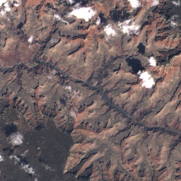
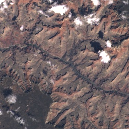
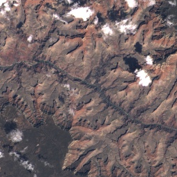
- img: https://pics.landcover100.com/pics/image/212aaBB.png
  link: https://developers.google.com/earth-engine/datasets/catalog/LANDSAT_GLS1975#terms-of-use
  name: Landsat Global Land Survey 1975 Mosaic
  desc: USGS
  author: global, gls, landsat, radiance, usgs
- img: https://pics.landcover100.com/pics/image/213aaBB.png
  link: https://developers.google.com/earth-engine/datasets/catalog/LANDSAT_GLS1975_MOSAIC#terms-of-use
  name: Landsat Global Land Survey 1975 Mosaic
  desc: USGS
  author: gls, landsat, radiance, usgs
- img: https://pics.landcover100.com/pics/image/214aaBB.png
  link: https://developers.google.com/earth-engine/datasets/catalog/LANDSAT_GLS2005#terms-of-use
  name: Landsat Global Land Survey 2005, Landsat 5+7 scenes
  desc: USGS
  author: gls, landsat, radiance, usgs
- img: https://pics.landcover100.com/pics/image/215aaBB.png
  link: https://developers.google.com/earth-engine/datasets/catalog/LANDSAT_GLS2005_L5#terms-of-use
  name: Landsat Global Land Survey 2005, Landsat 5 scenes
  desc: USGS
  author: etm, gls, l5, landsat, radiance, usgs
- img: https://pics.landcover100.com/pics/image/216aaBB.png
  link: https://developers.google.com/earth-engine/datasets/catalog/LANDSAT_GLS2005_L7#terms-of-use
  name: Landsat Global Land Survey 2005, Landsat 7 scenes
  desc: USGS
  author: etm, gls, l7, landsat, radiance, usgs
- img: https://pics.landcover100.com/pics/image/217aaBB.png
  link: https://developers.google.com/earth-engine/datasets/catalog/LANDSAT_LC8#terms-of-use
  name: USGS Landsat 8 Raw Scenes deprecated
  desc: USGS
  author: global, l8, landsat, lc8, oli_tirs, radiance, usgs
- img: https://pics.landcover100.com/pics/image/218aaBB.png
  link: https://developers.google.com/earth-engine/datasets/catalog/LANDSAT_LC08_C01_T1#terms-of-use
  name: USGS Landsat 8 Collection 1 Tier 1 Raw Scenes
  desc: USGS
  author: c1, global, l8, landsat, lc8, oli_tirs, radiance, t1, tier1, usgs
- img: https://pics.landcover100.com/pics/image/219aaBB.png
  link: https://developers.google.com/earth-engine/datasets/catalog/LANDSAT_LC08_C01_T1_8DAY_BAI#terms-of-use
  name: Landsat 8 Collection 1 Tier 1 8-Day BAI Composite
  desc: Google
  author: bai, landsat, usgs
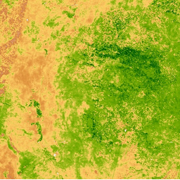
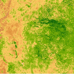
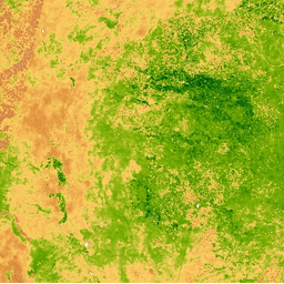
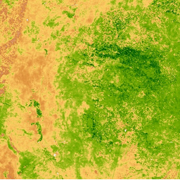
- img: https://pics.landcover100.com/pics/image/220aaBB.png
  link: https://developers.google.com/earth-engine/datasets/catalog/LANDSAT_LC08_C01_T1_8DAY_EVI#terms-of-use
  name: Landsat 8 Collection 1 Tier 1 8-Day EVI Composite
  desc: Google
  author: evi, landsat, usgs
- img: https://pics.landcover100.com/pics/image/221aaBB.png
  link: https://developers.google.com/earth-engine/datasets/catalog/LANDSAT_LC08_C01_T1_8DAY_NBRT#terms-of-use
  name: Landsat 8 Collection 1 Tier 1 8-Day NBRT Composite
  desc: Google
  author: landsat, nbrt, usgs
- img: https://pics.landcover100.com/pics/image/222aaBB.png
  link: https://developers.google.com/earth-engine/datasets/catalog/LANDSAT_LC08_C01_T1_8DAY_NDSI#terms-of-use
  name: Landsat 8 Collection 1 Tier 1 8-Day NDSI Composite
  desc: Google
  author: landsat, ndsi, usgs
- img: https://pics.landcover100.com/pics/image/223aaBB.png
  link: https://developers.google.com/earth-engine/datasets/catalog/LANDSAT_LC08_C01_T1_8DAY_NDVI#terms-of-use
  name: Landsat 8 Collection 1 Tier 1 8-Day NDVI Composite
  desc: Google
  author: landsat, ndvi, usgs
- img: https://pics.landcover100.com/pics/image/224aaBB.png
  link: https://developers.google.com/earth-engine/datasets/catalog/LANDSAT_LC08_C01_T1_8DAY_NDWI#terms-of-use
  name: Landsat 8 Collection 1 Tier 1 8-Day NDWI Composite
  desc: Google
  author: landsat, ndwi, usgs
- img: https://pics.landcover100.com/pics/image/225aaBB.png
  link: https://developers.google.com/earth-engine/datasets/catalog/LANDSAT_LC08_C01_T1_8DAY_RAW#terms-of-use
  name: Landsat 8 Collection 1 Tier 1 8-Day Raw Composite
  desc: USGS/Google
  author: landsat, raw, usgs
- img: https://pics.landcover100.com/pics/image/226aaBB.png
  link: https://developers.google.com/earth-engine/datasets/catalog/LANDSAT_LC08_C01_T1_8DAY_TOA#terms-of-use
  name: Landsat 8 Collection 1 Tier 1 8-Day TOA Reflectance Composite
  desc: Google
  author: landsat, toa, usgs
- img: https://pics.landcover100.com/pics/image/227aaBB.png
  link: https://developers.google.com/earth-engine/datasets/catalog/LANDSAT_LC08_C01_T1_32DAY_BAI#terms-of-use
  name: Landsat 8 Collection 1 Tier 1 32-Day BAI Composite
  desc: Google
  author: bai, landsat, usgs
- img: https://pics.landcover100.com/pics/image/228aaBB.png
  link: https://developers.google.com/earth-engine/datasets/catalog/LANDSAT_LC08_C01_T1_32DAY_EVI#terms-of-use
  name: Landsat 8 Collection 1 Tier 1 32-Day EVI Composite
  desc: Google
  author: evi, landsat, usgs
- img: https://pics.landcover100.com/pics/image/229aaBB.png
  link: https://developers.google.com/earth-engine/datasets/catalog/LANDSAT_LC08_C01_T1_32DAY_NBRT#terms-of-use
  name: Landsat 8 Collection 1 Tier 1 32-Day NBRT Composite
  desc: Google
  author: landsat, nbrt, usgs
- img: https://pics.landcover100.com/pics/image/230aaBB.png
  link: https://developers.google.com/earth-engine/datasets/catalog/LANDSAT_LC08_C01_T1_32DAY_NDSI#terms-of-use
  name: Landsat 8 Collection 1 Tier 1 32-Day NDSI Composite
  desc: Google
  author: landsat, ndsi, usgs
- img: https://pics.landcover100.com/pics/image/231aaBB.png
  link: https://developers.google.com/earth-engine/datasets/catalog/LANDSAT_LC08_C01_T1_32DAY_NDVI#terms-of-use
  name: Landsat 8 Collection 1 Tier 1 32-Day NDVI Composite
  desc: Google
  author: landsat, ndvi, usgs
- img: https://pics.landcover100.com/pics/image/232aaBB.png
  link: https://developers.google.com/earth-engine/datasets/catalog/LANDSAT_LC08_C01_T1_32DAY_NDWI#terms-of-use
  name: Landsat 8 Collection 1 Tier 1 32-Day NDWI Composite
  desc: Google
  author: landsat, ndwi, usgs
- img: https://pics.landcover100.com/pics/image/233aaBB.png
  link: https://developers.google.com/earth-engine/datasets/catalog/LANDSAT_LC08_C01_T1_32DAY_RAW#terms-of-use
  name: Landsat 8 Collection 1 Tier 1 32-Day Raw Composite
  desc: USGS/Google
  author: landsat, raw, usgs
- img: https://pics.landcover100.com/pics/image/234aaBB.png
  link: https://developers.google.com/earth-engine/datasets/catalog/LANDSAT_LC08_C01_T1_32DAY_TOA#terms-of-use
  name: Landsat 8 Collection 1 Tier 1 32-Day TOA Reflectance Composite
  desc: Google
  author: landsat, toa, usgs
- img: https://pics.landcover100.com/pics/image/235aaBB.png
  link: https://developers.google.com/earth-engine/datasets/catalog/LANDSAT_LC08_C01_T1_ANNUAL_BAI#terms-of-use
  name: Landsat 8 Collection 1 Tier 1 Annual BAI Composite
  desc: Google
  author: bai, landsat, usgs
- img: https://pics.landcover100.com/pics/image/236aaBB.png
  link: https://developers.google.com/earth-engine/datasets/catalog/LANDSAT_LC08_C01_T1_ANNUAL_EVI#terms-of-use
  name: Landsat 8 Collection 1 Tier 1 Annual EVI Composite
  desc: Google
  author: evi, landsat, usgs
- img: https://pics.landcover100.com/pics/image/237aaBB.png
  link: https://developers.google.com/earth-engine/datasets/catalog/LANDSAT_LC08_C01_T1_ANNUAL_GREENEST_TOA#terms-of-use
  name: Landsat 8 Collection 1 Tier 1 Landsat 8 Collection 1 Tier 1 Annual Greenest-Pixel TOA Reflectance Composite
  desc: Google
  author: greenest, landsat, toa, usgs
- img: https://pics.landcover100.com/pics/image/238aaBB.png
  link: https://developers.google.com/earth-engine/datasets/catalog/LANDSAT_LC08_C01_T1_ANNUAL_NBRT#terms-of-use
  name: Landsat 8 Collection 1 Tier 1 Annual NBRT Composite
  desc: Google
  author: landsat, nbrt, usgs
- img: https://pics.landcover100.com/pics/image/239aaBB.png
  link: https://developers.google.com/earth-engine/datasets/catalog/LANDSAT_LC08_C01_T1_ANNUAL_NDSI#terms-of-use
  name: Landsat 8 Collection 1 Tier 1 Annual NDSI Composite
  desc: Google
  author: landsat, ndsi, usgs
- img: https://pics.landcover100.com/pics/image/240aaBB.png
  link: https://developers.google.com/earth-engine/datasets/catalog/LANDSAT_LC08_C01_T1_ANNUAL_NDVI#terms-of-use
  name: Landsat 8 Collection 1 Tier 1 Annual NDVI Composite
  desc: Google
  author: landsat, ndvi, usgs
- img: https://pics.landcover100.com/pics/image/241aaBB.png
  link: https://developers.google.com/earth-engine/datasets/catalog/LANDSAT_LC08_C01_T1_ANNUAL_NDWI#terms-of-use
  name: Landsat 8 Collection 1 Tier 1 Annual NDWI Composite
  desc: Google
  author: landsat, ndwi, usgs
- img: https://pics.landcover100.com/pics/image/242aaBB.png
  link: https://developers.google.com/earth-engine/datasets/catalog/LANDSAT_LC08_C01_T1_ANNUAL_RAW#terms-of-use
  name: Landsat 8 Collection 1 Tier 1 Annual Raw Composite
  desc: USGS/Google
  author: landsat, raw, usgs
- img: https://pics.landcover100.com/pics/image/243aaBB.png
  link: https://developers.google.com/earth-engine/datasets/catalog/LANDSAT_LC08_C01_T1_ANNUAL_TOA#terms-of-use
  name: Landsat 8 Collection 1 Tier 1 Annual TOA Reflectance Composite
  desc: Google
  author: landsat, toa, usgs
- img: https://pics.landcover100.com/pics/image/244aaBB.png
  link: https://developers.google.com/earth-engine/datasets/catalog/LANDSAT_LC08_C01_T1_RT#terms-of-use
  name: USGS Landsat 8 Collection 1 Tier 1 and Real-Time data Raw Scenes
  desc: USGS
  author: c1, global, l8, landsat, lc8, nrt, oli_tirs, radiance, rt, t1, tier1, usgs
- img: https://pics.landcover100.com/pics/image/245aaBB.png
  link: https://developers.google.com/earth-engine/datasets/catalog/LANDSAT_LC08_C01_T1_RT_TOA#terms-of-use
  name: USGS Landsat 8 Collection 1 Tier 1 and Real-Time data TOA Reflectance
  desc: USGS/Google
  author: global, landsat, toa, usgs
- img: https://pics.landcover100.com/pics/image/246aaBB.png
  link: https://developers.google.com/earth-engine/datasets/catalog/LANDSAT_LC08_C01_T1_SR#terms-of-use
  name: USGS Landsat 8 Surface Reflectance Tier 1 deprecated
  desc: USGS
  author: cfmask, cloud, fmask, global, l8sr, landsat, lc08, reflectance, sr, usgs
- img: https://pics.landcover100.com/pics/image/247aaBB.png
  link: https://developers.google.com/earth-engine/datasets/catalog/LANDSAT_LC08_C01_T1_TOA#terms-of-use
  name: USGS Landsat 8 Collection 1 Tier 1 TOA Reflectance
  desc: USGS/Google
  author: global, landsat, toa, usgs
- img: https://pics.landcover100.com/pics/image/248aaBB.png
  link: https://developers.google.com/earth-engine/datasets/catalog/LANDSAT_LC08_C01_T2#terms-of-use
  name: USGS Landsat 8 Collection 1 Tier 2 Raw Scenes
  desc: USGS
  author: c1, global, l8, landsat, lc8, oli_tirs, radiance, t2, tier2, usgs
- img: https://pics.landcover100.com/pics/image/249aaBB.png
  link: https://developers.google.com/earth-engine/datasets/catalog/LANDSAT_LC08_C01_T2_SR#terms-of-use
  name: USGS Landsat 8 Surface Reflectance Tier 2
  desc: USGS
  author: cfmask, cloud, fmask, global, l8sr, landsat, lc08, reflectance, sr, usgs
- img: https://pics.landcover100.com/pics/image/250aaBB.png
  link: https://developers.google.com/earth-engine/datasets/catalog/LANDSAT_LC08_C01_T2_TOA#terms-of-use
  name: USGS Landsat 8 Collection 1 Tier 2 TOA Reflectance
  desc: USGS/Google
  author: global, landsat, toa, usgs
- img: https://pics.landcover100.com/pics/image/251aaBB.png
  link: https://developers.google.com/earth-engine/datasets/catalog/LANDSAT_LC08_C02_T1#terms-of-use
  name: USGS Landsat 8 Collection 2 Tier 1 Raw Scenes
  desc: USGS
  author: c2, global, l8, landsat, lc8, oli_tirs, radiance, t1, tier1, usgs
- img: https://pics.landcover100.com/pics/image/252aaBB.png
  link: https://developers.google.com/earth-engine/datasets/catalog/LANDSAT_LC08_C02_T1_L2#terms-of-use
  name: USGS Landsat 8 Level 2, Collection 2, Tier 1
  desc: USGS
  author: cfmask, cloud, fmask, global, l8sr, landsat, lasrc, lc08, lst, reflectance, sr, usgs
- img: https://pics.landcover100.com/pics/image/253aaBB.png
  link: https://developers.google.com/earth-engine/datasets/catalog/LANDSAT_LC08_C02_T1_RT#terms-of-use
  name: USGS Landsat 8 Collection 2 Tier 1 and Real-Time data Raw Scenes
  desc: USGS
  author: c2, global, l8, landsat, lc8, nrt, oli_tirs, radiance, rt, t1, tier1, usgs
- img: https://pics.landcover100.com/pics/image/254aaBB.png
  link: https://developers.google.com/earth-engine/datasets/catalog/LANDSAT_LC08_C02_T1_RT_TOA#terms-of-use
  name: USGS Landsat 8 Collection 2 Tier 1 and Real-Time data TOA Reflectance
  desc: USGS/Google
  author: c2, global, l8, landsat, lc8, toa, usgs
- img: https://pics.landcover100.com/pics/image/255aaBB.png
  link: https://developers.google.com/earth-engine/datasets/catalog/LANDSAT_LC08_C02_T1_TOA#terms-of-use
  name: USGS Landsat 8 Collection 2 Tier 1 TOA Reflectance
  desc: USGS/Google
  author: c2, global, landsat, toa, usgs
- img: https://pics.landcover100.com/pics/image/256aaBB.png
  link: https://developers.google.com/earth-engine/datasets/catalog/LANDSAT_LC08_C02_T2#terms-of-use
  name: USGS Landsat 8 Collection 2 Tier 2 Raw Scenes
  desc: USGS
  author: c2, global, l8, landsat, lc8, oli_tirs, radiance, t2, tier2, usgs
- img: https://pics.landcover100.com/pics/image/257aaBB.png
  link: https://developers.google.com/earth-engine/datasets/catalog/LANDSAT_LC08_C02_T2_L2#terms-of-use
  name: USGS Landsat 8 Level 2, Collection 2, Tier 2
  desc: USGS
  author: cfmask, cloud, fmask, global, l8sr, landsat, lasrc, lc08, lst, reflectance, sr, usgs
- img: https://pics.landcover100.com/pics/image/258aaBB.png
  link: https://developers.google.com/earth-engine/datasets/catalog/LANDSAT_LC08_C02_T2_TOA#terms-of-use
  name: USGS Landsat 8 Collection 2 Tier 2 TOA Reflectance
  desc: USGS/Google
  author: c2, global, landsat, toa, usgs
- img: https://pics.landcover100.com/pics/image/259aaBB.png
  link: https://developers.google.com/earth-engine/datasets/catalog/LANDSAT_LC8_L1T#terms-of-use
  name: USGS Landsat 8 Raw Scenes (Orthorectified) deprecated
  desc: USGS
  author: global, l8, landsat, lc8, oli_tirs, radiance, usgs
- img: https://pics.landcover100.com/pics/image/260aaBB.png
  link: https://developers.google.com/earth-engine/datasets/catalog/LANDSAT_LC8_L1T_8DAY_BAI#terms-of-use
  name: Landsat 8 8-Day BAI Composite deprecated
  desc: USGS
  author: bai, landsat, usgs
- img: https://pics.landcover100.com/pics/image/261aaBB.png
  link: https://developers.google.com/earth-engine/datasets/catalog/LANDSAT_LC8_L1T_8DAY_EVI#terms-of-use
  name: Landsat 8 8-Day EVI Composite deprecated
  desc: USGS
  author: evi, landsat, usgs
- img: https://pics.landcover100.com/pics/image/262aaBB.png
  link: https://developers.google.com/earth-engine/datasets/catalog/LANDSAT_LC8_L1T_8DAY_NBRT#terms-of-use
  name: Landsat 8 8-Day NBRT Composite deprecated
  desc: USGS
  author: landsat, nbrt, usgs
- img: https://pics.landcover100.com/pics/image/263aaBB.png
  link: https://developers.google.com/earth-engine/datasets/catalog/LANDSAT_LC8_L1T_8DAY_NDSI#terms-of-use
  name: Landsat 8 8-Day NDSI Composite deprecated
  desc: USGS
  author: landsat, ndsi, usgs
- img: https://pics.landcover100.com/pics/image/264aaBB.png
  link: https://developers.google.com/earth-engine/datasets/catalog/LANDSAT_LC8_L1T_8DAY_NDVI#terms-of-use
  name: Landsat 8 8-Day NDVI Composite deprecated
  desc: USGS
  author: landsat, ndvi, usgs
- img: https://pics.landcover100.com/pics/image/265aaBB.png
  link: https://developers.google.com/earth-engine/datasets/catalog/LANDSAT_LC8_L1T_8DAY_NDWI#terms-of-use
  name: Landsat 8 8-Day NDWI Composite deprecated
  desc: USGS
  author: landsat, ndwi, usgs
- img: https://pics.landcover100.com/pics/image/266aaBB.png
  link: https://developers.google.com/earth-engine/datasets/catalog/LANDSAT_LC8_L1T_8DAY_RAW#terms-of-use
  name: Landsat 8 8-Day Raw Composite deprecated
  desc: Google
  author: landsat, raw, usgs
- img: https://pics.landcover100.com/pics/image/267aaBB.png
  link: https://developers.google.com/earth-engine/datasets/catalog/LANDSAT_LC8_L1T_8DAY_TOA#terms-of-use
  name: Landsat 8 8-Day TOA Reflectance Composite deprecated
  desc: Google
  author: landsat, toa, usgs
- img: https://pics.landcover100.com/pics/image/268aaBB.png
  link: https://developers.google.com/earth-engine/datasets/catalog/LANDSAT_LC8_L1T_32DAY_BAI#terms-of-use
  name: Landsat 8 32-Day BAI Composite deprecated
  desc: USGS
  author: bai, landsat, usgs
- img: https://pics.landcover100.com/pics/image/269aaBB.png
  link: https://developers.google.com/earth-engine/datasets/catalog/LANDSAT_LC8_L1T_32DAY_EVI#terms-of-use
  name: Landsat 8 32-Day EVI Composite deprecated
  desc: USGS
  author: evi, landsat, usgs
- img: https://pics.landcover100.com/pics/image/270aaBB.png
  link: https://developers.google.com/earth-engine/datasets/catalog/LANDSAT_LC8_L1T_32DAY_NBRT#terms-of-use
  name: Landsat 8 32-Day NBRT Composite deprecated
  desc: USGS
  author: landsat, nbrt, usgs
- img: https://pics.landcover100.com/pics/image/271aaBB.png
  link: https://developers.google.com/earth-engine/datasets/catalog/LANDSAT_LC8_L1T_32DAY_NDSI#terms-of-use
  name: Landsat 8 32-Day NDSI Composite deprecated
  desc: USGS
  author: landsat, ndsi, usgs
- img: https://pics.landcover100.com/pics/image/272aaBB.png
  link: https://developers.google.com/earth-engine/datasets/catalog/LANDSAT_LC8_L1T_32DAY_NDVI#terms-of-use
  name: Landsat 8 32-Day NDVI Composite deprecated
  desc: USGS
  author: landsat, ndvi, usgs
- img: https://pics.landcover100.com/pics/image/273aaBB.png
  link: https://developers.google.com/earth-engine/datasets/catalog/LANDSAT_LC8_L1T_32DAY_NDWI#terms-of-use
  name: Landsat 8 32-Day NDWI Composite deprecated
  desc: USGS
  author: landsat, ndwi, usgs
- img: https://pics.landcover100.com/pics/image/274aaBB.png
  link: https://developers.google.com/earth-engine/datasets/catalog/LANDSAT_LC8_L1T_32DAY_RAW#terms-of-use
  name: Landsat 8 32-Day Raw Composite deprecated
  desc: Google
  author: landsat, raw, usgs
- img: https://pics.landcover100.com/pics/image/275aaBB.png
  link: https://developers.google.com/earth-engine/datasets/catalog/LANDSAT_LC8_L1T_32DAY_TOA#terms-of-use
  name: Landsat 8 32-Day TOA Reflectance Composite deprecated
  desc: Google
  author: landsat, toa, usgs
- img: https://pics.landcover100.com/pics/image/276aaBB.png
  link: https://developers.google.com/earth-engine/datasets/catalog/LANDSAT_LC8_L1T_ANNUAL_BAI#terms-of-use
  name: Landsat 8 Annual BAI Composite deprecated
  desc: USGS
  author: bai, landsat, usgs
- img: https://pics.landcover100.com/pics/image/277aaBB.png
  link: https://developers.google.com/earth-engine/datasets/catalog/LANDSAT_LC8_L1T_ANNUAL_EVI#terms-of-use
  name: Landsat 8 Annual EVI Composite deprecated
  desc: USGS
  author: evi, landsat, usgs
- img: https://pics.landcover100.com/pics/image/278aaBB.png
  link: https://developers.google.com/earth-engine/datasets/catalog/LANDSAT_LC8_L1T_ANNUAL_GREENEST_TOA#terms-of-use
  name: Landsat 8 Annual Greenest-Pixel TOA Reflectance Composite deprecated
  desc: USGS
  author: greenest, landsat, toa, usgs
- img: https://pics.landcover100.com/pics/image/279aaBB.png
  link: https://developers.google.com/earth-engine/datasets/catalog/LANDSAT_LC8_L1T_ANNUAL_NBRT#terms-of-use
  name: Landsat 8 Annual NBRT Composite deprecated
  desc: USGS
  author: landsat, nbrt, usgs
- img: https://pics.landcover100.com/pics/image/280aaBB.png
  link: https://developers.google.com/earth-engine/datasets/catalog/LANDSAT_LC8_L1T_ANNUAL_NDSI#terms-of-use
  name: Landsat 8 Annual NDSI Composite deprecated
  desc: USGS
  author: landsat, ndsi, usgs
- img: https://pics.landcover100.com/pics/image/281aaBB.png
  link: https://developers.google.com/earth-engine/datasets/catalog/LANDSAT_LC8_L1T_ANNUAL_NDVI#terms-of-use
  name: Landsat 8 Annual NDVI Composite deprecated
  desc: USGS
  author: landsat, ndvi, usgs
- img: https://pics.landcover100.com/pics/image/282aaBB.png
  link: https://developers.google.com/earth-engine/datasets/catalog/LANDSAT_LC8_L1T_ANNUAL_NDWI#terms-of-use
  name: Landsat 8 Annual NDWI Composite deprecated
  desc: USGS
  author: landsat, ndwi, usgs
- img: https://pics.landcover100.com/pics/image/283aaBB.png
  link: https://developers.google.com/earth-engine/datasets/catalog/LANDSAT_LC8_L1T_ANNUAL_RAW#terms-of-use
  name: Landsat 8 Annual Raw Composite deprecated
  desc: Google
  author: landsat, raw, usgs
- img: https://pics.landcover100.com/pics/image/284aaBB.png
  link: https://developers.google.com/earth-engine/datasets/catalog/LANDSAT_LC8_L1T_ANNUAL_TOA#terms-of-use
  name: Landsat 8 Annual TOA Reflectance Composite deprecated
  desc: Google
  author: landsat, toa, usgs
- img: https://pics.landcover100.com/pics/image/285aaBB.png
  link: https://developers.google.com/earth-engine/datasets/catalog/LANDSAT_LC8_L1T_TOA#terms-of-use
  name: USGS Landsat 8 TOA Reflectance (Orthorectified) deprecated
  desc: USGS/Google
  author: global, landsat, toa, usgs
- img: https://pics.landcover100.com/pics/image/286aaBB.png
  link: https://developers.google.com/earth-engine/datasets/catalog/LANDSAT_LC09_C02_T1#terms-of-use
  name: USGS Landsat 9 Collection 2 Tier 1 Raw Scenes
  desc: USGS
  author: c2, global, l9, landsat, lc9, oli_tirs, radiance, t1, tier1, usgs
- img: https://pics.landcover100.com/pics/image/287aaBB.png
  link: https://developers.google.com/earth-engine/datasets/catalog/LANDSAT_LC09_C02_T1_L2#terms-of-use
  name: USGS Landsat 9 Level 2, Collection 2, Tier 1
  desc: USGS
  author: cfmask, cloud, fmask, global, l9sr, landsat, lasrc, lc09, lst, reflectance, sr, usgs
- img: https://pics.landcover100.com/pics/image/288aaBB.png
  link: https://developers.google.com/earth-engine/datasets/catalog/LANDSAT_LC09_C02_T1_TOA#terms-of-use
  name: USGS Landsat 9 Collection 2 Tier 1 TOA Reflectance
  desc: USGS/Google
  author: c2, global, landsat, toa, usgs
- img: https://pics.landcover100.com/pics/image/289aaBB.png
  link: https://developers.google.com/earth-engine/datasets/catalog/LANDSAT_LC09_C02_T2_TOA#terms-of-use
  name: USGS Landsat 9 Collection 2 Tier 2 TOA Reflectance
  desc: USGS/Google
  author: c2, global, l9, landsat, lc9, toa, usgs
- img: https://pics.landcover100.com/pics/image/290aaBB.png
  link: https://developers.google.com/earth-engine/datasets/catalog/LANDSAT_LE7#terms-of-use
  name: USGS Landsat 7 Raw Scenes deprecated
  desc: USGS
  author: etm, global, l7, landsat, le7, radiance, usgs
- img: https://pics.landcover100.com/pics/image/291aaBB.png
  link: https://developers.google.com/earth-engine/datasets/catalog/LANDSAT_LE07_C01_T1#terms-of-use
  name: USGS Landsat 7 Collection 1 Tier 1 Raw Scenes
  desc: USGS
  author: c1, etm, global, l7, landsat, le7, radiance, t1, tier1, usgs
- img: https://pics.landcover100.com/pics/image/292aaBB.png
  link: https://developers.google.com/earth-engine/datasets/catalog/LANDSAT_LE07_C01_T1_8DAY_BAI#terms-of-use
  name: Landsat 7 Collection 1 Tier 1 8-Day BAI Composite
  desc: Google
  author: bai, landsat, usgs
- img: https://pics.landcover100.com/pics/image/293aaBB.png
  link: https://developers.google.com/earth-engine/datasets/catalog/LANDSAT_LE07_C01_T1_8DAY_EVI#terms-of-use
  name: Landsat 7 Collection 1 Tier 1 8-Day EVI Composite
  desc: Google
  author: evi, landsat, usgs
- img: https://pics.landcover100.com/pics/image/294aaBB.png
  link: https://developers.google.com/earth-engine/datasets/catalog/LANDSAT_LE07_C01_T1_8DAY_NBRT#terms-of-use
  name: Landsat 7 Collection 1 Tier 1 8-Day NBRT Composite
  desc: Google
  author: landsat, nbrt, usgs
- img: https://pics.landcover100.com/pics/image/295aaBB.png
  link: https://developers.google.com/earth-engine/datasets/catalog/LANDSAT_LE07_C01_T1_8DAY_NDSI#terms-of-use
  name: Landsat 7 Collection 1 Tier 1 8-Day NDSI Composite
  desc: Google
  author: landsat, ndsi, usgs
- img: https://pics.landcover100.com/pics/image/296aaBB.png
  link: https://developers.google.com/earth-engine/datasets/catalog/LANDSAT_LE07_C01_T1_8DAY_NDVI#terms-of-use
  name: Landsat 7 Collection 1 Tier 1 8-Day NDVI Composite
  desc: Google
  author: landsat, ndvi, usgs
- img: https://pics.landcover100.com/pics/image/297aaBB.png
  link: https://developers.google.com/earth-engine/datasets/catalog/LANDSAT_LE07_C01_T1_8DAY_NDWI#terms-of-use
  name: Landsat 7 Collection 1 Tier 1 8-Day NDWI Composite
  desc: Google
  author: landsat, ndwi, usgs
- img: https://pics.landcover100.com/pics/image/298aaBB.png
  link: https://developers.google.com/earth-engine/datasets/catalog/LANDSAT_LE07_C01_T1_8DAY_RAW#terms-of-use
  name: Landsat 7 Collection 1 Tier 1 8-Day Raw Composite
  desc: USGS/Google
  author: landsat, raw, usgs
- img: https://pics.landcover100.com/pics/image/299aaBB.png
  link: https://developers.google.com/earth-engine/datasets/catalog/LANDSAT_LE07_C01_T1_8DAY_TOA#terms-of-use
  name: Landsat 7 Collection 1 Tier 1 8-Day TOA Reflectance Composite
  desc: Google
  author: landsat, toa, usgs
- img: https://pics.landcover100.com/pics/image/300aaBB.png
  link: https://developers.google.com/earth-engine/datasets/catalog/LANDSAT_LE07_C01_T1_32DAY_BAI#terms-of-use
  name: Landsat 7 Collection 1 Tier 1 32-Day BAI Composite
  desc: Google
  author: bai, landsat, usgs
- img: https://pics.landcover100.com/pics/image/301aaBB.png
  link: https://developers.google.com/earth-engine/datasets/catalog/LANDSAT_LE07_C01_T1_32DAY_EVI#terms-of-use
  name: Landsat 7 Collection 1 Tier 1 32-Day EVI Composite
  desc: Google
  author: evi, landsat, usgs
- img: https://pics.landcover100.com/pics/image/302aaBB.png
  link: https://developers.google.com/earth-engine/datasets/catalog/LANDSAT_LE07_C01_T1_32DAY_NBRT#terms-of-use
  name: Landsat 7 Collection 1 Tier 1 32-Day NBRT Composite
  desc: Google
  author: landsat, nbrt, usgs
- img: https://pics.landcover100.com/pics/image/303aaBB.png
  link: https://developers.google.com/earth-engine/datasets/catalog/LANDSAT_LE07_C01_T1_32DAY_NDSI#terms-of-use
  name: Landsat 7 Collection 1 Tier 1 32-Day NDSI Composite
  desc: Google
  author: landsat, ndsi, usgs
- img: https://pics.landcover100.com/pics/image/304aaBB.png
  link: https://developers.google.com/earth-engine/datasets/catalog/LANDSAT_LE07_C01_T1_32DAY_NDVI#terms-of-use
  name: Landsat 7 Collection 1 Tier 1 32-Day NDVI Composite
  desc: Google
  author: landsat, ndvi, usgs
- img: https://pics.landcover100.com/pics/image/305aaBB.png
  link: https://developers.google.com/earth-engine/datasets/catalog/LANDSAT_LE07_C01_T1_32DAY_NDWI#terms-of-use
  name: Landsat 7 Collection 1 Tier 1 32-Day NDWI Composite
  desc: Google
  author: landsat, ndwi, usgs
- img: https://pics.landcover100.com/pics/image/306aaBB.png
  link: https://developers.google.com/earth-engine/datasets/catalog/LANDSAT_LE07_C01_T1_32DAY_RAW#terms-of-use
  name: Landsat 7 Collection 1 Tier 1 32-Day Raw Composite
  desc: USGS/Google
  author: landsat, raw, usgs
- img: https://pics.landcover100.com/pics/image/307aaBB.png
  link: https://developers.google.com/earth-engine/datasets/catalog/LANDSAT_LE07_C01_T1_32DAY_TOA#terms-of-use
  name: Landsat 7 Collection 1 Tier 1 32-Day TOA Reflectance Composite
  desc: Google
  author: landsat, toa, usgs
- img: https://pics.landcover100.com/pics/image/308aaBB.png
  link: https://developers.google.com/earth-engine/datasets/catalog/LANDSAT_LE07_C01_T1_ANNUAL_BAI#terms-of-use
  name: Landsat 7 Collection 1 Tier 1 Annual BAI Composite
  desc: Google
  author: bai, landsat, usgs
- img: https://pics.landcover100.com/pics/image/309aaBB.png
  link: https://developers.google.com/earth-engine/datasets/catalog/LANDSAT_LE07_C01_T1_ANNUAL_EVI#terms-of-use
  name: Landsat 7 Collection 1 Tier 1 Annual EVI Composite
  desc: Google
  author: evi, landsat, usgs
- img: https://pics.landcover100.com/pics/image/310aaBB.png
  link: https://developers.google.com/earth-engine/datasets/catalog/LANDSAT_LE07_C01_T1_ANNUAL_GREENEST_TOA#terms-of-use
  name: Landsat 7 Collection 1 Tier 1 Landsat 7 Collection 1 Tier 1 Annual Greenest-Pixel TOA Reflectance Composite
  desc: Google
  author: greenest, landsat, toa, usgs
- img: https://pics.landcover100.com/pics/image/311aaBB.png
  link: https://developers.google.com/earth-engine/datasets/catalog/LANDSAT_LE07_C01_T1_ANNUAL_NBRT#terms-of-use
  name: Landsat 7 Collection 1 Tier 1 Annual NBRT Composite
  desc: Google
  author: landsat, nbrt, usgs
- img: https://pics.landcover100.com/pics/image/312aaBB.png
  link: https://developers.google.com/earth-engine/datasets/catalog/LANDSAT_LE07_C01_T1_ANNUAL_NDSI#terms-of-use
  name: Landsat 7 Collection 1 Tier 1 Annual NDSI Composite
  desc: Google
  author: landsat, ndsi, usgs
- img: https://pics.landcover100.com/pics/image/313aaBB.png
  link: https://developers.google.com/earth-engine/datasets/catalog/LANDSAT_LE07_C01_T1_ANNUAL_NDVI#terms-of-use
  name: Landsat 7 Collection 1 Tier 1 Annual NDVI Composite
  desc: Google
  author: landsat, ndvi, usgs
- img: https://pics.landcover100.com/pics/image/314aaBB.png
  link: https://developers.google.com/earth-engine/datasets/catalog/LANDSAT_LE07_C01_T1_ANNUAL_NDWI#terms-of-use
  name: Landsat 7 Collection 1 Tier 1 Annual NDWI Composite
  desc: Google
  author: landsat, ndwi, usgs
- img: https://pics.landcover100.com/pics/image/315aaBB.png
  link: https://developers.google.com/earth-engine/datasets/catalog/LANDSAT_LE07_C01_T1_ANNUAL_RAW#terms-of-use
  name: Landsat 7 Collection 1 Tier 1 Annual Raw Composite
  desc: USGS/Google
  author: landsat, raw, usgs
- img: https://pics.landcover100.com/pics/image/316aaBB.png
  link: https://developers.google.com/earth-engine/datasets/catalog/LANDSAT_LE07_C01_T1_ANNUAL_TOA#terms-of-use
  name: Landsat 7 Collection 1 Tier 1 Annual TOA Reflectance Composite
  desc: Google
  author: landsat, toa, usgs
- img: https://pics.landcover100.com/pics/image/317aaBB.png
  link: https://developers.google.com/earth-engine/datasets/catalog/LANDSAT_LE07_C01_T1_RT#terms-of-use
  name: USGS Landsat 7 Collection 1 Tier 1 and Real-Time data Raw Scenes
  desc: USGS
  author: c1, etm, global, l7, landsat, le7, nrt, radiance, rt, t1, tier1, usgs
- img: https://pics.landcover100.com/pics/image/318aaBB.png
  link: https://developers.google.com/earth-engine/datasets/catalog/LANDSAT_LE07_C01_T1_RT_TOA#terms-of-use
  name: USGS Landsat 7 Collection 1 Tier 1 and Real-Time data TOA Reflectance
  desc: USGS/Google
  author: global, landsat, toa, usgs
- img: https://pics.landcover100.com/pics/image/319aaBB.png
  link: https://developers.google.com/earth-engine/datasets/catalog/LANDSAT_LE07_C01_T1_SR#terms-of-use
  name: USGS Landsat 7 Surface Reflectance Tier 1 deprecated
  desc: USGS
  author: cfmask, cloud, fmask, global, landsat, le07, ledaps, reflectance, sr, usgs
- img: https://pics.landcover100.com/pics/image/320aaBB.png
  link: https://developers.google.com/earth-engine/datasets/catalog/LANDSAT_LE07_C01_T1_TOA#terms-of-use
  name: USGS Landsat 7 Collection 1 Tier 1 TOA Reflectance
  desc: USGS/Google
  author: global, landsat, toa, usgs
- img: https://pics.landcover100.com/pics/image/321aaBB.png
  link: https://developers.google.com/earth-engine/datasets/catalog/LANDSAT_LE07_C01_T2#terms-of-use
  name: USGS Landsat 7 Collection 1 Tier 2 Raw Scenes
  desc: USGS
  author: c1, etm, global, l7, landsat, le7, radiance, t2, tier2, usgs
- img: https://pics.landcover100.com/pics/image/322aaBB.png
  link: https://developers.google.com/earth-engine/datasets/catalog/LANDSAT_LE07_C01_T2_SR#terms-of-use
  name: USGS Landsat 7 Surface Reflectance Tier 2
  desc: USGS
  author: cfmask, cloud, fmask, global, landsat, le07, ledaps, reflectance, sr, usgs
- img: https://pics.landcover100.com/pics/image/323aaBB.png
  link: https://developers.google.com/earth-engine/datasets/catalog/LANDSAT_LE07_C01_T2_TOA#terms-of-use
  name: USGS Landsat 7 Collection 1 Tier 2 TOA Reflectance
  desc: USGS/Google
  author: global, landsat, toa, usgs
- img: https://pics.landcover100.com/pics/image/324aaBB.png
  link: https://developers.google.com/earth-engine/datasets/catalog/LANDSAT_LE07_C02_T1#terms-of-use
  name: USGS Landsat 7 Collection 2 Tier 1 Raw Scenes
  desc: USGS
  author: c2, etm, global, l7, landsat, le7, radiance, t1, tier1, usgs
- img: https://pics.landcover100.com/pics/image/325aaBB.png
  link: https://developers.google.com/earth-engine/datasets/catalog/LANDSAT_LE07_C02_T1_L2#terms-of-use
  name: USGS Landsat 7 Level 2, Collection 2, Tier 1
  desc: USGS
  author: cfmask, cloud, etm, fmask, global, landsat, lasrc, le07, lst, reflectance, sr, usgs
- img: https://pics.landcover100.com/pics/image/326aaBB.png
  link: https://developers.google.com/earth-engine/datasets/catalog/LANDSAT_LE07_C02_T1_RT#terms-of-use
  name: USGS Landsat 7 Collection 2 Tier 1 and Real-Time data Raw Scenes
  desc: USGS
  author: c2, etm, global, l7, landsat, le7, nrt, radiance, rt, t1, tier1, usgs
- img: https://pics.landcover100.com/pics/image/327aaBB.png
  link: https://developers.google.com/earth-engine/datasets/catalog/LANDSAT_LE07_C02_T1_RT_TOA#terms-of-use
  name: USGS Landsat 7 Collection 2 Tier 1 and Real-Time data TOA Reflectance
  desc: USGS/Google
  author: c2, global, landsat, toa, usgs
- img: https://pics.landcover100.com/pics/image/328aaBB.png
  link: https://developers.google.com/earth-engine/datasets/catalog/LANDSAT_LE07_C02_T1_TOA#terms-of-use
  name: USGS Landsat 7 Collection 2 Tier 1 TOA Reflectance
  desc: USGS/Google
  author: c2, global, landsat, toa, usgs
- img: https://pics.landcover100.com/pics/image/329aaBB.png
  link: https://developers.google.com/earth-engine/datasets/catalog/LANDSAT_LE07_C02_T2#terms-of-use
  name: USGS Landsat 7 Collection 2 Tier 2 Raw Scenes
  desc: USGS
  author: c2, etm, global, l7, landsat, le7, radiance, t2, tier2, usgs
- img: https://pics.landcover100.com/pics/image/330aaBB.png
  link: https://developers.google.com/earth-engine/datasets/catalog/LANDSAT_LE07_C02_T2_L2#terms-of-use
  name: USGS Landsat 7 Level 2, Collection 2, Tier 2
  desc: USGS
  author: cfmask, cloud, etm, fmask, global, landsat, lasrc, le07, lst, reflectance, sr, usgs
- img: https://pics.landcover100.com/pics/image/331aaBB.png
  link: https://developers.google.com/earth-engine/datasets/catalog/LANDSAT_LE07_C02_T2_TOA#terms-of-use
  name: USGS Landsat 7 Collection 2 Tier 2 TOA Reflectance
  desc: USGS/Google
  author: c2, global, landsat, toa, usgs
- img: https://pics.landcover100.com/pics/image/332aaBB.png
  link: https://developers.google.com/earth-engine/datasets/catalog/LANDSAT_LE7_L1T#terms-of-use
  name: USGS Landsat 7 Raw Scenes (Orthorectified) deprecated
  desc: USGS
  author: etm, global, l7, landsat, le7, radiance, usgs
- img: https://pics.landcover100.com/pics/image/333aaBB.png
  link: https://developers.google.com/earth-engine/datasets/catalog/LANDSAT_LE7_L1T_8DAY_BAI#terms-of-use
  name: Landsat 7 8-Day BAI Composite deprecated
  desc: USGS
  author: bai, landsat, usgs
- img: https://pics.landcover100.com/pics/image/334aaBB.png
  link: https://developers.google.com/earth-engine/datasets/catalog/LANDSAT_LE7_L1T_8DAY_EVI#terms-of-use
  name: Landsat 7 8-Day EVI Composite deprecated
  desc: USGS
  author: evi, landsat, usgs
- img: https://pics.landcover100.com/pics/image/335aaBB.png
  link: https://developers.google.com/earth-engine/datasets/catalog/LANDSAT_LE7_L1T_8DAY_NBRT#terms-of-use
  name: Landsat 7 8-Day NBRT Composite deprecated
  desc: USGS
  author: landsat, nbrt, usgs
- img: https://pics.landcover100.com/pics/image/336aaBB.png
  link: https://developers.google.com/earth-engine/datasets/catalog/LANDSAT_LE7_L1T_8DAY_NDSI#terms-of-use
  name: Landsat 7 8-Day NDSI Composite deprecated
  desc: USGS
  author: landsat, ndsi, usgs
- img: https://pics.landcover100.com/pics/image/337aaBB.png
  link: https://developers.google.com/earth-engine/datasets/catalog/LANDSAT_LE7_L1T_8DAY_NDVI#terms-of-use
  name: Landsat 7 8-Day NDVI Composite deprecated
  desc: USGS
  author: landsat, ndvi, usgs
- img: https://pics.landcover100.com/pics/image/338aaBB.png
  link: https://developers.google.com/earth-engine/datasets/catalog/LANDSAT_LE7_L1T_8DAY_NDWI#terms-of-use
  name: Landsat 7 8-Day NDWI Composite deprecated
  desc: USGS
  author: landsat, ndwi, usgs
- img: https://pics.landcover100.com/pics/image/339aaBB.png
  link: https://developers.google.com/earth-engine/datasets/catalog/LANDSAT_LE7_L1T_8DAY_RAW#terms-of-use
  name: Landsat 7 8-Day Raw Composite deprecated
  desc: Google
  author: landsat, raw, usgs
- img: https://pics.landcover100.com/pics/image/340aaBB.png
  link: https://developers.google.com/earth-engine/datasets/catalog/LANDSAT_LE7_L1T_8DAY_TOA#terms-of-use
  name: Landsat 7 8-Day TOA Reflectance Composite deprecated
  desc: Google
  author: landsat, toa, usgs
- img: https://pics.landcover100.com/pics/image/341aaBB.png
  link: https://developers.google.com/earth-engine/datasets/catalog/LANDSAT_LE7_L1T_32DAY_BAI#terms-of-use
  name: Landsat 7 32-Day BAI Composite deprecated
  desc: USGS
  author: bai, landsat, usgs
- img: https://pics.landcover100.com/pics/image/342aaBB.png
  link: https://developers.google.com/earth-engine/datasets/catalog/LANDSAT_LE7_L1T_32DAY_EVI#terms-of-use
  name: Landsat 7 32-Day EVI Composite deprecated
  desc: USGS
  author: evi, landsat, usgs
- img: https://pics.landcover100.com/pics/image/343aaBB.png
  link: https://developers.google.com/earth-engine/datasets/catalog/LANDSAT_LE7_L1T_32DAY_NBRT#terms-of-use
  name: Landsat 7 32-Day NBRT Composite deprecated
  desc: USGS
  author: landsat, nbrt, usgs
- img: https://pics.landcover100.com/pics/image/344aaBB.png
  link: https://developers.google.com/earth-engine/datasets/catalog/LANDSAT_LE7_L1T_32DAY_NDSI#terms-of-use
  name: Landsat 7 32-Day NDSI Composite deprecated
  desc: USGS
  author: landsat, ndsi, usgs
- img: https://pics.landcover100.com/pics/image/345aaBB.png
  link: https://developers.google.com/earth-engine/datasets/catalog/LANDSAT_LE7_L1T_32DAY_NDVI#terms-of-use
  name: Landsat 7 32-Day NDVI Composite deprecated
  desc: USGS
  author: landsat, ndvi, usgs
- img: https://pics.landcover100.com/pics/image/346aaBB.png
  link: https://developers.google.com/earth-engine/datasets/catalog/LANDSAT_LE7_L1T_32DAY_NDWI#terms-of-use
  name: Landsat 7 32-Day NDWI Composite deprecated
  desc: USGS
  author: landsat, ndwi, usgs
- img: https://pics.landcover100.com/pics/image/347aaBB.png
  link: https://developers.google.com/earth-engine/datasets/catalog/LANDSAT_LE7_L1T_32DAY_RAW#terms-of-use
  name: Landsat 7 32-Day Raw Composite deprecated
  desc: Google
  author: landsat, raw, usgs
- img: https://pics.landcover100.com/pics/image/348aaBB.png
  link: https://developers.google.com/earth-engine/datasets/catalog/LANDSAT_LE7_L1T_32DAY_TOA#terms-of-use
  name: Landsat 7 32-Day TOA Reflectance Composite deprecated
  desc: Google
  author: landsat, toa, usgs
- img: https://pics.landcover100.com/pics/image/349aaBB.png
  link: https://developers.google.com/earth-engine/datasets/catalog/LANDSAT_LE7_L1T_ANNUAL_BAI#terms-of-use
  name: Landsat 7 Annual BAI Composite deprecated
  desc: USGS
  author: bai, landsat, usgs
- img: https://pics.landcover100.com/pics/image/350aaBB.png
  link: https://developers.google.com/earth-engine/datasets/catalog/LANDSAT_LE7_L1T_ANNUAL_EVI#terms-of-use
  name: Landsat 7 Annual EVI Composite deprecated
  desc: USGS
  author: evi, landsat, usgs
- img: https://pics.landcover100.com/pics/image/351aaBB.png
  link: https://developers.google.com/earth-engine/datasets/catalog/LANDSAT_LE7_L1T_ANNUAL_GREENEST_TOA#terms-of-use
  name: Landsat 7 Annual Greenest-Pixel TOA Reflectance Composite deprecated
  desc: USGS
  author: greenest, landsat, toa, usgs
- img: https://pics.landcover100.com/pics/image/352aaBB.png
  link: https://developers.google.com/earth-engine/datasets/catalog/LANDSAT_LE7_L1T_ANNUAL_NBRT#terms-of-use
  name: Landsat 7 Annual NBRT Composite deprecated
  desc: USGS
  author: landsat, nbrt, usgs
- img: https://pics.landcover100.com/pics/image/353aaBB.png
  link: https://developers.google.com/earth-engine/datasets/catalog/LANDSAT_LE7_L1T_ANNUAL_NDSI#terms-of-use
  name: Landsat 7 Annual NDSI Composite deprecated
  desc: USGS
  author: landsat, ndsi, usgs
- img: https://pics.landcover100.com/pics/image/354aaBB.png
  link: https://developers.google.com/earth-engine/datasets/catalog/LANDSAT_LE7_L1T_ANNUAL_NDVI#terms-of-use
  name: Landsat 7 Annual NDVI Composite deprecated
  desc: USGS
  author: landsat, ndvi, usgs
- img: https://pics.landcover100.com/pics/image/355aaBB.png
  link: https://developers.google.com/earth-engine/datasets/catalog/LANDSAT_LE7_L1T_ANNUAL_NDWI#terms-of-use
  name: Landsat 7 Annual NDWI Composite deprecated
  desc: USGS
  author: landsat, ndwi, usgs
- img: https://pics.landcover100.com/pics/image/356aaBB.png
  link: https://developers.google.com/earth-engine/datasets/catalog/LANDSAT_LE7_L1T_ANNUAL_RAW#terms-of-use
  name: Landsat 7 Annual Raw Composite deprecated
  desc: Google
  author: landsat, raw, usgs
- img: https://pics.landcover100.com/pics/image/357aaBB.png
  link: https://developers.google.com/earth-engine/datasets/catalog/LANDSAT_LE7_L1T_ANNUAL_TOA#terms-of-use
  name: Landsat 7 Annual TOA Reflectance Composite deprecated
  desc: Google
  author: landsat, toa, usgs
- img: https://pics.landcover100.com/pics/image/358aaBB.png
  link: https://developers.google.com/earth-engine/datasets/catalog/LANDSAT_LE7_L1T_TOA#terms-of-use
  name: USGS Landsat 7 TOA Reflectance (Orthorectified) deprecated
  desc: USGS/Google
  author: global, landsat, toa, usgs
- img: https://pics.landcover100.com/pics/image/359aaBB.png
  link: https://developers.google.com/earth-engine/datasets/catalog/LANDSAT_LE7_TOA_1YEAR#terms-of-use
  name: Landsat 7 annual TOA percentile composites
  desc: Google
  author: annual, etm, global, l7, landsat, le7, percentile, toa, usgs
- img: https://pics.landcover100.com/pics/image/360aaBB.png
  link: https://developers.google.com/earth-engine/datasets/catalog/LANDSAT_LE7_TOA_3YEAR#terms-of-use
  name: Landsat 7 3-year TOA percentile composites
  desc: Google
  author: etm, global, l7, landsat, le7, percentile, toa, usgs
- img: https://pics.landcover100.com/pics/image/361aaBB.png
  link: https://developers.google.com/earth-engine/datasets/catalog/LANDSAT_LE7_TOA_5YEAR#terms-of-use
  name: Landsat 7 5-year TOA percentile composites
  desc: Google
  author: etm, global, l7, landsat, le7, percentile, toa, usgs
- img: https://pics.landcover100.com/pics/image/362aaBB.png
  link: https://developers.google.com/earth-engine/datasets/catalog/LANDSAT_LM1#terms-of-use
  name: USGS Landsat 1 MSS Raw Scenes deprecated
  desc: USGS
  author: global, l1, landsat, lm1, mss, radiance, usgs
- img: https://pics.landcover100.com/pics/image/363aaBB.png
  link: https://developers.google.com/earth-engine/datasets/catalog/LANDSAT_LM01_C01_T1#terms-of-use
  name: USGS Landsat 1 MSS Collection 1 Tier 1 Raw Scenes
  desc: USGS
  author: c1, global, l1, landsat, lm1, mss, radiance, t1, tier1, usgs
- img: https://pics.landcover100.com/pics/image/364aaBB.png
  link: https://developers.google.com/earth-engine/datasets/catalog/LANDSAT_LM01_C01_T2#terms-of-use
  name: USGS Landsat 1 MSS Collection 1 Tier 2 Raw Scenes
  desc: USGS
  author: c1, global, l1, landsat, lm1, mss, radiance, t2, tier2, usgs
- img: https://pics.landcover100.com/pics/image/365aaBB.png
  link: https://developers.google.com/earth-engine/datasets/catalog/LANDSAT_LM1_L1T#terms-of-use
  name: USGS Landsat 1 MSS Raw Scenes (Orthorectified) deprecated
  desc: USGS
  author: global, l1, landsat, lm1, mss, radiance, usgs
- img: https://pics.landcover100.com/pics/image/366aaBB.png
  link: https://developers.google.com/earth-engine/datasets/catalog/LANDSAT_LM2#terms-of-use
  name: USGS Landsat 2 MSS Raw Scenes deprecated
  desc: USGS
  author: global, l2, landsat, lm2, mss, radiance, usgs
- img: https://pics.landcover100.com/pics/image/367aaBB.png
  link: https://developers.google.com/earth-engine/datasets/catalog/LANDSAT_LM02_C01_T1#terms-of-use
  name: USGS Landsat 2 MSS Collection 1 Tier 1 Raw Scenes
  desc: USGS
  author: c1, global, l2, landsat, lm2, mss, radiance, t1, tier1, usgs
- img: https://pics.landcover100.com/pics/image/368aaBB.png
  link: https://developers.google.com/earth-engine/datasets/catalog/LANDSAT_LM02_C01_T2#terms-of-use
  name: USGS Landsat 2 MSS Collection 1 Tier 2 Raw Scenes
  desc: USGS
  author: c1, global, l2, landsat, lm2, mss, radiance, t2, tier2, usgs
- img: https://pics.landcover100.com/pics/image/369aaBB.png
  link: https://developers.google.com/earth-engine/datasets/catalog/LANDSAT_LM2_L1T#terms-of-use
  name: USGS Landsat 2 MSS Raw Scenes (Orthorectified) deprecated
  desc: USGS
  author: global, l2, landsat, lm2, mss, radiance, usgs
- img: https://pics.landcover100.com/pics/image/370aaBB.png
  link: https://developers.google.com/earth-engine/datasets/catalog/LANDSAT_LM3#terms-of-use
  name: USGS Landsat 3 MSS Raw Scenes deprecated
  desc: USGS
  author: global, l3, landsat, lm3, mss, radiance, usgs
- img: https://pics.landcover100.com/pics/image/371aaBB.png
  link: https://developers.google.com/earth-engine/datasets/catalog/LANDSAT_LM03_C01_T1#terms-of-use
  name: USGS Landsat 3 MSS Collection 1 Tier 1 Raw Scenes
  desc: USGS
  author: c1, global, l3, landsat, lm3, mss, radiance, t1, tier1, usgs
- img: https://pics.landcover100.com/pics/image/372aaBB.png
  link: https://developers.google.com/earth-engine/datasets/catalog/LANDSAT_LM03_C01_T2#terms-of-use
  name: USGS Landsat 3 MSS Collection 1 Tier 2 Raw Scenes
  desc: USGS
  author: c1, global, l3, landsat, lm3, mss, radiance, t2, tier2, usgs
- img: https://pics.landcover100.com/pics/image/373aaBB.png
  link: https://developers.google.com/earth-engine/datasets/catalog/LANDSAT_LM3_L1T#terms-of-use
  name: USGS Landsat 3 MSS Raw Scenes (Orthorectified) deprecated
  desc: USGS
  author: global, l3, landsat, lm3, mss, radiance, usgs
- img: https://pics.landcover100.com/pics/image/374aaBB.png
  link: https://developers.google.com/earth-engine/datasets/catalog/LANDSAT_LM4#terms-of-use
  name: USGS Landsat 4 MSS Raw Scenes deprecated
  desc: USGS
  author: global, l4, landsat, lm4, mss, radiance, usgs
- img: https://pics.landcover100.com/pics/image/375aaBB.png
  link: https://developers.google.com/earth-engine/datasets/catalog/LANDSAT_LM04_C01_T1#terms-of-use
  name: USGS Landsat 4 MSS Collection 1 Tier 1 Raw Scenes
  desc: USGS
  author: c1, global, l4, landsat, lm4, mss, radiance, t1, tier1, usgs
- img: https://pics.landcover100.com/pics/image/376aaBB.png
  link: https://developers.google.com/earth-engine/datasets/catalog/LANDSAT_LM04_C01_T2#terms-of-use
  name: USGS Landsat 4 MSS Collection 1 Tier 2 Raw Scenes
  desc: USGS
  author: c1, global, l4, landsat, lm4, mss, radiance, t2, tier2, usgs
- img: https://pics.landcover100.com/pics/image/377aaBB.png
  link: https://developers.google.com/earth-engine/datasets/catalog/LANDSAT_LM4_L1T#terms-of-use
  name: USGS Landsat 4 MSS Raw Scenes (Orthorectified) deprecated
  desc: USGS
  author: global, l4, landsat, lm4, mss, radiance, usgs
- img: https://pics.landcover100.com/pics/image/378aaBB.png
  link: https://developers.google.com/earth-engine/datasets/catalog/LANDSAT_LM5#terms-of-use
  name: USGS Landsat 5 MSS Raw Scenes deprecated
  desc: USGS
  author: global, l5, landsat, lm5, mss, radiance, usgs
- img: https://pics.landcover100.com/pics/image/379aaBB.png
  link: https://developers.google.com/earth-engine/datasets/catalog/LANDSAT_LM05_C01_T1#terms-of-use
  name: USGS Landsat 5 MSS Collection 1 Tier 1 Raw Scenes
  desc: USGS
  author: c1, global, l5, landsat, lm5, mss, radiance, t1, tier1, usgs
- img: https://pics.landcover100.com/pics/image/380aaBB.png
  link: https://developers.google.com/earth-engine/datasets/catalog/LANDSAT_LM05_C01_T2#terms-of-use
  name: USGS Landsat 5 MSS Collection 1 Tier 2 Raw Scenes
  desc: USGS
  author: c1, global, l5, landsat, lm5, mss, radiance, t2, tier2, usgs
- img: https://pics.landcover100.com/pics/image/381aaBB.png
  link: https://developers.google.com/earth-engine/datasets/catalog/LANDSAT_LM5_L1T#terms-of-use
  name: USGS Landsat 5 MSS Raw Scenes (Orthorectified) deprecated
  desc: USGS
  author: global, l5, landsat, lm5, mss, radiance, usgs
- img: https://pics.landcover100.com/pics/image/382aaBB.png
  link: https://developers.google.com/earth-engine/datasets/catalog/LANDSAT_LO08_C01_T1#terms-of-use
  name: USGS Landsat 8 Collection 1 Tier 1 OLI Raw Scenes
  desc: USGS
  author: c1, global, l8, landsat, lo8, oli, radiance, t1, tier1, usgs
- img: https://pics.landcover100.com/pics/image/383aaBB.png
  link: https://developers.google.com/earth-engine/datasets/catalog/LANDSAT_LO08_C01_T1_RT#terms-of-use
  name: USGS Landsat 8 Collection 1 Tier 1 and Real-Time data OLI Raw Scenes
  desc: USGS
  author: c1, global, l8, landsat, lo8, nrt, oli, radiance, rt, t1, tier1, usgs
- img: https://pics.landcover100.com/pics/image/384aaBB.png
  link: https://developers.google.com/earth-engine/datasets/catalog/LANDSAT_LO08_C01_T2#terms-of-use
  name: USGS Landsat 8 Collection 1 Tier 2 OLI Raw Scenes
  desc: USGS
  author: c1, global, l8, landsat, lo8, oli, radiance, t2, tier2, usgs
- img: https://pics.landcover100.com/pics/image/385aaBB.png
  link: https://developers.google.com/earth-engine/datasets/catalog/LANDSAT_LT4#terms-of-use
  name: USGS Landsat 4 TM Raw Scenes deprecated
  desc: USGS
  author: global, l4, landsat, lt4, radiance, tm, usgs
- img: https://pics.landcover100.com/pics/image/386aaBB.png
  link: https://developers.google.com/earth-engine/datasets/catalog/LANDSAT_LT04_C01_T1#terms-of-use
  name: USGS Landsat 4 TM Collection 1 Tier 1 Raw Scenes
  desc: USGS
  author: c1, global, l4, landsat, lt4, radiance, t1, tier1, tm, usgs
- img: https://pics.landcover100.com/pics/image/387aaBB.png
  link: https://developers.google.com/earth-engine/datasets/catalog/LANDSAT_LT04_C01_T1_8DAY_BAI#terms-of-use
  name: Landsat 4 TM Collection 1 Tier 1 8-Day BAI Composite
  desc: Google
  author: bai, landsat, usgs
- img: https://pics.landcover100.com/pics/image/388aaBB.png
  link: https://developers.google.com/earth-engine/datasets/catalog/LANDSAT_LT04_C01_T1_8DAY_EVI#terms-of-use
  name: Landsat 4 TM Collection 1 Tier 1 8-Day EVI Composite
  desc: Google
  author: evi, landsat, usgs
- img: https://pics.landcover100.com/pics/image/389aaBB.png
  link: https://developers.google.com/earth-engine/datasets/catalog/LANDSAT_LT04_C01_T1_8DAY_NBRT#terms-of-use
  name: Landsat 4 TM Collection 1 Tier 1 8-Day NBRT Composite
  desc: Google
  author: landsat, nbrt, usgs
- img: https://pics.landcover100.com/pics/image/390aaBB.png
  link: https://developers.google.com/earth-engine/datasets/catalog/LANDSAT_LT04_C01_T1_8DAY_NDSI#terms-of-use
  name: Landsat 4 TM Collection 1 Tier 1 8-Day NDSI Composite
  desc: Google
  author: landsat, ndsi, usgs
- img: https://pics.landcover100.com/pics/image/391aaBB.png
  link: https://developers.google.com/earth-engine/datasets/catalog/LANDSAT_LT04_C01_T1_8DAY_NDVI#terms-of-use
  name: Landsat 4 TM Collection 1 Tier 1 8-Day NDVI Composite
  desc: Google
  author: landsat, ndvi, usgs
- img: https://pics.landcover100.com/pics/image/392aaBB.png
  link: https://developers.google.com/earth-engine/datasets/catalog/LANDSAT_LT04_C01_T1_8DAY_NDWI#terms-of-use
  name: Landsat 4 TM Collection 1 Tier 1 8-Day NDWI Composite
  desc: Google
  author: landsat, ndwi, usgs
- img: https://pics.landcover100.com/pics/image/393aaBB.png
  link: https://developers.google.com/earth-engine/datasets/catalog/LANDSAT_LT04_C01_T1_8DAY_RAW#terms-of-use
  name: Landsat 4 TM Collection 1 Tier 1 8-Day Raw Composite
  desc: USGS/Google
  author: landsat, raw, usgs
- img: https://pics.landcover100.com/pics/image/394aaBB.png
  link: https://developers.google.com/earth-engine/datasets/catalog/LANDSAT_LT04_C01_T1_8DAY_TOA#terms-of-use
  name: Landsat 4 TM Collection 1 Tier 1 8-Day TOA Reflectance Composite
  desc: Google
  author: landsat, toa, usgs
- img: https://pics.landcover100.com/pics/image/395aaBB.png
  link: https://developers.google.com/earth-engine/datasets/catalog/LANDSAT_LT04_C01_T1_32DAY_BAI#terms-of-use
  name: Landsat 4 TM Collection 1 Tier 1 32-Day BAI Composite
  desc: Google
  author: bai, landsat, usgs
- img: https://pics.landcover100.com/pics/image/396aaBB.png
  link: https://developers.google.com/earth-engine/datasets/catalog/LANDSAT_LT04_C01_T1_32DAY_EVI#terms-of-use
  name: Landsat 4 TM Collection 1 Tier 1 32-Day EVI Composite
  desc: Google
  author: evi, landsat, usgs
- img: https://pics.landcover100.com/pics/image/397aaBB.png
  link: https://developers.google.com/earth-engine/datasets/catalog/LANDSAT_LT04_C01_T1_32DAY_NBRT#terms-of-use
  name: Landsat 4 TM Collection 1 Tier 1 32-Day NBRT Composite
  desc: Google
  author: landsat, nbrt, usgs
- img: https://pics.landcover100.com/pics/image/398aaBB.png
  link: https://developers.google.com/earth-engine/datasets/catalog/LANDSAT_LT04_C01_T1_32DAY_NDSI#terms-of-use
  name: Landsat 4 TM Collection 1 Tier 1 32-Day NDSI Composite
  desc: Google
  author: landsat, ndsi, usgs
- img: https://pics.landcover100.com/pics/image/399aaBB.png
  link: https://developers.google.com/earth-engine/datasets/catalog/LANDSAT_LT04_C01_T1_32DAY_NDVI#terms-of-use
  name: Landsat 4 TM Collection 1 Tier 1 32-Day NDVI Composite
  desc: Google
  author: landsat, ndvi, usgs
- img: https://pics.landcover100.com/pics/image/400aaBB.png
  link: https://developers.google.com/earth-engine/datasets/catalog/LANDSAT_LT04_C01_T1_32DAY_NDWI#terms-of-use
  name: Landsat 4 TM Collection 1 Tier 1 32-Day NDWI Composite
  desc: Google
  author: landsat, ndwi, usgs
- img: https://pics.landcover100.com/pics/image/401aaBB.png
  link: https://developers.google.com/earth-engine/datasets/catalog/LANDSAT_LT04_C01_T1_32DAY_RAW#terms-of-use
  name: Landsat 4 TM Collection 1 Tier 1 32-Day Raw Composite
  desc: USGS/Google
  author: landsat, raw, usgs
- img: https://pics.landcover100.com/pics/image/402aaBB.png
  link: https://developers.google.com/earth-engine/datasets/catalog/LANDSAT_LT04_C01_T1_32DAY_TOA#terms-of-use
  name: Landsat 4 TM Collection 1 Tier 1 32-Day TOA Reflectance Composite
  desc: Google
  author: landsat, toa, usgs
- img: https://pics.landcover100.com/pics/image/403aaBB.png
  link: https://developers.google.com/earth-engine/datasets/catalog/LANDSAT_LT04_C01_T1_ANNUAL_BAI#terms-of-use
  name: Landsat 4 TM Collection 1 Tier 1 Annual BAI Composite
  desc: Google
  author: bai, landsat, usgs
- img: https://pics.landcover100.com/pics/image/404aaBB.png
  link: https://developers.google.com/earth-engine/datasets/catalog/LANDSAT_LT04_C01_T1_ANNUAL_EVI#terms-of-use
  name: Landsat 4 TM Collection 1 Tier 1 Annual EVI Composite
  desc: Google
  author: evi, landsat, usgs
- img: https://pics.landcover100.com/pics/image/405aaBB.png
  link: https://developers.google.com/earth-engine/datasets/catalog/LANDSAT_LT04_C01_T1_ANNUAL_GREENEST_TOA#terms-of-use
  name: Landsat 4 TM Collection 1 Tier 1 Landsat 4 TM Collection 1 Tier 1 Annual Greenest-Pixel TOA Reflectance Composite
  desc: Google
  author: greenest, landsat, toa, usgs
- img: https://pics.landcover100.com/pics/image/406aaBB.png
  link: https://developers.google.com/earth-engine/datasets/catalog/LANDSAT_LT04_C01_T1_ANNUAL_NBRT#terms-of-use
  name: Landsat 4 TM Collection 1 Tier 1 Annual NBRT Composite
  desc: Google
  author: landsat, nbrt, usgs
- img: https://pics.landcover100.com/pics/image/407aaBB.png
  link: https://developers.google.com/earth-engine/datasets/catalog/LANDSAT_LT04_C01_T1_ANNUAL_NDSI#terms-of-use
  name: Landsat 4 TM Collection 1 Tier 1 Annual NDSI Composite
  desc: Google
  author: landsat, ndsi, usgs
- img: https://pics.landcover100.com/pics/image/408aaBB.png
  link: https://developers.google.com/earth-engine/datasets/catalog/LANDSAT_LT04_C01_T1_ANNUAL_NDVI#terms-of-use
  name: Landsat 4 TM Collection 1 Tier 1 Annual NDVI Composite
  desc: Google
  author: landsat, ndvi, usgs
- img: https://pics.landcover100.com/pics/image/409aaBB.png
  link: https://developers.google.com/earth-engine/datasets/catalog/LANDSAT_LT04_C01_T1_ANNUAL_NDWI#terms-of-use
  name: Landsat 4 TM Collection 1 Tier 1 Annual NDWI Composite
  desc: Google
  author: landsat, ndwi, usgs
- img: https://pics.landcover100.com/pics/image/410aaBB.png
  link: https://developers.google.com/earth-engine/datasets/catalog/LANDSAT_LT04_C01_T1_ANNUAL_RAW#terms-of-use
  name: Landsat 4 TM Collection 1 Tier 1 Annual Raw Composite
  desc: USGS/Google
  author: landsat, raw, usgs
- img: https://pics.landcover100.com/pics/image/411aaBB.png
  link: https://developers.google.com/earth-engine/datasets/catalog/LANDSAT_LT04_C01_T1_ANNUAL_TOA#terms-of-use
  name: Landsat 4 TM Collection 1 Tier 1 Annual TOA Reflectance Composite
  desc: Google
  author: landsat, toa, usgs
- img: https://pics.landcover100.com/pics/image/412aaBB.png
  link: https://developers.google.com/earth-engine/datasets/catalog/LANDSAT_LT04_C01_T1_SR#terms-of-use
  name: USGS Landsat 4 Surface Reflectance Tier 1 deprecated
  desc: USGS
  author: cfmask, cloud, fmask, global, landsat, ledaps, lt04, reflectance, sr, usgs
- img: https://pics.landcover100.com/pics/image/413aaBB.png
  link: https://developers.google.com/earth-engine/datasets/catalog/LANDSAT_LT04_C01_T1_TOA#terms-of-use
  name: USGS Landsat 4 TM Collection 1 Tier 1 TOA Reflectance
  desc: USGS/Google
  author: global, landsat, toa, usgs
- img: https://pics.landcover100.com/pics/image/414aaBB.png
  link: https://developers.google.com/earth-engine/datasets/catalog/LANDSAT_LT04_C01_T2#terms-of-use
  name: USGS Landsat 4 TM Collection 1 Tier 2 Raw Scenes
  desc: USGS
  author: c1, global, l4, landsat, lt4, radiance, t2, tier2, tm, usgs
- img: https://pics.landcover100.com/pics/image/415aaBB.png
  link: https://developers.google.com/earth-engine/datasets/catalog/LANDSAT_LT04_C01_T2_SR#terms-of-use
  name: USGS Landsat 4 Surface Reflectance Tier 2
  desc: USGS
  author: cfmask, cloud, fmask, global, landsat, ledaps, lt04, reflectance, sr, usgs
- img: https://pics.landcover100.com/pics/image/416aaBB.png
  link: https://developers.google.com/earth-engine/datasets/catalog/LANDSAT_LT04_C01_T2_TOA#terms-of-use
  name: USGS Landsat 4 TM Collection 1 Tier 2 TOA Reflectance
  desc: USGS/Google
  author: global, landsat, toa, usgs
- img: https://pics.landcover100.com/pics/image/417aaBB.png
  link: https://developers.google.com/earth-engine/datasets/catalog/LANDSAT_LT04_C02_T1_L2#terms-of-use
  name: USGS Landsat 4 Level 2, Collection 2, Tier 1
  desc: USGS
  author: cfmask, cloud, fmask, global, landsat, lasrc, lst, lt04, reflectance, sr, tm, usgs
- img: https://pics.landcover100.com/pics/image/418aaBB.png
  link: https://developers.google.com/earth-engine/datasets/catalog/LANDSAT_LT04_C02_T2_L2#terms-of-use
  name: USGS Landsat 4 Level 2, Collection 2, Tier 2
  desc: USGS
  author: cfmask, cloud, fmask, global, landsat, lasrc, lst, lt04, reflectance, sr, tm, usgs
- img: https://pics.landcover100.com/pics/image/419aaBB.png
  link: https://developers.google.com/earth-engine/datasets/catalog/LANDSAT_LT4_L1T#terms-of-use
  name: USGS Landsat 4 TM Raw Scenes (Orthorectified) deprecated
  desc: USGS
  author: global, l4, landsat, lt4, radiance, tm, usgs
- img: https://pics.landcover100.com/pics/image/420aaBB.png
  link: https://developers.google.com/earth-engine/datasets/catalog/LANDSAT_LT4_L1T_8DAY_BAI#terms-of-use
  name: Landsat 4 TM 8-Day BAI Composite deprecated
  desc: USGS
  author: bai, landsat, usgs
- img: https://pics.landcover100.com/pics/image/421aaBB.png
  link: https://developers.google.com/earth-engine/datasets/catalog/LANDSAT_LT4_L1T_8DAY_EVI#terms-of-use
  name: Landsat 4 TM 8-Day EVI Composite deprecated
  desc: USGS
  author: evi, landsat, usgs
- img: https://pics.landcover100.com/pics/image/422aaBB.png
  link: https://developers.google.com/earth-engine/datasets/catalog/LANDSAT_LT4_L1T_8DAY_NBRT#terms-of-use
  name: Landsat 4 TM 8-Day NBRT Composite deprecated
  desc: USGS
  author: landsat, nbrt, usgs
- img: https://pics.landcover100.com/pics/image/423aaBB.png
  link: https://developers.google.com/earth-engine/datasets/catalog/LANDSAT_LT4_L1T_8DAY_NDSI#terms-of-use
  name: Landsat 4 TM 8-Day NDSI Composite deprecated
  desc: USGS
  author: landsat, ndsi, usgs
- img: https://pics.landcover100.com/pics/image/424aaBB.png
  link: https://developers.google.com/earth-engine/datasets/catalog/LANDSAT_LT4_L1T_8DAY_NDVI#terms-of-use
  name: Landsat 4 TM 8-Day NDVI Composite deprecated
  desc: USGS
  author: landsat, ndvi, usgs
- img: https://pics.landcover100.com/pics/image/425aaBB.png
  link: https://developers.google.com/earth-engine/datasets/catalog/LANDSAT_LT4_L1T_8DAY_NDWI#terms-of-use
  name: Landsat 4 TM 8-Day NDWI Composite deprecated
  desc: USGS
  author: landsat, ndwi, usgs
- img: https://pics.landcover100.com/pics/image/426aaBB.png
  link: https://developers.google.com/earth-engine/datasets/catalog/LANDSAT_LT4_L1T_8DAY_RAW#terms-of-use
  name: Landsat 4 TM 8-Day Raw Composite deprecated
  desc: Google
  author: landsat, raw, usgs
- img: https://pics.landcover100.com/pics/image/427aaBB.png
  link: https://developers.google.com/earth-engine/datasets/catalog/LANDSAT_LT4_L1T_8DAY_TOA#terms-of-use
  name: Landsat 4 TM 8-Day TOA Reflectance Composite deprecated
  desc: Google
  author: landsat, toa, usgs
- img: https://pics.landcover100.com/pics/image/428aaBB.png
  link: https://developers.google.com/earth-engine/datasets/catalog/LANDSAT_LT4_L1T_32DAY_BAI#terms-of-use
  name: Landsat 4 TM 32-Day BAI Composite deprecated
  desc: USGS
  author: bai, landsat, usgs
- img: https://pics.landcover100.com/pics/image/429aaBB.png
  link: https://developers.google.com/earth-engine/datasets/catalog/LANDSAT_LT4_L1T_32DAY_EVI#terms-of-use
  name: Landsat 4 TM 32-Day EVI Composite deprecated
  desc: USGS
  author: evi, landsat, usgs
- img: https://pics.landcover100.com/pics/image/430aaBB.png
  link: https://developers.google.com/earth-engine/datasets/catalog/LANDSAT_LT4_L1T_32DAY_NBRT#terms-of-use
  name: Landsat 4 TM 32-Day NBRT Composite deprecated
  desc: USGS
  author: landsat, nbrt, usgs
- img: https://pics.landcover100.com/pics/image/431aaBB.png
  link: https://developers.google.com/earth-engine/datasets/catalog/LANDSAT_LT4_L1T_32DAY_NDSI#terms-of-use
  name: Landsat 4 TM 32-Day NDSI Composite deprecated
  desc: USGS
  author: landsat, ndsi, usgs
- img: https://pics.landcover100.com/pics/image/432aaBB.png
  link: https://developers.google.com/earth-engine/datasets/catalog/LANDSAT_LT4_L1T_32DAY_NDVI#terms-of-use
  name: Landsat 4 TM 32-Day NDVI Composite deprecated
  desc: USGS
  author: landsat, ndvi, usgs
- img: https://pics.landcover100.com/pics/image/433aaBB.png
  link: https://developers.google.com/earth-engine/datasets/catalog/LANDSAT_LT4_L1T_32DAY_NDWI#terms-of-use
  name: Landsat 4 TM 32-Day NDWI Composite deprecated
  desc: USGS
  author: landsat, ndwi, usgs
- img: https://pics.landcover100.com/pics/image/434aaBB.png
  link: https://developers.google.com/earth-engine/datasets/catalog/LANDSAT_LT4_L1T_32DAY_RAW#terms-of-use
  name: Landsat 4 TM 32-Day Raw Composite deprecated
  desc: Google
  author: landsat, raw, usgs
- img: https://pics.landcover100.com/pics/image/435aaBB.png
  link: https://developers.google.com/earth-engine/datasets/catalog/LANDSAT_LT4_L1T_32DAY_TOA#terms-of-use
  name: Landsat 4 TM 32-Day TOA Reflectance Composite deprecated
  desc: Google
  author: landsat, toa, usgs
- img: https://pics.landcover100.com/pics/image/436aaBB.png
  link: https://developers.google.com/earth-engine/datasets/catalog/LANDSAT_LT4_L1T_ANNUAL_BAI#terms-of-use
  name: Landsat 4 TM Annual BAI Composite deprecated
  desc: USGS
  author: bai, landsat, usgs
- img: https://pics.landcover100.com/pics/image/437aaBB.png
  link: https://developers.google.com/earth-engine/datasets/catalog/LANDSAT_LT4_L1T_ANNUAL_EVI#terms-of-use
  name: Landsat 4 TM Annual EVI Composite deprecated
  desc: USGS
  author: evi, landsat, usgs
- img: https://pics.landcover100.com/pics/image/438aaBB.png
  link: https://developers.google.com/earth-engine/datasets/catalog/LANDSAT_LT4_L1T_ANNUAL_GREENEST_TOA#terms-of-use
  name: Landsat 4 TM Annual Greenest-Pixel TOA Reflectance Composite deprecated
  desc: USGS
  author: greenest, landsat, toa, usgs
- img: https://pics.landcover100.com/pics/image/439aaBB.png
  link: https://developers.google.com/earth-engine/datasets/catalog/LANDSAT_LT4_L1T_ANNUAL_NBRT#terms-of-use
  name: Landsat 4 TM Annual NBRT Composite deprecated
  desc: USGS
  author: landsat, nbrt, usgs
- img: https://pics.landcover100.com/pics/image/440aaBB.png
  link: https://developers.google.com/earth-engine/datasets/catalog/LANDSAT_LT4_L1T_ANNUAL_NDSI#terms-of-use
  name: Landsat 4 TM Annual NDSI Composite deprecated
  desc: USGS
  author: landsat, ndsi, usgs
- img: https://pics.landcover100.com/pics/image/441aaBB.png
  link: https://developers.google.com/earth-engine/datasets/catalog/LANDSAT_LT4_L1T_ANNUAL_NDVI#terms-of-use
  name: Landsat 4 TM Annual NDVI Composite deprecated
  desc: USGS
  author: landsat, ndvi, usgs
- img: https://pics.landcover100.com/pics/image/442aaBB.png
  link: https://developers.google.com/earth-engine/datasets/catalog/LANDSAT_LT4_L1T_ANNUAL_NDWI#terms-of-use
  name: Landsat 4 TM Annual NDWI Composite deprecated
  desc: USGS
  author: landsat, ndwi, usgs
- img: https://pics.landcover100.com/pics/image/443aaBB.png
  link: https://developers.google.com/earth-engine/datasets/catalog/LANDSAT_LT4_L1T_ANNUAL_RAW#terms-of-use
  name: Landsat 4 TM Annual Raw Composite deprecated
  desc: Google
  author: landsat, raw, usgs
- img: https://pics.landcover100.com/pics/image/444aaBB.png
  link: https://developers.google.com/earth-engine/datasets/catalog/LANDSAT_LT4_L1T_ANNUAL_TOA#terms-of-use
  name: Landsat 4 TM Annual TOA Reflectance Composite deprecated
  desc: Google
  author: landsat, toa, usgs
- img: https://pics.landcover100.com/pics/image/445aaBB.png
  link: https://developers.google.com/earth-engine/datasets/catalog/LANDSAT_LT4_L1T_TOA#terms-of-use
  name: USGS Landsat 4 TM TOA Reflectance (Orthorectified) deprecated
  desc: USGS/Google
  author: global, landsat, toa, usgs
- img: https://pics.landcover100.com/pics/image/446aaBB.png
  link: https://developers.google.com/earth-engine/datasets/catalog/LANDSAT_LT5#terms-of-use
  name: USGS Landsat 5 TM Raw Scenes deprecated
  desc: USGS
  author: global, l5, landsat, lt5, radiance, tm, usgs
- img: https://pics.landcover100.com/pics/image/447aaBB.png
  link: https://developers.google.com/earth-engine/datasets/catalog/LANDSAT_LT05_C01_T1#terms-of-use
  name: USGS Landsat 5 TM Collection 1 Tier 1 Raw Scenes
  desc: USGS
  author: c1, global, l5, landsat, lt5, radiance, t1, tier1, tm, usgs
- img: https://pics.landcover100.com/pics/image/448aaBB.png
  link: https://developers.google.com/earth-engine/datasets/catalog/LANDSAT_LT05_C01_T1_8DAY_BAI#terms-of-use
  name: Landsat 5 TM Collection 1 Tier 1 8-Day BAI Composite
  desc: Google
  author: bai, landsat, usgs
- img: https://pics.landcover100.com/pics/image/449aaBB.png
  link: https://developers.google.com/earth-engine/datasets/catalog/LANDSAT_LT05_C01_T1_8DAY_EVI#terms-of-use
  name: Landsat 5 TM Collection 1 Tier 1 8-Day EVI Composite
  desc: Google
  author: evi, landsat, usgs
- img: https://pics.landcover100.com/pics/image/450aaBB.png
  link: https://developers.google.com/earth-engine/datasets/catalog/LANDSAT_LT05_C01_T1_8DAY_NBRT#terms-of-use
  name: Landsat 5 TM Collection 1 Tier 1 8-Day NBRT Composite
  desc: Google
  author: landsat, nbrt, usgs
- img: https://pics.landcover100.com/pics/image/451aaBB.png
  link: https://developers.google.com/earth-engine/datasets/catalog/LANDSAT_LT05_C01_T1_8DAY_NDSI#terms-of-use
  name: Landsat 5 TM Collection 1 Tier 1 8-Day NDSI Composite
  desc: Google
  author: landsat, ndsi, usgs
- img: https://pics.landcover100.com/pics/image/452aaBB.png
  link: https://developers.google.com/earth-engine/datasets/catalog/LANDSAT_LT05_C01_T1_8DAY_NDVI#terms-of-use
  name: Landsat 5 TM Collection 1 Tier 1 8-Day NDVI Composite
  desc: Google
  author: landsat, ndvi, usgs
- img: https://pics.landcover100.com/pics/image/453aaBB.png
  link: https://developers.google.com/earth-engine/datasets/catalog/LANDSAT_LT05_C01_T1_8DAY_NDWI#terms-of-use
  name: Landsat 5 TM Collection 1 Tier 1 8-Day NDWI Composite
  desc: Google
  author: landsat, ndwi, usgs
- img: https://pics.landcover100.com/pics/image/454aaBB.png
  link: https://developers.google.com/earth-engine/datasets/catalog/LANDSAT_LT05_C01_T1_8DAY_RAW#terms-of-use
  name: Landsat 5 TM Collection 1 Tier 1 8-Day Raw Composite
  desc: USGS/Google
  author: landsat, raw, usgs
- img: https://pics.landcover100.com/pics/image/455aaBB.png
  link: https://developers.google.com/earth-engine/datasets/catalog/LANDSAT_LT05_C01_T1_8DAY_TOA#terms-of-use
  name: Landsat 5 TM Collection 1 Tier 1 8-Day TOA Reflectance Composite
  desc: Google
  author: landsat, toa, usgs
- img: https://pics.landcover100.com/pics/image/456aaBB.png
  link: https://developers.google.com/earth-engine/datasets/catalog/LANDSAT_LT05_C01_T1_32DAY_BAI#terms-of-use
  name: Landsat 5 TM Collection 1 Tier 1 32-Day BAI Composite
  desc: Google
  author: bai, landsat, usgs
- img: https://pics.landcover100.com/pics/image/457aaBB.png
  link: https://developers.google.com/earth-engine/datasets/catalog/LANDSAT_LT05_C01_T1_32DAY_EVI#terms-of-use
  name: Landsat 5 TM Collection 1 Tier 1 32-Day EVI Composite
  desc: Google
  author: evi, landsat, usgs
- img: https://pics.landcover100.com/pics/image/458aaBB.png
  link: https://developers.google.com/earth-engine/datasets/catalog/LANDSAT_LT05_C01_T1_32DAY_NBRT#terms-of-use
  name: Landsat 5 TM Collection 1 Tier 1 32-Day NBRT Composite
  desc: Google
  author: landsat, nbrt, usgs
- img: https://pics.landcover100.com/pics/image/459aaBB.png
  link: https://developers.google.com/earth-engine/datasets/catalog/LANDSAT_LT05_C01_T1_32DAY_NDSI#terms-of-use
  name: Landsat 5 TM Collection 1 Tier 1 32-Day NDSI Composite
  desc: Google
  author: landsat, ndsi, usgs
- img: https://pics.landcover100.com/pics/image/460aaBB.png
  link: https://developers.google.com/earth-engine/datasets/catalog/LANDSAT_LT05_C01_T1_32DAY_NDVI#terms-of-use
  name: Landsat 5 TM Collection 1 Tier 1 32-Day NDVI Composite
  desc: Google
  author: landsat, ndvi, usgs
- img: https://pics.landcover100.com/pics/image/461aaBB.png
  link: https://developers.google.com/earth-engine/datasets/catalog/LANDSAT_LT05_C01_T1_32DAY_NDWI#terms-of-use
  name: Landsat 5 TM Collection 1 Tier 1 32-Day NDWI Composite
  desc: Google
  author: landsat, ndwi, usgs
- img: https://pics.landcover100.com/pics/image/462aaBB.png
  link: https://developers.google.com/earth-engine/datasets/catalog/LANDSAT_LT05_C01_T1_32DAY_RAW#terms-of-use
  name: Landsat 5 TM Collection 1 Tier 1 32-Day Raw Composite
  desc: USGS/Google
  author: landsat, raw, usgs
- img: https://pics.landcover100.com/pics/image/463aaBB.png
  link: https://developers.google.com/earth-engine/datasets/catalog/LANDSAT_LT05_C01_T1_32DAY_TOA#terms-of-use
  name: Landsat 5 TM Collection 1 Tier 1 32-Day TOA Reflectance Composite
  desc: Google
  author: landsat, toa, usgs
- img: https://pics.landcover100.com/pics/image/464aaBB.png
  link: https://developers.google.com/earth-engine/datasets/catalog/LANDSAT_LT05_C01_T1_ANNUAL_BAI#terms-of-use
  name: Landsat 5 TM Collection 1 Tier 1 Annual BAI Composite
  desc: Google
  author: bai, landsat, usgs
- img: https://pics.landcover100.com/pics/image/465aaBB.png
  link: https://developers.google.com/earth-engine/datasets/catalog/LANDSAT_LT05_C01_T1_ANNUAL_EVI#terms-of-use
  name: Landsat 5 TM Collection 1 Tier 1 Annual EVI Composite
  desc: Google
  author: evi, landsat, usgs
- img: https://pics.landcover100.com/pics/image/466aaBB.png
  link: https://developers.google.com/earth-engine/datasets/catalog/LANDSAT_LT05_C01_T1_ANNUAL_GREENEST_TOA#terms-of-use
  name: Landsat 5 TM Collection 1 Tier 1 Landsat 5 TM Collection 1 Tier 1 Annual Greenest-Pixel TOA Reflectance Composite
  desc: Google
  author: greenest, landsat, toa, usgs
- img: https://pics.landcover100.com/pics/image/467aaBB.png
  link: https://developers.google.com/earth-engine/datasets/catalog/LANDSAT_LT05_C01_T1_ANNUAL_NBRT#terms-of-use
  name: Landsat 5 TM Collection 1 Tier 1 Annual NBRT Composite
  desc: Google
  author: landsat, nbrt, usgs
- img: https://pics.landcover100.com/pics/image/468aaBB.png
  link: https://developers.google.com/earth-engine/datasets/catalog/LANDSAT_LT05_C01_T1_ANNUAL_NDSI#terms-of-use
  name: Landsat 5 TM Collection 1 Tier 1 Annual NDSI Composite
  desc: Google
  author: landsat, ndsi, usgs
- img: https://pics.landcover100.com/pics/image/469aaBB.png
  link: https://developers.google.com/earth-engine/datasets/catalog/LANDSAT_LT05_C01_T1_ANNUAL_NDVI#terms-of-use
  name: Landsat 5 TM Collection 1 Tier 1 Annual NDVI Composite
  desc: Google
  author: landsat, ndvi, usgs
- img: https://pics.landcover100.com/pics/image/470aaBB.png
  link: https://developers.google.com/earth-engine/datasets/catalog/LANDSAT_LT05_C01_T1_ANNUAL_NDWI#terms-of-use
  name: Landsat 5 TM Collection 1 Tier 1 Annual NDWI Composite
  desc: Google
  author: landsat, ndwi, usgs
- img: https://pics.landcover100.com/pics/image/471aaBB.png
  link: https://developers.google.com/earth-engine/datasets/catalog/LANDSAT_LT05_C01_T1_ANNUAL_RAW#terms-of-use
  name: Landsat 5 TM Collection 1 Tier 1 Annual Raw Composite
  desc: USGS/Google
  author: landsat, raw, usgs
- img: https://pics.landcover100.com/pics/image/472aaBB.png
  link: https://developers.google.com/earth-engine/datasets/catalog/LANDSAT_LT05_C01_T1_ANNUAL_TOA#terms-of-use
  name: Landsat 5 TM Collection 1 Tier 1 Annual TOA Reflectance Composite
  desc: Google
  author: landsat, toa, usgs
- img: https://pics.landcover100.com/pics/image/473aaBB.png
  link: https://developers.google.com/earth-engine/datasets/catalog/LANDSAT_LT05_C01_T1_SR#terms-of-use
  name: USGS Landsat 5 Surface Reflectance Tier 1 deprecated
  desc: USGS
  author: cfmask, cloud, fmask, global, landsat, ledaps, lt05, reflectance, sr, usgs
- img: https://pics.landcover100.com/pics/image/474aaBB.png
  link: https://developers.google.com/earth-engine/datasets/catalog/LANDSAT_LT05_C01_T1_TOA#terms-of-use
  name: USGS Landsat 5 TM Collection 1 Tier 1 TOA Reflectance
  desc: USGS/Google
  author: global, landsat, toa, usgs
- img: https://pics.landcover100.com/pics/image/475aaBB.png
  link: https://developers.google.com/earth-engine/datasets/catalog/LANDSAT_LT05_C01_T2#terms-of-use
  name: USGS Landsat 5 TM Collection 1 Tier 2 Raw Scenes
  desc: USGS
  author: c1, global, l5, landsat, lt5, radiance, t2, tier2, tm, usgs
- img: https://pics.landcover100.com/pics/image/476aaBB.png
  link: https://developers.google.com/earth-engine/datasets/catalog/LANDSAT_LT05_C01_T2_SR#terms-of-use
  name: USGS Landsat 5 Surface Reflectance Tier 2
  desc: USGS
  author: cfmask, cloud, fmask, global, landsat, ledaps, lt05, reflectance, sr, usgs
- img: https://pics.landcover100.com/pics/image/477aaBB.png
  link: https://developers.google.com/earth-engine/datasets/catalog/LANDSAT_LT05_C01_T2_TOA#terms-of-use
  name: USGS Landsat 5 TM Collection 1 Tier 2 TOA Reflectance
  desc: USGS/Google
  author: global, landsat, toa, usgs
- img: https://pics.landcover100.com/pics/image/478aaBB.png
  link: https://developers.google.com/earth-engine/datasets/catalog/LANDSAT_LT05_C02_T1#terms-of-use
  name: USGS Landsat 5 TM Collection 2 Tier 1 Raw Scenes
  desc: USGS
  author: c2, global, l5, landsat, lt5, radiance, t1, tier1, tm, usgs
- img: https://pics.landcover100.com/pics/image/479aaBB.png
  link: https://developers.google.com/earth-engine/datasets/catalog/LANDSAT_LT05_C02_T1_L2#terms-of-use
  name: USGS Landsat 5 Level 2, Collection 2, Tier 1
  desc: USGS
  author: cfmask, cloud, fmask, global, landsat, lasrc, lst, lt05, reflectance, sr, tm, usgs
- img: https://pics.landcover100.com/pics/image/480aaBB.png
  link: https://developers.google.com/earth-engine/datasets/catalog/LANDSAT_LT05_C02_T1_TOA#terms-of-use
  name: USGS Landsat 5 TM Collection 2 Tier 1 TOA Reflectance
  desc: USGS/Google
  author: global, landsat, toa, usgs
- img: https://pics.landcover100.com/pics/image/481aaBB.png
  link: https://developers.google.com/earth-engine/datasets/catalog/LANDSAT_LT05_C02_T2#terms-of-use
  name: USGS Landsat 5 TM Collection 2 Tier 2 Raw Scenes
  desc: USGS
  author: c2, global, l5, landsat, lt5, radiance, t2, tier2, tm, usgs
- img: https://pics.landcover100.com/pics/image/482aaBB.png
  link: https://developers.google.com/earth-engine/datasets/catalog/LANDSAT_LT05_C02_T2_L2#terms-of-use
  name: USGS Landsat 5 Level 2, Collection 2, Tier 2
  desc: USGS
  author: cfmask, cloud, fmask, global, landsat, lasrc, lst, lt05, reflectance, sr, tm, usgs
- img: https://pics.landcover100.com/pics/image/483aaBB.png
  link: https://developers.google.com/earth-engine/datasets/catalog/LANDSAT_LT05_C02_T2_TOA#terms-of-use
  name: USGS Landsat 5 TM Collection 2 Tier 2 TOA Reflectance
  desc: USGS/Google
  author: global, landsat, toa, usgs
- img: https://pics.landcover100.com/pics/image/484aaBB.png
  link: https://developers.google.com/earth-engine/datasets/catalog/LANDSAT_LT5_L1T#terms-of-use
  name: USGS Landsat 5 TM Raw Scenes (Orthorectified) deprecated
  desc: USGS
  author: global, l5, landsat, lt5, radiance, tm, usgs
- img: https://pics.landcover100.com/pics/image/485aaBB.png
  link: https://developers.google.com/earth-engine/datasets/catalog/LANDSAT_LT5_L1T_8DAY_BAI#terms-of-use
  name: Landsat 5 TM 8-Day BAI Composite deprecated
  desc: USGS
  author: bai, landsat, usgs
- img: https://pics.landcover100.com/pics/image/486aaBB.png
  link: https://developers.google.com/earth-engine/datasets/catalog/LANDSAT_LT5_L1T_8DAY_EVI#terms-of-use
  name: Landsat 5 TM 8-Day EVI Composite deprecated
  desc: USGS
  author: evi, landsat, usgs
- img: https://pics.landcover100.com/pics/image/487aaBB.png
  link: https://developers.google.com/earth-engine/datasets/catalog/LANDSAT_LT5_L1T_8DAY_NBRT#terms-of-use
  name: Landsat 5 TM 8-Day NBRT Composite deprecated
  desc: USGS
  author: landsat, nbrt, usgs
- img: https://pics.landcover100.com/pics/image/488aaBB.png
  link: https://developers.google.com/earth-engine/datasets/catalog/LANDSAT_LT5_L1T_8DAY_NDSI#terms-of-use
  name: Landsat 5 TM 8-Day NDSI Composite deprecated
  desc: USGS
  author: landsat, ndsi, usgs
- img: https://pics.landcover100.com/pics/image/489aaBB.png
  link: https://developers.google.com/earth-engine/datasets/catalog/LANDSAT_LT5_L1T_8DAY_NDVI#terms-of-use
  name: Landsat 5 TM 8-Day NDVI Composite deprecated
  desc: USGS
  author: landsat, ndvi, usgs
- img: https://pics.landcover100.com/pics/image/490aaBB.png
  link: https://developers.google.com/earth-engine/datasets/catalog/LANDSAT_LT5_L1T_8DAY_NDWI#terms-of-use
  name: Landsat 5 TM 8-Day NDWI Composite deprecated
  desc: USGS
  author: landsat, ndwi, usgs
- img: https://pics.landcover100.com/pics/image/491aaBB.png
  link: https://developers.google.com/earth-engine/datasets/catalog/LANDSAT_LT5_L1T_8DAY_RAW#terms-of-use
  name: Landsat 5 TM 8-Day Raw Composite deprecated
  desc: Google
  author: landsat, raw, usgs
- img: https://pics.landcover100.com/pics/image/492aaBB.png
  link: https://developers.google.com/earth-engine/datasets/catalog/LANDSAT_LT5_L1T_8DAY_TOA#terms-of-use
  name: Landsat 5 TM 8-Day TOA Reflectance Composite deprecated
  desc: Google
  author: landsat, toa, usgs
- img: https://pics.landcover100.com/pics/image/493aaBB.png
  link: https://developers.google.com/earth-engine/datasets/catalog/LANDSAT_LT5_L1T_32DAY_BAI#terms-of-use
  name: Landsat 5 TM 32-Day BAI Composite deprecated
  desc: USGS
  author: bai, landsat, usgs
- img: https://pics.landcover100.com/pics/image/494aaBB.png
  link: https://developers.google.com/earth-engine/datasets/catalog/LANDSAT_LT5_L1T_32DAY_EVI#terms-of-use
  name: Landsat 5 TM 32-Day EVI Composite deprecated
  desc: USGS
  author: evi, landsat, usgs
- img: https://pics.landcover100.com/pics/image/495aaBB.png
  link: https://developers.google.com/earth-engine/datasets/catalog/LANDSAT_LT5_L1T_32DAY_NBRT#terms-of-use
  name: Landsat 5 TM 32-Day NBRT Composite deprecated
  desc: USGS
  author: landsat, nbrt, usgs
- img: https://pics.landcover100.com/pics/image/496aaBB.png
  link: https://developers.google.com/earth-engine/datasets/catalog/LANDSAT_LT5_L1T_32DAY_NDSI#terms-of-use
  name: Landsat 5 TM 32-Day NDSI Composite deprecated
  desc: USGS
  author: landsat, ndsi, usgs
- img: https://pics.landcover100.com/pics/image/497aaBB.png
  link: https://developers.google.com/earth-engine/datasets/catalog/LANDSAT_LT5_L1T_32DAY_NDVI#terms-of-use
  name: Landsat 5 TM 32-Day NDVI Composite deprecated
  desc: USGS
  author: landsat, ndvi, usgs
- img: https://pics.landcover100.com/pics/image/498aaBB.png
  link: https://developers.google.com/earth-engine/datasets/catalog/LANDSAT_LT5_L1T_32DAY_NDWI#terms-of-use
  name: Landsat 5 TM 32-Day NDWI Composite deprecated
  desc: USGS
  author: landsat, ndwi, usgs
- img: https://pics.landcover100.com/pics/image/499aaBB.png
  link: https://developers.google.com/earth-engine/datasets/catalog/LANDSAT_LT5_L1T_32DAY_RAW#terms-of-use
  name: Landsat 5 TM 32-Day Raw Composite deprecated
  desc: Google
  author: landsat, raw, usgs
- img: https://pics.landcover100.com/pics/image/500aaBB.png
  link: https://developers.google.com/earth-engine/datasets/catalog/LANDSAT_LT5_L1T_32DAY_TOA#terms-of-use
  name: Landsat 5 TM 32-Day TOA Reflectance Composite deprecated
  desc: Google
  author: landsat, toa, usgs
- img: https://pics.landcover100.com/pics/image/501aaBB.png
  link: https://developers.google.com/earth-engine/datasets/catalog/LANDSAT_LT5_L1T_ANNUAL_BAI#terms-of-use
  name: Landsat 5 TM Annual BAI Composite deprecated
  desc: USGS
  author: bai, landsat, usgs
- img: https://pics.landcover100.com/pics/image/502aaBB.png
  link: https://developers.google.com/earth-engine/datasets/catalog/LANDSAT_LT5_L1T_ANNUAL_EVI#terms-of-use
  name: Landsat 5 TM Annual EVI Composite deprecated
  desc: USGS
  author: evi, landsat, usgs
- img: https://pics.landcover100.com/pics/image/503aaBB.png
  link: https://developers.google.com/earth-engine/datasets/catalog/LANDSAT_LT5_L1T_ANNUAL_GREENEST_TOA#terms-of-use
  name: Landsat 5 TM Annual Greenest-Pixel TOA Reflectance Composite deprecated
  desc: USGS
  author: greenest, landsat, toa, usgs
- img: https://pics.landcover100.com/pics/image/504aaBB.png
  link: https://developers.google.com/earth-engine/datasets/catalog/LANDSAT_LT5_L1T_ANNUAL_NBRT#terms-of-use
  name: Landsat 5 TM Annual NBRT Composite deprecated
  desc: USGS
  author: landsat, nbrt, usgs
- img: https://pics.landcover100.com/pics/image/505aaBB.png
  link: https://developers.google.com/earth-engine/datasets/catalog/LANDSAT_LT5_L1T_ANNUAL_NDSI#terms-of-use
  name: Landsat 5 TM Annual NDSI Composite deprecated
  desc: USGS
  author: landsat, ndsi, usgs
- img: https://pics.landcover100.com/pics/image/506aaBB.png
  link: https://developers.google.com/earth-engine/datasets/catalog/LANDSAT_LT5_L1T_ANNUAL_NDVI#terms-of-use
  name: Landsat 5 TM Annual NDVI Composite deprecated
  desc: USGS
  author: landsat, ndvi, usgs
- img: https://pics.landcover100.com/pics/image/507aaBB.png
  link: https://developers.google.com/earth-engine/datasets/catalog/LANDSAT_LT5_L1T_ANNUAL_NDWI#terms-of-use
  name: Landsat 5 TM Annual NDWI Composite deprecated
  desc: USGS
  author: landsat, ndwi, usgs
- img: https://pics.landcover100.com/pics/image/508aaBB.png
  link: https://developers.google.com/earth-engine/datasets/catalog/LANDSAT_LT5_L1T_ANNUAL_RAW#terms-of-use
  name: Landsat 5 TM Annual Raw Composite deprecated
  desc: Google
  author: landsat, raw, usgs
- img: https://pics.landcover100.com/pics/image/509aaBB.png
  link: https://developers.google.com/earth-engine/datasets/catalog/LANDSAT_LT5_L1T_ANNUAL_TOA#terms-of-use
  name: Landsat 5 TM Annual TOA Reflectance Composite deprecated
  desc: Google
  author: landsat, toa, usgs
- img: https://pics.landcover100.com/pics/image/510aaBB.png
  link: https://developers.google.com/earth-engine/datasets/catalog/LANDSAT_LT5_L1T_TOA#terms-of-use
  name: USGS Landsat 5 TM TOA Reflectance (Orthorectified) deprecated
  desc: USGS/Google
  author: global, landsat, toa, usgs
- img: https://pics.landcover100.com/pics/image/511aaBB.png
  link: https://developers.google.com/earth-engine/datasets/catalog/LANDSAT_LT08_C01_T2#terms-of-use
  name: USGS Landsat 8 Collection 1 Tier 2 TIRS Raw Scenes
  desc: USGS
  author: c1, global, l8, landsat, lt8, radiance, t2, tier2, tirs, usgs
- img: https://pics.landcover100.com/pics/image/512aaBB.png
  link: https://developers.google.com/earth-engine/datasets/catalog/LANDSAT_MANGROVE_FORESTS#terms-of-use
  name: Global Mangrove Forests Distribution, v1 (2000)
  desc: NASA SEDAC at the Center for International Earth Science Information Network
  author: annual, ciesin, global, landsat_derived, mangrove, nasa, usgs
- img: https://pics.landcover100.com/pics/image/635aaBB.png
  link: https://developers.google.com/earth-engine/datasets/catalog/NASA_MEASURES_GFCC_TC_v3#terms-of-use
  name: Global Forest Cover Change (GFCC) Tree Cover Multi-Year Global 30m
  desc: NASA LP DAAC at the USGS EROS Center
  author: forest, glcf, landsat_derived, nasa, umd
- img: https://pics.landcover100.com/pics/image/730aaBB.png
  link: https://developers.google.com/earth-engine/datasets/catalog/TERN_AET_CMRSET_LANDSAT_V2_1#terms-of-use
  name: Actual Evapotranspiration for Australia (CMRSET Landsat V2.1)
  desc: TERN Landscapes / CSIRO Land and Water
  author: agriculture, australia, csiro, evaporation, evapotranspiration, hydrology, landsat-derived, tern, viirs-derived
- img: https://pics.landcover100.com/pics/image/747aaBB.png
  link: https://developers.google.com/earth-engine/datasets/catalog/UMD_GLAD_PRIMARY_HUMID_TROPICAL_FORESTS_v1#terms-of-use
  name: Primary Humid Tropical Forests
  desc: UMD/GLAD
  author: forest, glad, global, landsat_derived, umd
- img: https://pics.landcover100.com/pics/image/748aaBB.png
  link: https://developers.google.com/earth-engine/datasets/catalog/UMD_hansen_global_forest_change_2013#terms-of-use
  name: Hansen Global Forest Change v1.0 (2000-2012) deprecated
  desc: Hansen/UMD/Google/USGS/NASA
  author: forest, geophysical, hansen, landsat_derived, umd
- img: https://pics.landcover100.com/pics/image/749aaBB.png
  link: https://developers.google.com/earth-engine/datasets/catalog/UMD_hansen_global_forest_change_2014#terms-of-use
  name: Hansen Global Forest Change v1.1 (2000-2013) deprecated
  desc: Hansen/UMD/Google/USGS/NASA
  author: forest, geophysical, hansen, landsat_derived, umd
- img: https://pics.landcover100.com/pics/image/750aaBB.png
  link: https://developers.google.com/earth-engine/datasets/catalog/UMD_hansen_global_forest_change_2015#terms-of-use
  name: Hansen Global Forest Change v1.2 (2000-2014) deprecated
  desc: Hansen/UMD/Google/USGS/NASA
  author: forest, geophysical, hansen, landsat_derived, umd
- img: https://pics.landcover100.com/pics/image/751aaBB.png
  link: https://developers.google.com/earth-engine/datasets/catalog/UMD_hansen_global_forest_change_2015_v1_3#terms-of-use
  name: Hansen Global Forest Change v1.3 (2000-2015) deprecated
  desc: Hansen/UMD/Google/USGS/NASA
  author: forest, geophysical, hansen, landsat_derived, umd
- img: https://pics.landcover100.com/pics/image/752aaBB.png
  link: https://developers.google.com/earth-engine/datasets/catalog/UMD_hansen_global_forest_change_2016_v1_4#terms-of-use
  name: Hansen Global Forest Change v1.4 (2000-2016) deprecated
  desc: Hansen/UMD/Google/USGS/NASA
  author: forest, geophysical, hansen, landsat_derived, umd
- img: https://pics.landcover100.com/pics/image/753aaBB.png
  link: https://developers.google.com/earth-engine/datasets/catalog/UMD_hansen_global_forest_change_2017_v1_5#terms-of-use
  name: Hansen Global Forest Change v1.5 (2000-2017) deprecated
  desc: Hansen/UMD/Google/USGS/NASA
  author: forest, geophysical, hansen, landsat_derived, umd
- img: https://pics.landcover100.com/pics/image/754aaBB.png
  link: https://developers.google.com/earth-engine/datasets/catalog/UMD_hansen_global_forest_change_2018_v1_6#terms-of-use
  name: Hansen Global Forest Change v1.6 (2000-2018) deprecated
  desc: Hansen/UMD/Google/USGS/NASA
  author: forest, geophysical, hansen, landsat_derived, umd
- img: https://pics.landcover100.com/pics/image/755aaBB.png
  link: https://developers.google.com/earth-engine/datasets/catalog/UMD_hansen_global_forest_change_2019_v1_7#terms-of-use
  name: Hansen Global Forest Change v1.7 (2000-2019) deprecated
  desc: Hansen/UMD/Google/USGS/NASA
  author: forest, geophysical, hansen, landsat_derived, umd
- img: https://pics.landcover100.com/pics/image/756aaBB.png
  link: https://developers.google.com/earth-engine/datasets/catalog/UMD_hansen_global_forest_change_2020_v1_8#terms-of-use
  name: Hansen Global Forest Change v1.8 (2000-2020) deprecated
  desc: Hansen/UMD/Google/USGS/NASA
  author: forest, geophysical, hansen, landsat_derived, umd
- img: https://pics.landcover100.com/pics/image/757aaBB.png
  link: https://developers.google.com/earth-engine/datasets/catalog/UMD_hansen_global_forest_change_2021_v1_9#terms-of-use
  name: Hansen Global Forest Change v1.9 (2000-2021)
  desc: Hansen/UMD/Google/USGS/NASA
  author: forest, geophysical, hansen, landsat_derived, umd
- img: https://pics.landcover100.com/pics/image/765aaBB.png
  link: https://developers.google.com/earth-engine/datasets/catalog/UMT_Climate_IrrMapper_RF_v1_0#terms-of-use
  name: IrrMapper Irrigated Lands
  desc: University of Montana / Montana Climate Office
  author: irrigated_land, landsat-derived
- img: https://pics.landcover100.com/pics/image/766aaBB.png
  link: https://developers.google.com/earth-engine/datasets/catalog/UMT_NTSG_v2_LANDSAT_GPP#terms-of-use
  name: Landsat Gross Primary Production CONUS
  desc: University of Montana Numerical Terradynamic Simulation Group (NTSG)
  author: 16-day, conus, gpp, gridmet_derived, landsat, mod17, nlcd_derived, photosynthesis, production, productivity
- img: https://pics.landcover100.com/pics/image/767aaBB.png
  link: https://developers.google.com/earth-engine/datasets/catalog/UMT_NTSG_v2_LANDSAT_NPP#terms-of-use
  name: Landsat Net Primary Production CONUS
  desc: University of Montana Numerical Terradynamic Simulation Group (NTSG)
  author: conus, gridmet_derived, landsat, mod17, nlcd_derived, npp, photosynthesis, production, productivity, yearly
- img: https://pics.landcover100.com/pics/image/770aaBB.png
  link: https://developers.google.com/earth-engine/datasets/catalog/UQ_murray_Intertidal_v1_1_data_mask#terms-of-use
  name: Murray Global Intertidal Change Data Mask
  desc: Murray/UQ/Google/USGS/NASA
  author: coastal, google, intertidal, landsat_derived, murray, tidal_flats, uq
- img: https://pics.landcover100.com/pics/image/771aaBB.png
  link: https://developers.google.com/earth-engine/datasets/catalog/UQ_murray_Intertidal_v1_1_global_intertidal#terms-of-use
  name: Murray Global Intertidal Change Classification
  desc: Murray/UQ/Google/USGS/NASA
  author: coastal, google, intertidal, landsat_derived, murray, tidal_flats, uq
- img: https://pics.landcover100.com/pics/image/772aaBB.png
  link: https://developers.google.com/earth-engine/datasets/catalog/UQ_murray_Intertidal_v1_1_qa_pixel_count#terms-of-use
  name: Murray Global Intertidal Change QA Pixel Count
  desc: Murray/UQ/Google/USGS/NASA
  author: coastal, google, intertidal, landsat_derived, murray, tidal_flats, uq
- img: https://pics.landcover100.com/pics/image/778aaBB.png
  link: https://developers.google.com/earth-engine/datasets/catalog/USFS_GTAC_LCMS_v2020-5#terms-of-use
  name: USFS Landscape Change Monitoring System v2020.5
  desc: USDA Forest Service (USFS) Geospatial Technology and Applications Center (GTAC)
  author: change, change-detection, forest, gtac, landcover, landsat-derived, landuse, lcms, redcastle-resources, rmrs, sentinel2-derived, time-series, usda, usfs
- img: https://pics.landcover100.com/pics/image/779aaBB.png
  link: https://developers.google.com/earth-engine/datasets/catalog/USFS_GTAC_LCMS_v2020-6#terms-of-use
  name: USFS Landscape Change Monitoring System v2020.6 (Puerto Rico - US Virgin Islands only)
  desc: USDA Forest Service (USFS) Geospatial Technology and Applications Center (GTAC)
  author: change, change-detection, forest, gtac, landcover, landsat-derived, landuse, lcms, redcastle-resources, rmrs, sentinel2-derived, time-series, usda, usfs
- img: https://pics.landcover100.com/pics/image/780aaBB.png
  link: https://developers.google.com/earth-engine/datasets/catalog/USFS_GTAC_LCMS_v2021-7#terms-of-use
  name: USFS Landscape Change Monitoring System v2021.7 (Conterminous United States and Southeastern Alaska)
  desc: USDA Forest Service (USFS) Geospatial Technology and Applications Center (GTAC)
  author: change, change-detection, forest, gtac, landcover, landsat-derived, landuse, lcms, redcastle-resources, rmrs, sentinel2-derived, time-series, usda, usfs
- img: https://pics.landcover100.com/pics/image/793aaBB.png
  link: https://developers.google.com/earth-engine/datasets/catalog/USGS_LIMA_MOSAIC#terms-of-use
  name: Landsat Image Mosaic of Antarctica (LIMA) 16-Bit Pan-Sharpened Mosaic
  desc: USGS
  author: antarctica, ice, landsat_derived, lima, mosaic, sr, usgs
- img: https://pics.landcover100.com/pics/image/794aaBB.png
  link: https://developers.google.com/earth-engine/datasets/catalog/USGS_LIMA_SR#terms-of-use
  name: Landsat Image Mosaic of Antarctica (LIMA) - Processed Landsat Scenes (16 bit)
  desc: USGS
  author: antarctica, ice, landsat_derived, lima, mosaic, sr, usgs
- img: https://pics.landcover100.com/pics/image/797aaBB.png
  link: https://developers.google.com/earth-engine/datasets/catalog/USGS_NLCD_RELEASES_2019_REL_RCMAP_V4_COVER#terms-of-use
  name: RCMAP Rangeland Component Timeseries v4 (1985-2020)
  desc: United States Geological Survey and Bureau of Land Management
  author: climate_change, disturbance, landsat-derived, nlcd, rangeland, trends
| title | provider | tags | asset_url |
|---|---|---|---|
| World Settlement Footprint 2015 | Deutsches Zentrum f眉r Luft- und Raumfahrt (DLR) | landcover, landsat-derived, sentinel1-derived, settlement, urban | https://developers.google.com/earth-engine/datasets/catalog/DLR_WSF_WSF2015_v1#terms-of-use |
| GLCF: Landsat Tree Cover Continuous Fields [deprecated] | NASA LP DAAC at the USGS EROS Center | forest, glcf, landsat_derived, nasa, umd | https://developers.google.com/earth-engine/datasets/catalog/GLCF_GLS_TCC#terms-of-use |
| GLCF: Landsat Global Inland Water | NASA LP DAAC at the USGS EROS Center | glcf, landsat_derived, nasa, umd, water | https://developers.google.com/earth-engine/datasets/catalog/GLCF_GLS_WATER#terms-of-use |
| GHSL: Global Human Settlement Layers, Built-Up Grid 1975-1990-2000-2015 (P2016) | EC JRC | built, builtup, jrc, landsat_derived, multitemporal | https://developers.google.com/earth-engine/datasets/catalog/JRC_GHSL_P2016_BUILT_LDSMT_GLOBE_V1#terms-of-use |
| JRC Global Surface Water Mapping Layers, v1.0 [deprecated] | EC JRC / Google | geophysical, google, jrc, landsat_derived, surface, water | https://developers.google.com/earth-engine/datasets/catalog/JRC_GSW1_0_GlobalSurfaceWater#terms-of-use |
| JRC Global Surface Water Metadata, v1.0 [deprecated] | EC JRC / Google | geophysical, google, jrc, landsat_derived, surface, water | https://developers.google.com/earth-engine/datasets/catalog/JRC_GSW1_0_Metadata#terms-of-use |
| JRC Monthly Water History, v1.0 [deprecated] | EC JRC / Google | geophysical, google, history, jrc, landsat_derived, monthly, surface, water | https://developers.google.com/earth-engine/datasets/catalog/JRC_GSW1_0_MonthlyHistory#terms-of-use |
| JRC Monthly Water Recurrence, v1.0 [deprecated] | EC JRC / Google | geophysical, google, history, jrc, landsat_derived, monthly, recurrence, surface, water | https://developers.google.com/earth-engine/datasets/catalog/JRC_GSW1_0_MonthlyRecurrence#terms-of-use |
| JRC Yearly Water Classification History, v1.0 [deprecated] | EC JRC / Google | annual, geophysical, google, history, jrc, landsat_derived, surface, water, yearly | https://developers.google.com/earth-engine/datasets/catalog/JRC_GSW1_0_YearlyHistory#terms-of-use |
| JRC Global Surface Water Mapping Layers, v1.1 [deprecated] | EC JRC / Google | geophysical, google, jrc, landsat_derived, surface, water | https://developers.google.com/earth-engine/datasets/catalog/JRC_GSW1_1_GlobalSurfaceWater#terms-of-use |
| JRC Global Surface Water Metadata, v1.1 [deprecated] | EC JRC / Google | geophysical, google, jrc, landsat_derived, surface, water | https://developers.google.com/earth-engine/datasets/catalog/JRC_GSW1_1_Metadata#terms-of-use |
| JRC Monthly Water History, v1.1 [deprecated] | EC JRC / Google | geophysical, google, history, jrc, landsat_derived, monthly, surface, water | https://developers.google.com/earth-engine/datasets/catalog/JRC_GSW1_1_MonthlyHistory#terms-of-use |
| JRC Monthly Water Recurrence, v1.1 [deprecated] | EC JRC / Google | geophysical, google, history, jrc, landsat_derived, monthly, recurrence, surface, water | https://developers.google.com/earth-engine/datasets/catalog/JRC_GSW1_1_MonthlyRecurrence#terms-of-use |
| JRC Yearly Water Classification History, v1.1 [deprecated] | EC JRC / Google | annual, geophysical, google, history, jrc, landsat_derived, surface, water, yearly | https://developers.google.com/earth-engine/datasets/catalog/JRC_GSW1_1_YearlyHistory#terms-of-use |
| JRC Global Surface Water Mapping Layers, v1.2 [deprecated] | EC JRC / Google | geophysical, google, jrc, landsat_derived, surface, water | https://developers.google.com/earth-engine/datasets/catalog/JRC_GSW1_2_GlobalSurfaceWater#terms-of-use |
| JRC Global Surface Water Metadata, v1.2 [deprecated] | EC JRC / Google | geophysical, google, jrc, landsat_derived, surface, water | https://developers.google.com/earth-engine/datasets/catalog/JRC_GSW1_2_Metadata#terms-of-use |
| JRC Monthly Water History, v1.2 [deprecated] | EC JRC / Google | geophysical, google, history, jrc, landsat_derived, monthly, surface, water | https://developers.google.com/earth-engine/datasets/catalog/JRC_GSW1_2_MonthlyHistory#terms-of-use |
| JRC Monthly Water Recurrence, v1.2 [deprecated] | EC JRC / Google | geophysical, google, history, jrc, landsat_derived, monthly, recurrence, surface, water | https://developers.google.com/earth-engine/datasets/catalog/JRC_GSW1_2_MonthlyRecurrence#terms-of-use |
| JRC Yearly Water Classification History, v1.2 [deprecated] | EC JRC / Google | annual, geophysical, google, history, jrc, landsat_derived, surface, water, yearly | https://developers.google.com/earth-engine/datasets/catalog/JRC_GSW1_2_YearlyHistory#terms-of-use |
| JRC Global Surface Water Mapping Layers, v1.3 | EC JRC / Google | geophysical, google, jrc, landsat_derived, surface, water | https://developers.google.com/earth-engine/datasets/catalog/JRC_GSW1_3_GlobalSurfaceWater#terms-of-use |
| JRC Global Surface Water Metadata, v1.3 | EC JRC / Google | geophysical, google, jrc, landsat_derived, surface, water | https://developers.google.com/earth-engine/datasets/catalog/JRC_GSW1_3_Metadata#terms-of-use |
| JRC Monthly Water History, v1.3 | EC JRC / Google | geophysical, google, history, jrc, landsat_derived, monthly, surface, water | https://developers.google.com/earth-engine/datasets/catalog/JRC_GSW1_3_MonthlyHistory#terms-of-use |
| JRC Monthly Water Recurrence, v1.3 | EC JRC / Google | geophysical, google, history, jrc, landsat_derived, monthly, recurrence, surface, water | https://developers.google.com/earth-engine/datasets/catalog/JRC_GSW1_3_MonthlyRecurrence#terms-of-use |
| JRC Yearly Water Classification History, v1.3 | EC JRC / Google | annual, geophysical, google, history, jrc, landsat_derived, surface, water, yearly | https://developers.google.com/earth-engine/datasets/catalog/JRC_GSW1_3_YearlyHistory#terms-of-use |
| Landsat Global Land Survey 1975 Mosaic | USGS | global, gls, landsat, radiance, usgs | https://developers.google.com/earth-engine/datasets/catalog/LANDSAT_GLS1975#terms-of-use |
| Landsat Global Land Survey 1975 Mosaic | USGS | gls, landsat, radiance, usgs | https://developers.google.com/earth-engine/datasets/catalog/LANDSAT_GLS1975_MOSAIC#terms-of-use |
| Landsat Global Land Survey 2005, Landsat 5+7 scenes | USGS | gls, landsat, radiance, usgs | https://developers.google.com/earth-engine/datasets/catalog/LANDSAT_GLS2005#terms-of-use |
| Landsat Global Land Survey 2005, Landsat 5 scenes | USGS | etm, gls, l5, landsat, radiance, usgs | https://developers.google.com/earth-engine/datasets/catalog/LANDSAT_GLS2005_L5#terms-of-use |
| Landsat Global Land Survey 2005, Landsat 7 scenes | USGS | etm, gls, l7, landsat, radiance, usgs | https://developers.google.com/earth-engine/datasets/catalog/LANDSAT_GLS2005_L7#terms-of-use |
| USGS Landsat 8 Raw Scenes [deprecated] | USGS | global, l8, landsat, lc8, oli_tirs, radiance, usgs | https://developers.google.com/earth-engine/datasets/catalog/LANDSAT_LC8#terms-of-use |
| USGS Landsat 8 Collection 1 Tier 1 Raw Scenes | USGS | c1, global, l8, landsat, lc8, oli_tirs, radiance, t1, tier1, usgs | https://developers.google.com/earth-engine/datasets/catalog/LANDSAT_LC08_C01_T1#terms-of-use |
| Landsat 8 Collection 1 Tier 1 8-Day BAI Composite | bai, landsat, usgs | https://developers.google.com/earth-engine/datasets/catalog/LANDSAT_LC08_C01_T1_8DAY_BAI#terms-of-use | |
| Landsat 8 Collection 1 Tier 1 8-Day EVI Composite | evi, landsat, usgs | https://developers.google.com/earth-engine/datasets/catalog/LANDSAT_LC08_C01_T1_8DAY_EVI#terms-of-use | |
| Landsat 8 Collection 1 Tier 1 8-Day NBRT Composite | landsat, nbrt, usgs | https://developers.google.com/earth-engine/datasets/catalog/LANDSAT_LC08_C01_T1_8DAY_NBRT#terms-of-use | |
| Landsat 8 Collection 1 Tier 1 8-Day NDSI Composite | landsat, ndsi, usgs | https://developers.google.com/earth-engine/datasets/catalog/LANDSAT_LC08_C01_T1_8DAY_NDSI#terms-of-use | |
| Landsat 8 Collection 1 Tier 1 8-Day NDVI Composite | landsat, ndvi, usgs | https://developers.google.com/earth-engine/datasets/catalog/LANDSAT_LC08_C01_T1_8DAY_NDVI#terms-of-use | |
| Landsat 8 Collection 1 Tier 1 8-Day NDWI Composite | landsat, ndwi, usgs | https://developers.google.com/earth-engine/datasets/catalog/LANDSAT_LC08_C01_T1_8DAY_NDWI#terms-of-use | |
| Landsat 8 Collection 1 Tier 1 8-Day Raw Composite | USGS/Google | landsat, raw, usgs | https://developers.google.com/earth-engine/datasets/catalog/LANDSAT_LC08_C01_T1_8DAY_RAW#terms-of-use |
| Landsat 8 Collection 1 Tier 1 8-Day TOA Reflectance Composite | landsat, toa, usgs | https://developers.google.com/earth-engine/datasets/catalog/LANDSAT_LC08_C01_T1_8DAY_TOA#terms-of-use | |
| Landsat 8 Collection 1 Tier 1 32-Day BAI Composite | bai, landsat, usgs | https://developers.google.com/earth-engine/datasets/catalog/LANDSAT_LC08_C01_T1_32DAY_BAI#terms-of-use | |
| Landsat 8 Collection 1 Tier 1 32-Day EVI Composite | evi, landsat, usgs | https://developers.google.com/earth-engine/datasets/catalog/LANDSAT_LC08_C01_T1_32DAY_EVI#terms-of-use | |
| Landsat 8 Collection 1 Tier 1 32-Day NBRT Composite | landsat, nbrt, usgs | https://developers.google.com/earth-engine/datasets/catalog/LANDSAT_LC08_C01_T1_32DAY_NBRT#terms-of-use | |
| Landsat 8 Collection 1 Tier 1 32-Day NDSI Composite | landsat, ndsi, usgs | https://developers.google.com/earth-engine/datasets/catalog/LANDSAT_LC08_C01_T1_32DAY_NDSI#terms-of-use | |
| Landsat 8 Collection 1 Tier 1 32-Day NDVI Composite | landsat, ndvi, usgs | https://developers.google.com/earth-engine/datasets/catalog/LANDSAT_LC08_C01_T1_32DAY_NDVI#terms-of-use | |
| Landsat 8 Collection 1 Tier 1 32-Day NDWI Composite | landsat, ndwi, usgs | https://developers.google.com/earth-engine/datasets/catalog/LANDSAT_LC08_C01_T1_32DAY_NDWI#terms-of-use | |
| Landsat 8 Collection 1 Tier 1 32-Day Raw Composite | USGS/Google | landsat, raw, usgs | https://developers.google.com/earth-engine/datasets/catalog/LANDSAT_LC08_C01_T1_32DAY_RAW#terms-of-use |
| Landsat 8 Collection 1 Tier 1 32-Day TOA Reflectance Composite | landsat, toa, usgs | https://developers.google.com/earth-engine/datasets/catalog/LANDSAT_LC08_C01_T1_32DAY_TOA#terms-of-use | |
| Landsat 8 Collection 1 Tier 1 Annual BAI Composite | bai, landsat, usgs | https://developers.google.com/earth-engine/datasets/catalog/LANDSAT_LC08_C01_T1_ANNUAL_BAI#terms-of-use | |
| Landsat 8 Collection 1 Tier 1 Annual EVI Composite | evi, landsat, usgs | https://developers.google.com/earth-engine/datasets/catalog/LANDSAT_LC08_C01_T1_ANNUAL_EVI#terms-of-use | |
| Landsat 8 Collection 1 Tier 1 Landsat 8 Collection 1 Tier 1 Annual Greenest-Pixel TOA Reflectance Composite | greenest, landsat, toa, usgs | https://developers.google.com/earth-engine/datasets/catalog/LANDSAT_LC08_C01_T1_ANNUAL_GREENEST_TOA#terms-of-use | |
| Landsat 8 Collection 1 Tier 1 Annual NBRT Composite | landsat, nbrt, usgs | https://developers.google.com/earth-engine/datasets/catalog/LANDSAT_LC08_C01_T1_ANNUAL_NBRT#terms-of-use | |
| Landsat 8 Collection 1 Tier 1 Annual NDSI Composite | landsat, ndsi, usgs | https://developers.google.com/earth-engine/datasets/catalog/LANDSAT_LC08_C01_T1_ANNUAL_NDSI#terms-of-use | |
| Landsat 8 Collection 1 Tier 1 Annual NDVI Composite | landsat, ndvi, usgs | https://developers.google.com/earth-engine/datasets/catalog/LANDSAT_LC08_C01_T1_ANNUAL_NDVI#terms-of-use | |
| Landsat 8 Collection 1 Tier 1 Annual NDWI Composite | landsat, ndwi, usgs | https://developers.google.com/earth-engine/datasets/catalog/LANDSAT_LC08_C01_T1_ANNUAL_NDWI#terms-of-use | |
| Landsat 8 Collection 1 Tier 1 Annual Raw Composite | USGS/Google | landsat, raw, usgs | https://developers.google.com/earth-engine/datasets/catalog/LANDSAT_LC08_C01_T1_ANNUAL_RAW#terms-of-use |
| Landsat 8 Collection 1 Tier 1 Annual TOA Reflectance Composite | landsat, toa, usgs | https://developers.google.com/earth-engine/datasets/catalog/LANDSAT_LC08_C01_T1_ANNUAL_TOA#terms-of-use | |
| USGS Landsat 8 Collection 1 Tier 1 and Real-Time data Raw Scenes | USGS | c1, global, l8, landsat, lc8, nrt, oli_tirs, radiance, rt, t1, tier1, usgs | https://developers.google.com/earth-engine/datasets/catalog/LANDSAT_LC08_C01_T1_RT#terms-of-use |
| USGS Landsat 8 Collection 1 Tier 1 and Real-Time data TOA Reflectance | USGS/Google | global, landsat, toa, usgs | https://developers.google.com/earth-engine/datasets/catalog/LANDSAT_LC08_C01_T1_RT_TOA#terms-of-use |
| USGS Landsat 8 Surface Reflectance Tier 1 [deprecated] | USGS | cfmask, cloud, fmask, global, l8sr, landsat, lc08, reflectance, sr, usgs | https://developers.google.com/earth-engine/datasets/catalog/LANDSAT_LC08_C01_T1_SR#terms-of-use |
| USGS Landsat 8 Collection 1 Tier 1 TOA Reflectance | USGS/Google | global, landsat, toa, usgs | https://developers.google.com/earth-engine/datasets/catalog/LANDSAT_LC08_C01_T1_TOA#terms-of-use |
| USGS Landsat 8 Collection 1 Tier 2 Raw Scenes | USGS | c1, global, l8, landsat, lc8, oli_tirs, radiance, t2, tier2, usgs | https://developers.google.com/earth-engine/datasets/catalog/LANDSAT_LC08_C01_T2#terms-of-use |
| USGS Landsat 8 Surface Reflectance Tier 2 | USGS | cfmask, cloud, fmask, global, l8sr, landsat, lc08, reflectance, sr, usgs | https://developers.google.com/earth-engine/datasets/catalog/LANDSAT_LC08_C01_T2_SR#terms-of-use |
| USGS Landsat 8 Collection 1 Tier 2 TOA Reflectance | USGS/Google | global, landsat, toa, usgs | https://developers.google.com/earth-engine/datasets/catalog/LANDSAT_LC08_C01_T2_TOA#terms-of-use |
| USGS Landsat 8 Collection 2 Tier 1 Raw Scenes | USGS | c2, global, l8, landsat, lc8, oli_tirs, radiance, t1, tier1, usgs | https://developers.google.com/earth-engine/datasets/catalog/LANDSAT_LC08_C02_T1#terms-of-use |
| USGS Landsat 8 Level 2, Collection 2, Tier 1 | USGS | cfmask, cloud, fmask, global, l8sr, landsat, lasrc, lc08, lst, reflectance, sr, usgs | https://developers.google.com/earth-engine/datasets/catalog/LANDSAT_LC08_C02_T1_L2#terms-of-use |
| USGS Landsat 8 Collection 2 Tier 1 and Real-Time data Raw Scenes | USGS | c2, global, l8, landsat, lc8, nrt, oli_tirs, radiance, rt, t1, tier1, usgs | https://developers.google.com/earth-engine/datasets/catalog/LANDSAT_LC08_C02_T1_RT#terms-of-use |
| USGS Landsat 8 Collection 2 Tier 1 and Real-Time data TOA Reflectance | USGS/Google | c2, global, l8, landsat, lc8, toa, usgs | https://developers.google.com/earth-engine/datasets/catalog/LANDSAT_LC08_C02_T1_RT_TOA#terms-of-use |
| USGS Landsat 8 Collection 2 Tier 1 TOA Reflectance | USGS/Google | c2, global, landsat, toa, usgs | https://developers.google.com/earth-engine/datasets/catalog/LANDSAT_LC08_C02_T1_TOA#terms-of-use |
| USGS Landsat 8 Collection 2 Tier 2 Raw Scenes | USGS | c2, global, l8, landsat, lc8, oli_tirs, radiance, t2, tier2, usgs | https://developers.google.com/earth-engine/datasets/catalog/LANDSAT_LC08_C02_T2#terms-of-use |
| USGS Landsat 8 Level 2, Collection 2, Tier 2 | USGS | cfmask, cloud, fmask, global, l8sr, landsat, lasrc, lc08, lst, reflectance, sr, usgs | https://developers.google.com/earth-engine/datasets/catalog/LANDSAT_LC08_C02_T2_L2#terms-of-use |
| USGS Landsat 8 Collection 2 Tier 2 TOA Reflectance | USGS/Google | c2, global, landsat, toa, usgs | https://developers.google.com/earth-engine/datasets/catalog/LANDSAT_LC08_C02_T2_TOA#terms-of-use |
| USGS Landsat 8 Raw Scenes (Orthorectified) [deprecated] | USGS | global, l8, landsat, lc8, oli_tirs, radiance, usgs | https://developers.google.com/earth-engine/datasets/catalog/LANDSAT_LC8_L1T#terms-of-use |
| Landsat 8 8-Day BAI Composite [deprecated] | USGS | bai, landsat, usgs | https://developers.google.com/earth-engine/datasets/catalog/LANDSAT_LC8_L1T_8DAY_BAI#terms-of-use |
| Landsat 8 8-Day EVI Composite [deprecated] | USGS | evi, landsat, usgs | https://developers.google.com/earth-engine/datasets/catalog/LANDSAT_LC8_L1T_8DAY_EVI#terms-of-use |
| Landsat 8 8-Day NBRT Composite [deprecated] | USGS | landsat, nbrt, usgs | https://developers.google.com/earth-engine/datasets/catalog/LANDSAT_LC8_L1T_8DAY_NBRT#terms-of-use |
| Landsat 8 8-Day NDSI Composite [deprecated] | USGS | landsat, ndsi, usgs | https://developers.google.com/earth-engine/datasets/catalog/LANDSAT_LC8_L1T_8DAY_NDSI#terms-of-use |
| Landsat 8 8-Day NDVI Composite [deprecated] | USGS | landsat, ndvi, usgs | https://developers.google.com/earth-engine/datasets/catalog/LANDSAT_LC8_L1T_8DAY_NDVI#terms-of-use |
| Landsat 8 8-Day NDWI Composite [deprecated] | USGS | landsat, ndwi, usgs | https://developers.google.com/earth-engine/datasets/catalog/LANDSAT_LC8_L1T_8DAY_NDWI#terms-of-use |
| Landsat 8 8-Day Raw Composite [deprecated] | landsat, raw, usgs | https://developers.google.com/earth-engine/datasets/catalog/LANDSAT_LC8_L1T_8DAY_RAW#terms-of-use | |
| Landsat 8 8-Day TOA Reflectance Composite [deprecated] | landsat, toa, usgs | https://developers.google.com/earth-engine/datasets/catalog/LANDSAT_LC8_L1T_8DAY_TOA#terms-of-use | |
| Landsat 8 32-Day BAI Composite [deprecated] | USGS | bai, landsat, usgs | https://developers.google.com/earth-engine/datasets/catalog/LANDSAT_LC8_L1T_32DAY_BAI#terms-of-use |
| Landsat 8 32-Day EVI Composite [deprecated] | USGS | evi, landsat, usgs | https://developers.google.com/earth-engine/datasets/catalog/LANDSAT_LC8_L1T_32DAY_EVI#terms-of-use |
| Landsat 8 32-Day NBRT Composite [deprecated] | USGS | landsat, nbrt, usgs | https://developers.google.com/earth-engine/datasets/catalog/LANDSAT_LC8_L1T_32DAY_NBRT#terms-of-use |
| Landsat 8 32-Day NDSI Composite [deprecated] | USGS | landsat, ndsi, usgs | https://developers.google.com/earth-engine/datasets/catalog/LANDSAT_LC8_L1T_32DAY_NDSI#terms-of-use |
| Landsat 8 32-Day NDVI Composite [deprecated] | USGS | landsat, ndvi, usgs | https://developers.google.com/earth-engine/datasets/catalog/LANDSAT_LC8_L1T_32DAY_NDVI#terms-of-use |
| Landsat 8 32-Day NDWI Composite [deprecated] | USGS | landsat, ndwi, usgs | https://developers.google.com/earth-engine/datasets/catalog/LANDSAT_LC8_L1T_32DAY_NDWI#terms-of-use |
| Landsat 8 32-Day Raw Composite [deprecated] | landsat, raw, usgs | https://developers.google.com/earth-engine/datasets/catalog/LANDSAT_LC8_L1T_32DAY_RAW#terms-of-use | |
| Landsat 8 32-Day TOA Reflectance Composite [deprecated] | landsat, toa, usgs | https://developers.google.com/earth-engine/datasets/catalog/LANDSAT_LC8_L1T_32DAY_TOA#terms-of-use | |
| Landsat 8 Annual BAI Composite [deprecated] | USGS | bai, landsat, usgs | https://developers.google.com/earth-engine/datasets/catalog/LANDSAT_LC8_L1T_ANNUAL_BAI#terms-of-use |
| Landsat 8 Annual EVI Composite [deprecated] | USGS | evi, landsat, usgs | https://developers.google.com/earth-engine/datasets/catalog/LANDSAT_LC8_L1T_ANNUAL_EVI#terms-of-use |
| Landsat 8 Annual Greenest-Pixel TOA Reflectance Composite [deprecated] | USGS | greenest, landsat, toa, usgs | https://developers.google.com/earth-engine/datasets/catalog/LANDSAT_LC8_L1T_ANNUAL_GREENEST_TOA#terms-of-use |
| Landsat 8 Annual NBRT Composite [deprecated] | USGS | landsat, nbrt, usgs | https://developers.google.com/earth-engine/datasets/catalog/LANDSAT_LC8_L1T_ANNUAL_NBRT#terms-of-use |
| Landsat 8 Annual NDSI Composite [deprecated] | USGS | landsat, ndsi, usgs | https://developers.google.com/earth-engine/datasets/catalog/LANDSAT_LC8_L1T_ANNUAL_NDSI#terms-of-use |
| Landsat 8 Annual NDVI Composite [deprecated] | USGS | landsat, ndvi, usgs | https://developers.google.com/earth-engine/datasets/catalog/LANDSAT_LC8_L1T_ANNUAL_NDVI#terms-of-use |
| Landsat 8 Annual NDWI Composite [deprecated] | USGS | landsat, ndwi, usgs | https://developers.google.com/earth-engine/datasets/catalog/LANDSAT_LC8_L1T_ANNUAL_NDWI#terms-of-use |
| Landsat 8 Annual Raw Composite [deprecated] | landsat, raw, usgs | https://developers.google.com/earth-engine/datasets/catalog/LANDSAT_LC8_L1T_ANNUAL_RAW#terms-of-use | |
| Landsat 8 Annual TOA Reflectance Composite [deprecated] | landsat, toa, usgs | https://developers.google.com/earth-engine/datasets/catalog/LANDSAT_LC8_L1T_ANNUAL_TOA#terms-of-use | |
| USGS Landsat 8 TOA Reflectance (Orthorectified) [deprecated] | USGS/Google | global, landsat, toa, usgs | https://developers.google.com/earth-engine/datasets/catalog/LANDSAT_LC8_L1T_TOA#terms-of-use |
| USGS Landsat 9 Collection 2 Tier 1 Raw Scenes | USGS | c2, global, l9, landsat, lc9, oli_tirs, radiance, t1, tier1, usgs | https://developers.google.com/earth-engine/datasets/catalog/LANDSAT_LC09_C02_T1#terms-of-use |
| USGS Landsat 9 Level 2, Collection 2, Tier 1 | USGS | cfmask, cloud, fmask, global, l9sr, landsat, lasrc, lc09, lst, reflectance, sr, usgs | https://developers.google.com/earth-engine/datasets/catalog/LANDSAT_LC09_C02_T1_L2#terms-of-use |
| USGS Landsat 9 Collection 2 Tier 1 TOA Reflectance | USGS/Google | c2, global, landsat, toa, usgs | https://developers.google.com/earth-engine/datasets/catalog/LANDSAT_LC09_C02_T1_TOA#terms-of-use |
| USGS Landsat 9 Collection 2 Tier 2 TOA Reflectance | USGS/Google | c2, global, l9, landsat, lc9, toa, usgs | https://developers.google.com/earth-engine/datasets/catalog/LANDSAT_LC09_C02_T2_TOA#terms-of-use |
| USGS Landsat 7 Raw Scenes [deprecated] | USGS | etm, global, l7, landsat, le7, radiance, usgs | https://developers.google.com/earth-engine/datasets/catalog/LANDSAT_LE7#terms-of-use |
| USGS Landsat 7 Collection 1 Tier 1 Raw Scenes | USGS | c1, etm, global, l7, landsat, le7, radiance, t1, tier1, usgs | https://developers.google.com/earth-engine/datasets/catalog/LANDSAT_LE07_C01_T1#terms-of-use |
| Landsat 7 Collection 1 Tier 1 8-Day BAI Composite | bai, landsat, usgs | https://developers.google.com/earth-engine/datasets/catalog/LANDSAT_LE07_C01_T1_8DAY_BAI#terms-of-use | |
| Landsat 7 Collection 1 Tier 1 8-Day EVI Composite | evi, landsat, usgs | https://developers.google.com/earth-engine/datasets/catalog/LANDSAT_LE07_C01_T1_8DAY_EVI#terms-of-use | |
| Landsat 7 Collection 1 Tier 1 8-Day NBRT Composite | landsat, nbrt, usgs | https://developers.google.com/earth-engine/datasets/catalog/LANDSAT_LE07_C01_T1_8DAY_NBRT#terms-of-use | |
| Landsat 7 Collection 1 Tier 1 8-Day NDSI Composite | landsat, ndsi, usgs | https://developers.google.com/earth-engine/datasets/catalog/LANDSAT_LE07_C01_T1_8DAY_NDSI#terms-of-use | |
| Landsat 7 Collection 1 Tier 1 8-Day NDVI Composite | landsat, ndvi, usgs | https://developers.google.com/earth-engine/datasets/catalog/LANDSAT_LE07_C01_T1_8DAY_NDVI#terms-of-use | |
| Landsat 7 Collection 1 Tier 1 8-Day NDWI Composite | landsat, ndwi, usgs | https://developers.google.com/earth-engine/datasets/catalog/LANDSAT_LE07_C01_T1_8DAY_NDWI#terms-of-use | |
| Landsat 7 Collection 1 Tier 1 8-Day Raw Composite | USGS/Google | landsat, raw, usgs | https://developers.google.com/earth-engine/datasets/catalog/LANDSAT_LE07_C01_T1_8DAY_RAW#terms-of-use |
| Landsat 7 Collection 1 Tier 1 8-Day TOA Reflectance Composite | landsat, toa, usgs | https://developers.google.com/earth-engine/datasets/catalog/LANDSAT_LE07_C01_T1_8DAY_TOA#terms-of-use | |
| Landsat 7 Collection 1 Tier 1 32-Day BAI Composite | bai, landsat, usgs | https://developers.google.com/earth-engine/datasets/catalog/LANDSAT_LE07_C01_T1_32DAY_BAI#terms-of-use | |
| Landsat 7 Collection 1 Tier 1 32-Day EVI Composite | evi, landsat, usgs | https://developers.google.com/earth-engine/datasets/catalog/LANDSAT_LE07_C01_T1_32DAY_EVI#terms-of-use | |
| Landsat 7 Collection 1 Tier 1 32-Day NBRT Composite | landsat, nbrt, usgs | https://developers.google.com/earth-engine/datasets/catalog/LANDSAT_LE07_C01_T1_32DAY_NBRT#terms-of-use | |
| Landsat 7 Collection 1 Tier 1 32-Day NDSI Composite | landsat, ndsi, usgs | https://developers.google.com/earth-engine/datasets/catalog/LANDSAT_LE07_C01_T1_32DAY_NDSI#terms-of-use | |
| Landsat 7 Collection 1 Tier 1 32-Day NDVI Composite | landsat, ndvi, usgs | https://developers.google.com/earth-engine/datasets/catalog/LANDSAT_LE07_C01_T1_32DAY_NDVI#terms-of-use | |
| Landsat 7 Collection 1 Tier 1 32-Day NDWI Composite | landsat, ndwi, usgs | https://developers.google.com/earth-engine/datasets/catalog/LANDSAT_LE07_C01_T1_32DAY_NDWI#terms-of-use | |
| Landsat 7 Collection 1 Tier 1 32-Day Raw Composite | USGS/Google | landsat, raw, usgs | https://developers.google.com/earth-engine/datasets/catalog/LANDSAT_LE07_C01_T1_32DAY_RAW#terms-of-use |
| Landsat 7 Collection 1 Tier 1 32-Day TOA Reflectance Composite | landsat, toa, usgs | https://developers.google.com/earth-engine/datasets/catalog/LANDSAT_LE07_C01_T1_32DAY_TOA#terms-of-use | |
| Landsat 7 Collection 1 Tier 1 Annual BAI Composite | bai, landsat, usgs | https://developers.google.com/earth-engine/datasets/catalog/LANDSAT_LE07_C01_T1_ANNUAL_BAI#terms-of-use | |
| Landsat 7 Collection 1 Tier 1 Annual EVI Composite | evi, landsat, usgs | https://developers.google.com/earth-engine/datasets/catalog/LANDSAT_LE07_C01_T1_ANNUAL_EVI#terms-of-use | |
| Landsat 7 Collection 1 Tier 1 Landsat 7 Collection 1 Tier 1 Annual Greenest-Pixel TOA Reflectance Composite | greenest, landsat, toa, usgs | https://developers.google.com/earth-engine/datasets/catalog/LANDSAT_LE07_C01_T1_ANNUAL_GREENEST_TOA#terms-of-use | |
| Landsat 7 Collection 1 Tier 1 Annual NBRT Composite | landsat, nbrt, usgs | https://developers.google.com/earth-engine/datasets/catalog/LANDSAT_LE07_C01_T1_ANNUAL_NBRT#terms-of-use | |
| Landsat 7 Collection 1 Tier 1 Annual NDSI Composite | landsat, ndsi, usgs | https://developers.google.com/earth-engine/datasets/catalog/LANDSAT_LE07_C01_T1_ANNUAL_NDSI#terms-of-use | |
| Landsat 7 Collection 1 Tier 1 Annual NDVI Composite | landsat, ndvi, usgs | https://developers.google.com/earth-engine/datasets/catalog/LANDSAT_LE07_C01_T1_ANNUAL_NDVI#terms-of-use | |
| Landsat 7 Collection 1 Tier 1 Annual NDWI Composite | landsat, ndwi, usgs | https://developers.google.com/earth-engine/datasets/catalog/LANDSAT_LE07_C01_T1_ANNUAL_NDWI#terms-of-use | |
| Landsat 7 Collection 1 Tier 1 Annual Raw Composite | USGS/Google | landsat, raw, usgs | https://developers.google.com/earth-engine/datasets/catalog/LANDSAT_LE07_C01_T1_ANNUAL_RAW#terms-of-use |
| Landsat 7 Collection 1 Tier 1 Annual TOA Reflectance Composite | landsat, toa, usgs | https://developers.google.com/earth-engine/datasets/catalog/LANDSAT_LE07_C01_T1_ANNUAL_TOA#terms-of-use | |
| USGS Landsat 7 Collection 1 Tier 1 and Real-Time data Raw Scenes | USGS | c1, etm, global, l7, landsat, le7, nrt, radiance, rt, t1, tier1, usgs | https://developers.google.com/earth-engine/datasets/catalog/LANDSAT_LE07_C01_T1_RT#terms-of-use |
| USGS Landsat 7 Collection 1 Tier 1 and Real-Time data TOA Reflectance | USGS/Google | global, landsat, toa, usgs | https://developers.google.com/earth-engine/datasets/catalog/LANDSAT_LE07_C01_T1_RT_TOA#terms-of-use |
| USGS Landsat 7 Surface Reflectance Tier 1 [deprecated] | USGS | cfmask, cloud, fmask, global, landsat, le07, ledaps, reflectance, sr, usgs | https://developers.google.com/earth-engine/datasets/catalog/LANDSAT_LE07_C01_T1_SR#terms-of-use |
| USGS Landsat 7 Collection 1 Tier 1 TOA Reflectance | USGS/Google | global, landsat, toa, usgs | https://developers.google.com/earth-engine/datasets/catalog/LANDSAT_LE07_C01_T1_TOA#terms-of-use |
| USGS Landsat 7 Collection 1 Tier 2 Raw Scenes | USGS | c1, etm, global, l7, landsat, le7, radiance, t2, tier2, usgs | https://developers.google.com/earth-engine/datasets/catalog/LANDSAT_LE07_C01_T2#terms-of-use |
| USGS Landsat 7 Surface Reflectance Tier 2 | USGS | cfmask, cloud, fmask, global, landsat, le07, ledaps, reflectance, sr, usgs | https://developers.google.com/earth-engine/datasets/catalog/LANDSAT_LE07_C01_T2_SR#terms-of-use |
| USGS Landsat 7 Collection 1 Tier 2 TOA Reflectance | USGS/Google | global, landsat, toa, usgs | https://developers.google.com/earth-engine/datasets/catalog/LANDSAT_LE07_C01_T2_TOA#terms-of-use |
| USGS Landsat 7 Collection 2 Tier 1 Raw Scenes | USGS | c2, etm, global, l7, landsat, le7, radiance, t1, tier1, usgs | https://developers.google.com/earth-engine/datasets/catalog/LANDSAT_LE07_C02_T1#terms-of-use |
| USGS Landsat 7 Level 2, Collection 2, Tier 1 | USGS | cfmask, cloud, etm, fmask, global, landsat, lasrc, le07, lst, reflectance, sr, usgs | https://developers.google.com/earth-engine/datasets/catalog/LANDSAT_LE07_C02_T1_L2#terms-of-use |
| USGS Landsat 7 Collection 2 Tier 1 and Real-Time data Raw Scenes | USGS | c2, etm, global, l7, landsat, le7, nrt, radiance, rt, t1, tier1, usgs | https://developers.google.com/earth-engine/datasets/catalog/LANDSAT_LE07_C02_T1_RT#terms-of-use |
| USGS Landsat 7 Collection 2 Tier 1 and Real-Time data TOA Reflectance | USGS/Google | c2, global, landsat, toa, usgs | https://developers.google.com/earth-engine/datasets/catalog/LANDSAT_LE07_C02_T1_RT_TOA#terms-of-use |
| USGS Landsat 7 Collection 2 Tier 1 TOA Reflectance | USGS/Google | c2, global, landsat, toa, usgs | https://developers.google.com/earth-engine/datasets/catalog/LANDSAT_LE07_C02_T1_TOA#terms-of-use |
| USGS Landsat 7 Collection 2 Tier 2 Raw Scenes | USGS | c2, etm, global, l7, landsat, le7, radiance, t2, tier2, usgs | https://developers.google.com/earth-engine/datasets/catalog/LANDSAT_LE07_C02_T2#terms-of-use |
| USGS Landsat 7 Level 2, Collection 2, Tier 2 | USGS | cfmask, cloud, etm, fmask, global, landsat, lasrc, le07, lst, reflectance, sr, usgs | https://developers.google.com/earth-engine/datasets/catalog/LANDSAT_LE07_C02_T2_L2#terms-of-use |
| USGS Landsat 7 Collection 2 Tier 2 TOA Reflectance | USGS/Google | c2, global, landsat, toa, usgs | https://developers.google.com/earth-engine/datasets/catalog/LANDSAT_LE07_C02_T2_TOA#terms-of-use |
| USGS Landsat 7 Raw Scenes (Orthorectified) [deprecated] | USGS | etm, global, l7, landsat, le7, radiance, usgs | https://developers.google.com/earth-engine/datasets/catalog/LANDSAT_LE7_L1T#terms-of-use |
| Landsat 7 8-Day BAI Composite [deprecated] | USGS | bai, landsat, usgs | https://developers.google.com/earth-engine/datasets/catalog/LANDSAT_LE7_L1T_8DAY_BAI#terms-of-use |
| Landsat 7 8-Day EVI Composite [deprecated] | USGS | evi, landsat, usgs | https://developers.google.com/earth-engine/datasets/catalog/LANDSAT_LE7_L1T_8DAY_EVI#terms-of-use |
| Landsat 7 8-Day NBRT Composite [deprecated] | USGS | landsat, nbrt, usgs | https://developers.google.com/earth-engine/datasets/catalog/LANDSAT_LE7_L1T_8DAY_NBRT#terms-of-use |
| Landsat 7 8-Day NDSI Composite [deprecated] | USGS | landsat, ndsi, usgs | https://developers.google.com/earth-engine/datasets/catalog/LANDSAT_LE7_L1T_8DAY_NDSI#terms-of-use |
| Landsat 7 8-Day NDVI Composite [deprecated] | USGS | landsat, ndvi, usgs | https://developers.google.com/earth-engine/datasets/catalog/LANDSAT_LE7_L1T_8DAY_NDVI#terms-of-use |
| Landsat 7 8-Day NDWI Composite [deprecated] | USGS | landsat, ndwi, usgs | https://developers.google.com/earth-engine/datasets/catalog/LANDSAT_LE7_L1T_8DAY_NDWI#terms-of-use |
| Landsat 7 8-Day Raw Composite [deprecated] | landsat, raw, usgs | https://developers.google.com/earth-engine/datasets/catalog/LANDSAT_LE7_L1T_8DAY_RAW#terms-of-use | |
| Landsat 7 8-Day TOA Reflectance Composite [deprecated] | landsat, toa, usgs | https://developers.google.com/earth-engine/datasets/catalog/LANDSAT_LE7_L1T_8DAY_TOA#terms-of-use | |
| Landsat 7 32-Day BAI Composite [deprecated] | USGS | bai, landsat, usgs | https://developers.google.com/earth-engine/datasets/catalog/LANDSAT_LE7_L1T_32DAY_BAI#terms-of-use |
| Landsat 7 32-Day EVI Composite [deprecated] | USGS | evi, landsat, usgs | https://developers.google.com/earth-engine/datasets/catalog/LANDSAT_LE7_L1T_32DAY_EVI#terms-of-use |
| Landsat 7 32-Day NBRT Composite [deprecated] | USGS | landsat, nbrt, usgs | https://developers.google.com/earth-engine/datasets/catalog/LANDSAT_LE7_L1T_32DAY_NBRT#terms-of-use |
| Landsat 7 32-Day NDSI Composite [deprecated] | USGS | landsat, ndsi, usgs | https://developers.google.com/earth-engine/datasets/catalog/LANDSAT_LE7_L1T_32DAY_NDSI#terms-of-use |
| Landsat 7 32-Day NDVI Composite [deprecated] | USGS | landsat, ndvi, usgs | https://developers.google.com/earth-engine/datasets/catalog/LANDSAT_LE7_L1T_32DAY_NDVI#terms-of-use |
| Landsat 7 32-Day NDWI Composite [deprecated] | USGS | landsat, ndwi, usgs | https://developers.google.com/earth-engine/datasets/catalog/LANDSAT_LE7_L1T_32DAY_NDWI#terms-of-use |
| Landsat 7 32-Day Raw Composite [deprecated] | landsat, raw, usgs | https://developers.google.com/earth-engine/datasets/catalog/LANDSAT_LE7_L1T_32DAY_RAW#terms-of-use | |
| Landsat 7 32-Day TOA Reflectance Composite [deprecated] | landsat, toa, usgs | https://developers.google.com/earth-engine/datasets/catalog/LANDSAT_LE7_L1T_32DAY_TOA#terms-of-use | |
| Landsat 7 Annual BAI Composite [deprecated] | USGS | bai, landsat, usgs | https://developers.google.com/earth-engine/datasets/catalog/LANDSAT_LE7_L1T_ANNUAL_BAI#terms-of-use |
| Landsat 7 Annual EVI Composite [deprecated] | USGS | evi, landsat, usgs | https://developers.google.com/earth-engine/datasets/catalog/LANDSAT_LE7_L1T_ANNUAL_EVI#terms-of-use |
| Landsat 7 Annual Greenest-Pixel TOA Reflectance Composite [deprecated] | USGS | greenest, landsat, toa, usgs | https://developers.google.com/earth-engine/datasets/catalog/LANDSAT_LE7_L1T_ANNUAL_GREENEST_TOA#terms-of-use |
| Landsat 7 Annual NBRT Composite [deprecated] | USGS | landsat, nbrt, usgs | https://developers.google.com/earth-engine/datasets/catalog/LANDSAT_LE7_L1T_ANNUAL_NBRT#terms-of-use |
| Landsat 7 Annual NDSI Composite [deprecated] | USGS | landsat, ndsi, usgs | https://developers.google.com/earth-engine/datasets/catalog/LANDSAT_LE7_L1T_ANNUAL_NDSI#terms-of-use |
| Landsat 7 Annual NDVI Composite [deprecated] | USGS | landsat, ndvi, usgs | https://developers.google.com/earth-engine/datasets/catalog/LANDSAT_LE7_L1T_ANNUAL_NDVI#terms-of-use |
| Landsat 7 Annual NDWI Composite [deprecated] | USGS | landsat, ndwi, usgs | https://developers.google.com/earth-engine/datasets/catalog/LANDSAT_LE7_L1T_ANNUAL_NDWI#terms-of-use |
| Landsat 7 Annual Raw Composite [deprecated] | landsat, raw, usgs | https://developers.google.com/earth-engine/datasets/catalog/LANDSAT_LE7_L1T_ANNUAL_RAW#terms-of-use | |
| Landsat 7 Annual TOA Reflectance Composite [deprecated] | landsat, toa, usgs | https://developers.google.com/earth-engine/datasets/catalog/LANDSAT_LE7_L1T_ANNUAL_TOA#terms-of-use | |
| USGS Landsat 7 TOA Reflectance (Orthorectified) [deprecated] | USGS/Google | global, landsat, toa, usgs | https://developers.google.com/earth-engine/datasets/catalog/LANDSAT_LE7_L1T_TOA#terms-of-use |
| Landsat 7 annual TOA percentile composites | annual, etm, global, l7, landsat, le7, percentile, toa, usgs | https://developers.google.com/earth-engine/datasets/catalog/LANDSAT_LE7_TOA_1YEAR#terms-of-use | |
| Landsat 7 3-year TOA percentile composites | etm, global, l7, landsat, le7, percentile, toa, usgs | https://developers.google.com/earth-engine/datasets/catalog/LANDSAT_LE7_TOA_3YEAR#terms-of-use | |
| Landsat 7 5-year TOA percentile composites | etm, global, l7, landsat, le7, percentile, toa, usgs | https://developers.google.com/earth-engine/datasets/catalog/LANDSAT_LE7_TOA_5YEAR#terms-of-use | |
| USGS Landsat 1 MSS Raw Scenes [deprecated] | USGS | global, l1, landsat, lm1, mss, radiance, usgs | https://developers.google.com/earth-engine/datasets/catalog/LANDSAT_LM1#terms-of-use |
| USGS Landsat 1 MSS Collection 1 Tier 1 Raw Scenes | USGS | c1, global, l1, landsat, lm1, mss, radiance, t1, tier1, usgs | https://developers.google.com/earth-engine/datasets/catalog/LANDSAT_LM01_C01_T1#terms-of-use |
| USGS Landsat 1 MSS Collection 1 Tier 2 Raw Scenes | USGS | c1, global, l1, landsat, lm1, mss, radiance, t2, tier2, usgs | https://developers.google.com/earth-engine/datasets/catalog/LANDSAT_LM01_C01_T2#terms-of-use |
| USGS Landsat 1 MSS Raw Scenes (Orthorectified) [deprecated] | USGS | global, l1, landsat, lm1, mss, radiance, usgs | https://developers.google.com/earth-engine/datasets/catalog/LANDSAT_LM1_L1T#terms-of-use |
| USGS Landsat 2 MSS Raw Scenes [deprecated] | USGS | global, l2, landsat, lm2, mss, radiance, usgs | https://developers.google.com/earth-engine/datasets/catalog/LANDSAT_LM2#terms-of-use |
| USGS Landsat 2 MSS Collection 1 Tier 1 Raw Scenes | USGS | c1, global, l2, landsat, lm2, mss, radiance, t1, tier1, usgs | https://developers.google.com/earth-engine/datasets/catalog/LANDSAT_LM02_C01_T1#terms-of-use |
| USGS Landsat 2 MSS Collection 1 Tier 2 Raw Scenes | USGS | c1, global, l2, landsat, lm2, mss, radiance, t2, tier2, usgs | https://developers.google.com/earth-engine/datasets/catalog/LANDSAT_LM02_C01_T2#terms-of-use |
| USGS Landsat 2 MSS Raw Scenes (Orthorectified) [deprecated] | USGS | global, l2, landsat, lm2, mss, radiance, usgs | https://developers.google.com/earth-engine/datasets/catalog/LANDSAT_LM2_L1T#terms-of-use |
| USGS Landsat 3 MSS Raw Scenes [deprecated] | USGS | global, l3, landsat, lm3, mss, radiance, usgs | https://developers.google.com/earth-engine/datasets/catalog/LANDSAT_LM3#terms-of-use |
| USGS Landsat 3 MSS Collection 1 Tier 1 Raw Scenes | USGS | c1, global, l3, landsat, lm3, mss, radiance, t1, tier1, usgs | https://developers.google.com/earth-engine/datasets/catalog/LANDSAT_LM03_C01_T1#terms-of-use |
| USGS Landsat 3 MSS Collection 1 Tier 2 Raw Scenes | USGS | c1, global, l3, landsat, lm3, mss, radiance, t2, tier2, usgs | https://developers.google.com/earth-engine/datasets/catalog/LANDSAT_LM03_C01_T2#terms-of-use |
| USGS Landsat 3 MSS Raw Scenes (Orthorectified) [deprecated] | USGS | global, l3, landsat, lm3, mss, radiance, usgs | https://developers.google.com/earth-engine/datasets/catalog/LANDSAT_LM3_L1T#terms-of-use |
| USGS Landsat 4 MSS Raw Scenes [deprecated] | USGS | global, l4, landsat, lm4, mss, radiance, usgs | https://developers.google.com/earth-engine/datasets/catalog/LANDSAT_LM4#terms-of-use |
| USGS Landsat 4 MSS Collection 1 Tier 1 Raw Scenes | USGS | c1, global, l4, landsat, lm4, mss, radiance, t1, tier1, usgs | https://developers.google.com/earth-engine/datasets/catalog/LANDSAT_LM04_C01_T1#terms-of-use |
| USGS Landsat 4 MSS Collection 1 Tier 2 Raw Scenes | USGS | c1, global, l4, landsat, lm4, mss, radiance, t2, tier2, usgs | https://developers.google.com/earth-engine/datasets/catalog/LANDSAT_LM04_C01_T2#terms-of-use |
| USGS Landsat 4 MSS Raw Scenes (Orthorectified) [deprecated] | USGS | global, l4, landsat, lm4, mss, radiance, usgs | https://developers.google.com/earth-engine/datasets/catalog/LANDSAT_LM4_L1T#terms-of-use |
| USGS Landsat 5 MSS Raw Scenes [deprecated] | USGS | global, l5, landsat, lm5, mss, radiance, usgs | https://developers.google.com/earth-engine/datasets/catalog/LANDSAT_LM5#terms-of-use |
| USGS Landsat 5 MSS Collection 1 Tier 1 Raw Scenes | USGS | c1, global, l5, landsat, lm5, mss, radiance, t1, tier1, usgs | https://developers.google.com/earth-engine/datasets/catalog/LANDSAT_LM05_C01_T1#terms-of-use |
| USGS Landsat 5 MSS Collection 1 Tier 2 Raw Scenes | USGS | c1, global, l5, landsat, lm5, mss, radiance, t2, tier2, usgs | https://developers.google.com/earth-engine/datasets/catalog/LANDSAT_LM05_C01_T2#terms-of-use |
| USGS Landsat 5 MSS Raw Scenes (Orthorectified) [deprecated] | USGS | global, l5, landsat, lm5, mss, radiance, usgs | https://developers.google.com/earth-engine/datasets/catalog/LANDSAT_LM5_L1T#terms-of-use |
| USGS Landsat 8 Collection 1 Tier 1 OLI Raw Scenes | USGS | c1, global, l8, landsat, lo8, oli, radiance, t1, tier1, usgs | https://developers.google.com/earth-engine/datasets/catalog/LANDSAT_LO08_C01_T1#terms-of-use |
| USGS Landsat 8 Collection 1 Tier 1 and Real-Time data OLI Raw Scenes | USGS | c1, global, l8, landsat, lo8, nrt, oli, radiance, rt, t1, tier1, usgs | https://developers.google.com/earth-engine/datasets/catalog/LANDSAT_LO08_C01_T1_RT#terms-of-use |
| USGS Landsat 8 Collection 1 Tier 2 OLI Raw Scenes | USGS | c1, global, l8, landsat, lo8, oli, radiance, t2, tier2, usgs | https://developers.google.com/earth-engine/datasets/catalog/LANDSAT_LO08_C01_T2#terms-of-use |
| USGS Landsat 4 TM Raw Scenes [deprecated] | USGS | global, l4, landsat, lt4, radiance, tm, usgs | https://developers.google.com/earth-engine/datasets/catalog/LANDSAT_LT4#terms-of-use |
| USGS Landsat 4 TM Collection 1 Tier 1 Raw Scenes | USGS | c1, global, l4, landsat, lt4, radiance, t1, tier1, tm, usgs | https://developers.google.com/earth-engine/datasets/catalog/LANDSAT_LT04_C01_T1#terms-of-use |
| Landsat 4 TM Collection 1 Tier 1 8-Day BAI Composite | bai, landsat, usgs | https://developers.google.com/earth-engine/datasets/catalog/LANDSAT_LT04_C01_T1_8DAY_BAI#terms-of-use | |
| Landsat 4 TM Collection 1 Tier 1 8-Day EVI Composite | evi, landsat, usgs | https://developers.google.com/earth-engine/datasets/catalog/LANDSAT_LT04_C01_T1_8DAY_EVI#terms-of-use | |
| Landsat 4 TM Collection 1 Tier 1 8-Day NBRT Composite | landsat, nbrt, usgs | https://developers.google.com/earth-engine/datasets/catalog/LANDSAT_LT04_C01_T1_8DAY_NBRT#terms-of-use | |
| Landsat 4 TM Collection 1 Tier 1 8-Day NDSI Composite | landsat, ndsi, usgs | https://developers.google.com/earth-engine/datasets/catalog/LANDSAT_LT04_C01_T1_8DAY_NDSI#terms-of-use | |
| Landsat 4 TM Collection 1 Tier 1 8-Day NDVI Composite | landsat, ndvi, usgs | https://developers.google.com/earth-engine/datasets/catalog/LANDSAT_LT04_C01_T1_8DAY_NDVI#terms-of-use | |
| Landsat 4 TM Collection 1 Tier 1 8-Day NDWI Composite | landsat, ndwi, usgs | https://developers.google.com/earth-engine/datasets/catalog/LANDSAT_LT04_C01_T1_8DAY_NDWI#terms-of-use | |
| Landsat 4 TM Collection 1 Tier 1 8-Day Raw Composite | USGS/Google | landsat, raw, usgs | https://developers.google.com/earth-engine/datasets/catalog/LANDSAT_LT04_C01_T1_8DAY_RAW#terms-of-use |
| Landsat 4 TM Collection 1 Tier 1 8-Day TOA Reflectance Composite | landsat, toa, usgs | https://developers.google.com/earth-engine/datasets/catalog/LANDSAT_LT04_C01_T1_8DAY_TOA#terms-of-use | |
| Landsat 4 TM Collection 1 Tier 1 32-Day BAI Composite | bai, landsat, usgs | https://developers.google.com/earth-engine/datasets/catalog/LANDSAT_LT04_C01_T1_32DAY_BAI#terms-of-use | |
| Landsat 4 TM Collection 1 Tier 1 32-Day EVI Composite | evi, landsat, usgs | https://developers.google.com/earth-engine/datasets/catalog/LANDSAT_LT04_C01_T1_32DAY_EVI#terms-of-use | |
| Landsat 4 TM Collection 1 Tier 1 32-Day NBRT Composite | landsat, nbrt, usgs | https://developers.google.com/earth-engine/datasets/catalog/LANDSAT_LT04_C01_T1_32DAY_NBRT#terms-of-use | |
| Landsat 4 TM Collection 1 Tier 1 32-Day NDSI Composite | landsat, ndsi, usgs | https://developers.google.com/earth-engine/datasets/catalog/LANDSAT_LT04_C01_T1_32DAY_NDSI#terms-of-use | |
| Landsat 4 TM Collection 1 Tier 1 32-Day NDVI Composite | landsat, ndvi, usgs | https://developers.google.com/earth-engine/datasets/catalog/LANDSAT_LT04_C01_T1_32DAY_NDVI#terms-of-use | |
| Landsat 4 TM Collection 1 Tier 1 32-Day NDWI Composite | landsat, ndwi, usgs | https://developers.google.com/earth-engine/datasets/catalog/LANDSAT_LT04_C01_T1_32DAY_NDWI#terms-of-use | |
| Landsat 4 TM Collection 1 Tier 1 32-Day Raw Composite | USGS/Google | landsat, raw, usgs | https://developers.google.com/earth-engine/datasets/catalog/LANDSAT_LT04_C01_T1_32DAY_RAW#terms-of-use |
| Landsat 4 TM Collection 1 Tier 1 32-Day TOA Reflectance Composite | landsat, toa, usgs | https://developers.google.com/earth-engine/datasets/catalog/LANDSAT_LT04_C01_T1_32DAY_TOA#terms-of-use | |
| Landsat 4 TM Collection 1 Tier 1 Annual BAI Composite | bai, landsat, usgs | https://developers.google.com/earth-engine/datasets/catalog/LANDSAT_LT04_C01_T1_ANNUAL_BAI#terms-of-use | |
| Landsat 4 TM Collection 1 Tier 1 Annual EVI Composite | evi, landsat, usgs | https://developers.google.com/earth-engine/datasets/catalog/LANDSAT_LT04_C01_T1_ANNUAL_EVI#terms-of-use | |
| Landsat 4 TM Collection 1 Tier 1 Landsat 4 TM Collection 1 Tier 1 Annual Greenest-Pixel TOA Reflectance Composite | greenest, landsat, toa, usgs | https://developers.google.com/earth-engine/datasets/catalog/LANDSAT_LT04_C01_T1_ANNUAL_GREENEST_TOA#terms-of-use | |
| Landsat 4 TM Collection 1 Tier 1 Annual NBRT Composite | landsat, nbrt, usgs | https://developers.google.com/earth-engine/datasets/catalog/LANDSAT_LT04_C01_T1_ANNUAL_NBRT#terms-of-use | |
| Landsat 4 TM Collection 1 Tier 1 Annual NDSI Composite | landsat, ndsi, usgs | https://developers.google.com/earth-engine/datasets/catalog/LANDSAT_LT04_C01_T1_ANNUAL_NDSI#terms-of-use | |
| Landsat 4 TM Collection 1 Tier 1 Annual NDVI Composite | landsat, ndvi, usgs | https://developers.google.com/earth-engine/datasets/catalog/LANDSAT_LT04_C01_T1_ANNUAL_NDVI#terms-of-use | |
| Landsat 4 TM Collection 1 Tier 1 Annual NDWI Composite | landsat, ndwi, usgs | https://developers.google.com/earth-engine/datasets/catalog/LANDSAT_LT04_C01_T1_ANNUAL_NDWI#terms-of-use | |
| Landsat 4 TM Collection 1 Tier 1 Annual Raw Composite | USGS/Google | landsat, raw, usgs | https://developers.google.com/earth-engine/datasets/catalog/LANDSAT_LT04_C01_T1_ANNUAL_RAW#terms-of-use |
| Landsat 4 TM Collection 1 Tier 1 Annual TOA Reflectance Composite | landsat, toa, usgs | https://developers.google.com/earth-engine/datasets/catalog/LANDSAT_LT04_C01_T1_ANNUAL_TOA#terms-of-use | |
| USGS Landsat 4 Surface Reflectance Tier 1 [deprecated] | USGS | cfmask, cloud, fmask, global, landsat, ledaps, lt04, reflectance, sr, usgs | https://developers.google.com/earth-engine/datasets/catalog/LANDSAT_LT04_C01_T1_SR#terms-of-use |
| USGS Landsat 4 TM Collection 1 Tier 1 TOA Reflectance | USGS/Google | global, landsat, toa, usgs | https://developers.google.com/earth-engine/datasets/catalog/LANDSAT_LT04_C01_T1_TOA#terms-of-use |
| USGS Landsat 4 TM Collection 1 Tier 2 Raw Scenes | USGS | c1, global, l4, landsat, lt4, radiance, t2, tier2, tm, usgs | https://developers.google.com/earth-engine/datasets/catalog/LANDSAT_LT04_C01_T2#terms-of-use |
| USGS Landsat 4 Surface Reflectance Tier 2 | USGS | cfmask, cloud, fmask, global, landsat, ledaps, lt04, reflectance, sr, usgs | https://developers.google.com/earth-engine/datasets/catalog/LANDSAT_LT04_C01_T2_SR#terms-of-use |
| USGS Landsat 4 TM Collection 1 Tier 2 TOA Reflectance | USGS/Google | global, landsat, toa, usgs | https://developers.google.com/earth-engine/datasets/catalog/LANDSAT_LT04_C01_T2_TOA#terms-of-use |
| USGS Landsat 4 Level 2, Collection 2, Tier 1 | USGS | cfmask, cloud, fmask, global, landsat, lasrc, lst, lt04, reflectance, sr, tm, usgs | https://developers.google.com/earth-engine/datasets/catalog/LANDSAT_LT04_C02_T1_L2#terms-of-use |
| USGS Landsat 4 Level 2, Collection 2, Tier 2 | USGS | cfmask, cloud, fmask, global, landsat, lasrc, lst, lt04, reflectance, sr, tm, usgs | https://developers.google.com/earth-engine/datasets/catalog/LANDSAT_LT04_C02_T2_L2#terms-of-use |
| USGS Landsat 4 TM Raw Scenes (Orthorectified) [deprecated] | USGS | global, l4, landsat, lt4, radiance, tm, usgs | https://developers.google.com/earth-engine/datasets/catalog/LANDSAT_LT4_L1T#terms-of-use |
| Landsat 4 TM 8-Day BAI Composite [deprecated] | USGS | bai, landsat, usgs | https://developers.google.com/earth-engine/datasets/catalog/LANDSAT_LT4_L1T_8DAY_BAI#terms-of-use |
| Landsat 4 TM 8-Day EVI Composite [deprecated] | USGS | evi, landsat, usgs | https://developers.google.com/earth-engine/datasets/catalog/LANDSAT_LT4_L1T_8DAY_EVI#terms-of-use |
| Landsat 4 TM 8-Day NBRT Composite [deprecated] | USGS | landsat, nbrt, usgs | https://developers.google.com/earth-engine/datasets/catalog/LANDSAT_LT4_L1T_8DAY_NBRT#terms-of-use |
| Landsat 4 TM 8-Day NDSI Composite [deprecated] | USGS | landsat, ndsi, usgs | https://developers.google.com/earth-engine/datasets/catalog/LANDSAT_LT4_L1T_8DAY_NDSI#terms-of-use |
| Landsat 4 TM 8-Day NDVI Composite [deprecated] | USGS | landsat, ndvi, usgs | https://developers.google.com/earth-engine/datasets/catalog/LANDSAT_LT4_L1T_8DAY_NDVI#terms-of-use |
| Landsat 4 TM 8-Day NDWI Composite [deprecated] | USGS | landsat, ndwi, usgs | https://developers.google.com/earth-engine/datasets/catalog/LANDSAT_LT4_L1T_8DAY_NDWI#terms-of-use |
| Landsat 4 TM 8-Day Raw Composite [deprecated] | landsat, raw, usgs | https://developers.google.com/earth-engine/datasets/catalog/LANDSAT_LT4_L1T_8DAY_RAW#terms-of-use | |
| Landsat 4 TM 8-Day TOA Reflectance Composite [deprecated] | landsat, toa, usgs | https://developers.google.com/earth-engine/datasets/catalog/LANDSAT_LT4_L1T_8DAY_TOA#terms-of-use | |
| Landsat 4 TM 32-Day BAI Composite [deprecated] | USGS | bai, landsat, usgs | https://developers.google.com/earth-engine/datasets/catalog/LANDSAT_LT4_L1T_32DAY_BAI#terms-of-use |
| Landsat 4 TM 32-Day EVI Composite [deprecated] | USGS | evi, landsat, usgs | https://developers.google.com/earth-engine/datasets/catalog/LANDSAT_LT4_L1T_32DAY_EVI#terms-of-use |
| Landsat 4 TM 32-Day NBRT Composite [deprecated] | USGS | landsat, nbrt, usgs | https://developers.google.com/earth-engine/datasets/catalog/LANDSAT_LT4_L1T_32DAY_NBRT#terms-of-use |
| Landsat 4 TM 32-Day NDSI Composite [deprecated] | USGS | landsat, ndsi, usgs | https://developers.google.com/earth-engine/datasets/catalog/LANDSAT_LT4_L1T_32DAY_NDSI#terms-of-use |
| Landsat 4 TM 32-Day NDVI Composite [deprecated] | USGS | landsat, ndvi, usgs | https://developers.google.com/earth-engine/datasets/catalog/LANDSAT_LT4_L1T_32DAY_NDVI#terms-of-use |
| Landsat 4 TM 32-Day NDWI Composite [deprecated] | USGS | landsat, ndwi, usgs | https://developers.google.com/earth-engine/datasets/catalog/LANDSAT_LT4_L1T_32DAY_NDWI#terms-of-use |
| Landsat 4 TM 32-Day Raw Composite [deprecated] | landsat, raw, usgs | https://developers.google.com/earth-engine/datasets/catalog/LANDSAT_LT4_L1T_32DAY_RAW#terms-of-use | |
| Landsat 4 TM 32-Day TOA Reflectance Composite [deprecated] | landsat, toa, usgs | https://developers.google.com/earth-engine/datasets/catalog/LANDSAT_LT4_L1T_32DAY_TOA#terms-of-use | |
| Landsat 4 TM Annual BAI Composite [deprecated] | USGS | bai, landsat, usgs | https://developers.google.com/earth-engine/datasets/catalog/LANDSAT_LT4_L1T_ANNUAL_BAI#terms-of-use |
| Landsat 4 TM Annual EVI Composite [deprecated] | USGS | evi, landsat, usgs | https://developers.google.com/earth-engine/datasets/catalog/LANDSAT_LT4_L1T_ANNUAL_EVI#terms-of-use |
| Landsat 4 TM Annual Greenest-Pixel TOA Reflectance Composite [deprecated] | USGS | greenest, landsat, toa, usgs | https://developers.google.com/earth-engine/datasets/catalog/LANDSAT_LT4_L1T_ANNUAL_GREENEST_TOA#terms-of-use |
| Landsat 4 TM Annual NBRT Composite [deprecated] | USGS | landsat, nbrt, usgs | https://developers.google.com/earth-engine/datasets/catalog/LANDSAT_LT4_L1T_ANNUAL_NBRT#terms-of-use |
| Landsat 4 TM Annual NDSI Composite [deprecated] | USGS | landsat, ndsi, usgs | https://developers.google.com/earth-engine/datasets/catalog/LANDSAT_LT4_L1T_ANNUAL_NDSI#terms-of-use |
| Landsat 4 TM Annual NDVI Composite [deprecated] | USGS | landsat, ndvi, usgs | https://developers.google.com/earth-engine/datasets/catalog/LANDSAT_LT4_L1T_ANNUAL_NDVI#terms-of-use |
| Landsat 4 TM Annual NDWI Composite [deprecated] | USGS | landsat, ndwi, usgs | https://developers.google.com/earth-engine/datasets/catalog/LANDSAT_LT4_L1T_ANNUAL_NDWI#terms-of-use |
| Landsat 4 TM Annual Raw Composite [deprecated] | landsat, raw, usgs | https://developers.google.com/earth-engine/datasets/catalog/LANDSAT_LT4_L1T_ANNUAL_RAW#terms-of-use | |
| Landsat 4 TM Annual TOA Reflectance Composite [deprecated] | landsat, toa, usgs | https://developers.google.com/earth-engine/datasets/catalog/LANDSAT_LT4_L1T_ANNUAL_TOA#terms-of-use | |
| USGS Landsat 4 TM TOA Reflectance (Orthorectified) [deprecated] | USGS/Google | global, landsat, toa, usgs | https://developers.google.com/earth-engine/datasets/catalog/LANDSAT_LT4_L1T_TOA#terms-of-use |
| USGS Landsat 5 TM Raw Scenes [deprecated] | USGS | global, l5, landsat, lt5, radiance, tm, usgs | https://developers.google.com/earth-engine/datasets/catalog/LANDSAT_LT5#terms-of-use |
| USGS Landsat 5 TM Collection 1 Tier 1 Raw Scenes | USGS | c1, global, l5, landsat, lt5, radiance, t1, tier1, tm, usgs | https://developers.google.com/earth-engine/datasets/catalog/LANDSAT_LT05_C01_T1#terms-of-use |
| Landsat 5 TM Collection 1 Tier 1 8-Day BAI Composite | bai, landsat, usgs | https://developers.google.com/earth-engine/datasets/catalog/LANDSAT_LT05_C01_T1_8DAY_BAI#terms-of-use | |
| Landsat 5 TM Collection 1 Tier 1 8-Day EVI Composite | evi, landsat, usgs | https://developers.google.com/earth-engine/datasets/catalog/LANDSAT_LT05_C01_T1_8DAY_EVI#terms-of-use | |
| Landsat 5 TM Collection 1 Tier 1 8-Day NBRT Composite | landsat, nbrt, usgs | https://developers.google.com/earth-engine/datasets/catalog/LANDSAT_LT05_C01_T1_8DAY_NBRT#terms-of-use | |
| Landsat 5 TM Collection 1 Tier 1 8-Day NDSI Composite | landsat, ndsi, usgs | https://developers.google.com/earth-engine/datasets/catalog/LANDSAT_LT05_C01_T1_8DAY_NDSI#terms-of-use | |
| Landsat 5 TM Collection 1 Tier 1 8-Day NDVI Composite | landsat, ndvi, usgs | https://developers.google.com/earth-engine/datasets/catalog/LANDSAT_LT05_C01_T1_8DAY_NDVI#terms-of-use | |
| Landsat 5 TM Collection 1 Tier 1 8-Day NDWI Composite | landsat, ndwi, usgs | https://developers.google.com/earth-engine/datasets/catalog/LANDSAT_LT05_C01_T1_8DAY_NDWI#terms-of-use | |
| Landsat 5 TM Collection 1 Tier 1 8-Day Raw Composite | USGS/Google | landsat, raw, usgs | https://developers.google.com/earth-engine/datasets/catalog/LANDSAT_LT05_C01_T1_8DAY_RAW#terms-of-use |
| Landsat 5 TM Collection 1 Tier 1 8-Day TOA Reflectance Composite | landsat, toa, usgs | https://developers.google.com/earth-engine/datasets/catalog/LANDSAT_LT05_C01_T1_8DAY_TOA#terms-of-use | |
| Landsat 5 TM Collection 1 Tier 1 32-Day BAI Composite | bai, landsat, usgs | https://developers.google.com/earth-engine/datasets/catalog/LANDSAT_LT05_C01_T1_32DAY_BAI#terms-of-use | |
| Landsat 5 TM Collection 1 Tier 1 32-Day EVI Composite | evi, landsat, usgs | https://developers.google.com/earth-engine/datasets/catalog/LANDSAT_LT05_C01_T1_32DAY_EVI#terms-of-use | |
| Landsat 5 TM Collection 1 Tier 1 32-Day NBRT Composite | landsat, nbrt, usgs | https://developers.google.com/earth-engine/datasets/catalog/LANDSAT_LT05_C01_T1_32DAY_NBRT#terms-of-use | |
| Landsat 5 TM Collection 1 Tier 1 32-Day NDSI Composite | landsat, ndsi, usgs | https://developers.google.com/earth-engine/datasets/catalog/LANDSAT_LT05_C01_T1_32DAY_NDSI#terms-of-use | |
| Landsat 5 TM Collection 1 Tier 1 32-Day NDVI Composite | landsat, ndvi, usgs | https://developers.google.com/earth-engine/datasets/catalog/LANDSAT_LT05_C01_T1_32DAY_NDVI#terms-of-use | |
| Landsat 5 TM Collection 1 Tier 1 32-Day NDWI Composite | landsat, ndwi, usgs | https://developers.google.com/earth-engine/datasets/catalog/LANDSAT_LT05_C01_T1_32DAY_NDWI#terms-of-use | |
| Landsat 5 TM Collection 1 Tier 1 32-Day Raw Composite | USGS/Google | landsat, raw, usgs | https://developers.google.com/earth-engine/datasets/catalog/LANDSAT_LT05_C01_T1_32DAY_RAW#terms-of-use |
| Landsat 5 TM Collection 1 Tier 1 32-Day TOA Reflectance Composite | landsat, toa, usgs | https://developers.google.com/earth-engine/datasets/catalog/LANDSAT_LT05_C01_T1_32DAY_TOA#terms-of-use | |
| Landsat 5 TM Collection 1 Tier 1 Annual BAI Composite | bai, landsat, usgs | https://developers.google.com/earth-engine/datasets/catalog/LANDSAT_LT05_C01_T1_ANNUAL_BAI#terms-of-use | |
| Landsat 5 TM Collection 1 Tier 1 Annual EVI Composite | evi, landsat, usgs | https://developers.google.com/earth-engine/datasets/catalog/LANDSAT_LT05_C01_T1_ANNUAL_EVI#terms-of-use | |
| Landsat 5 TM Collection 1 Tier 1 Landsat 5 TM Collection 1 Tier 1 Annual Greenest-Pixel TOA Reflectance Composite | greenest, landsat, toa, usgs | https://developers.google.com/earth-engine/datasets/catalog/LANDSAT_LT05_C01_T1_ANNUAL_GREENEST_TOA#terms-of-use | |
| Landsat 5 TM Collection 1 Tier 1 Annual NBRT Composite | landsat, nbrt, usgs | https://developers.google.com/earth-engine/datasets/catalog/LANDSAT_LT05_C01_T1_ANNUAL_NBRT#terms-of-use | |
| Landsat 5 TM Collection 1 Tier 1 Annual NDSI Composite | landsat, ndsi, usgs | https://developers.google.com/earth-engine/datasets/catalog/LANDSAT_LT05_C01_T1_ANNUAL_NDSI#terms-of-use | |
| Landsat 5 TM Collection 1 Tier 1 Annual NDVI Composite | landsat, ndvi, usgs | https://developers.google.com/earth-engine/datasets/catalog/LANDSAT_LT05_C01_T1_ANNUAL_NDVI#terms-of-use | |
| Landsat 5 TM Collection 1 Tier 1 Annual NDWI Composite | landsat, ndwi, usgs | https://developers.google.com/earth-engine/datasets/catalog/LANDSAT_LT05_C01_T1_ANNUAL_NDWI#terms-of-use | |
| Landsat 5 TM Collection 1 Tier 1 Annual Raw Composite | USGS/Google | landsat, raw, usgs | https://developers.google.com/earth-engine/datasets/catalog/LANDSAT_LT05_C01_T1_ANNUAL_RAW#terms-of-use |
| Landsat 5 TM Collection 1 Tier 1 Annual TOA Reflectance Composite | landsat, toa, usgs | https://developers.google.com/earth-engine/datasets/catalog/LANDSAT_LT05_C01_T1_ANNUAL_TOA#terms-of-use | |
| USGS Landsat 5 Surface Reflectance Tier 1 [deprecated] | USGS | cfmask, cloud, fmask, global, landsat, ledaps, lt05, reflectance, sr, usgs | https://developers.google.com/earth-engine/datasets/catalog/LANDSAT_LT05_C01_T1_SR#terms-of-use |
| USGS Landsat 5 TM Collection 1 Tier 1 TOA Reflectance | USGS/Google | global, landsat, toa, usgs | https://developers.google.com/earth-engine/datasets/catalog/LANDSAT_LT05_C01_T1_TOA#terms-of-use |
| USGS Landsat 5 TM Collection 1 Tier 2 Raw Scenes | USGS | c1, global, l5, landsat, lt5, radiance, t2, tier2, tm, usgs | https://developers.google.com/earth-engine/datasets/catalog/LANDSAT_LT05_C01_T2#terms-of-use |
| USGS Landsat 5 Surface Reflectance Tier 2 | USGS | cfmask, cloud, fmask, global, landsat, ledaps, lt05, reflectance, sr, usgs | https://developers.google.com/earth-engine/datasets/catalog/LANDSAT_LT05_C01_T2_SR#terms-of-use |
| USGS Landsat 5 TM Collection 1 Tier 2 TOA Reflectance | USGS/Google | global, landsat, toa, usgs | https://developers.google.com/earth-engine/datasets/catalog/LANDSAT_LT05_C01_T2_TOA#terms-of-use |
| USGS Landsat 5 TM Collection 2 Tier 1 Raw Scenes | USGS | c2, global, l5, landsat, lt5, radiance, t1, tier1, tm, usgs | https://developers.google.com/earth-engine/datasets/catalog/LANDSAT_LT05_C02_T1#terms-of-use |
| USGS Landsat 5 Level 2, Collection 2, Tier 1 | USGS | cfmask, cloud, fmask, global, landsat, lasrc, lst, lt05, reflectance, sr, tm, usgs | https://developers.google.com/earth-engine/datasets/catalog/LANDSAT_LT05_C02_T1_L2#terms-of-use |
| USGS Landsat 5 TM Collection 2 Tier 1 TOA Reflectance | USGS/Google | global, landsat, toa, usgs | https://developers.google.com/earth-engine/datasets/catalog/LANDSAT_LT05_C02_T1_TOA#terms-of-use |
| USGS Landsat 5 TM Collection 2 Tier 2 Raw Scenes | USGS | c2, global, l5, landsat, lt5, radiance, t2, tier2, tm, usgs | https://developers.google.com/earth-engine/datasets/catalog/LANDSAT_LT05_C02_T2#terms-of-use |
| USGS Landsat 5 Level 2, Collection 2, Tier 2 | USGS | cfmask, cloud, fmask, global, landsat, lasrc, lst, lt05, reflectance, sr, tm, usgs | https://developers.google.com/earth-engine/datasets/catalog/LANDSAT_LT05_C02_T2_L2#terms-of-use |
| USGS Landsat 5 TM Collection 2 Tier 2 TOA Reflectance | USGS/Google | global, landsat, toa, usgs | https://developers.google.com/earth-engine/datasets/catalog/LANDSAT_LT05_C02_T2_TOA#terms-of-use |
| USGS Landsat 5 TM Raw Scenes (Orthorectified) [deprecated] | USGS | global, l5, landsat, lt5, radiance, tm, usgs | https://developers.google.com/earth-engine/datasets/catalog/LANDSAT_LT5_L1T#terms-of-use |
| Landsat 5 TM 8-Day BAI Composite [deprecated] | USGS | bai, landsat, usgs | https://developers.google.com/earth-engine/datasets/catalog/LANDSAT_LT5_L1T_8DAY_BAI#terms-of-use |
| Landsat 5 TM 8-Day EVI Composite [deprecated] | USGS | evi, landsat, usgs | https://developers.google.com/earth-engine/datasets/catalog/LANDSAT_LT5_L1T_8DAY_EVI#terms-of-use |
| Landsat 5 TM 8-Day NBRT Composite [deprecated] | USGS | landsat, nbrt, usgs | https://developers.google.com/earth-engine/datasets/catalog/LANDSAT_LT5_L1T_8DAY_NBRT#terms-of-use |
| Landsat 5 TM 8-Day NDSI Composite [deprecated] | USGS | landsat, ndsi, usgs | https://developers.google.com/earth-engine/datasets/catalog/LANDSAT_LT5_L1T_8DAY_NDSI#terms-of-use |
| Landsat 5 TM 8-Day NDVI Composite [deprecated] | USGS | landsat, ndvi, usgs | https://developers.google.com/earth-engine/datasets/catalog/LANDSAT_LT5_L1T_8DAY_NDVI#terms-of-use |
| Landsat 5 TM 8-Day NDWI Composite [deprecated] | USGS | landsat, ndwi, usgs | https://developers.google.com/earth-engine/datasets/catalog/LANDSAT_LT5_L1T_8DAY_NDWI#terms-of-use |
| Landsat 5 TM 8-Day Raw Composite [deprecated] | landsat, raw, usgs | https://developers.google.com/earth-engine/datasets/catalog/LANDSAT_LT5_L1T_8DAY_RAW#terms-of-use | |
| Landsat 5 TM 8-Day TOA Reflectance Composite [deprecated] | landsat, toa, usgs | https://developers.google.com/earth-engine/datasets/catalog/LANDSAT_LT5_L1T_8DAY_TOA#terms-of-use | |
| Landsat 5 TM 32-Day BAI Composite [deprecated] | USGS | bai, landsat, usgs | https://developers.google.com/earth-engine/datasets/catalog/LANDSAT_LT5_L1T_32DAY_BAI#terms-of-use |
| Landsat 5 TM 32-Day EVI Composite [deprecated] | USGS | evi, landsat, usgs | https://developers.google.com/earth-engine/datasets/catalog/LANDSAT_LT5_L1T_32DAY_EVI#terms-of-use |
| Landsat 5 TM 32-Day NBRT Composite [deprecated] | USGS | landsat, nbrt, usgs | https://developers.google.com/earth-engine/datasets/catalog/LANDSAT_LT5_L1T_32DAY_NBRT#terms-of-use |
| Landsat 5 TM 32-Day NDSI Composite [deprecated] | USGS | landsat, ndsi, usgs | https://developers.google.com/earth-engine/datasets/catalog/LANDSAT_LT5_L1T_32DAY_NDSI#terms-of-use |
| Landsat 5 TM 32-Day NDVI Composite [deprecated] | USGS | landsat, ndvi, usgs | https://developers.google.com/earth-engine/datasets/catalog/LANDSAT_LT5_L1T_32DAY_NDVI#terms-of-use |
| Landsat 5 TM 32-Day NDWI Composite [deprecated] | USGS | landsat, ndwi, usgs | https://developers.google.com/earth-engine/datasets/catalog/LANDSAT_LT5_L1T_32DAY_NDWI#terms-of-use |
| Landsat 5 TM 32-Day Raw Composite [deprecated] | landsat, raw, usgs | https://developers.google.com/earth-engine/datasets/catalog/LANDSAT_LT5_L1T_32DAY_RAW#terms-of-use | |
| Landsat 5 TM 32-Day TOA Reflectance Composite [deprecated] | landsat, toa, usgs | https://developers.google.com/earth-engine/datasets/catalog/LANDSAT_LT5_L1T_32DAY_TOA#terms-of-use | |
| Landsat 5 TM Annual BAI Composite [deprecated] | USGS | bai, landsat, usgs | https://developers.google.com/earth-engine/datasets/catalog/LANDSAT_LT5_L1T_ANNUAL_BAI#terms-of-use |
| Landsat 5 TM Annual EVI Composite [deprecated] | USGS | evi, landsat, usgs | https://developers.google.com/earth-engine/datasets/catalog/LANDSAT_LT5_L1T_ANNUAL_EVI#terms-of-use |
| Landsat 5 TM Annual Greenest-Pixel TOA Reflectance Composite [deprecated] | USGS | greenest, landsat, toa, usgs | https://developers.google.com/earth-engine/datasets/catalog/LANDSAT_LT5_L1T_ANNUAL_GREENEST_TOA#terms-of-use |
| Landsat 5 TM Annual NBRT Composite [deprecated] | USGS | landsat, nbrt, usgs | https://developers.google.com/earth-engine/datasets/catalog/LANDSAT_LT5_L1T_ANNUAL_NBRT#terms-of-use |
| Landsat 5 TM Annual NDSI Composite [deprecated] | USGS | landsat, ndsi, usgs | https://developers.google.com/earth-engine/datasets/catalog/LANDSAT_LT5_L1T_ANNUAL_NDSI#terms-of-use |
| Landsat 5 TM Annual NDVI Composite [deprecated] | USGS | landsat, ndvi, usgs | https://developers.google.com/earth-engine/datasets/catalog/LANDSAT_LT5_L1T_ANNUAL_NDVI#terms-of-use |
| Landsat 5 TM Annual NDWI Composite [deprecated] | USGS | landsat, ndwi, usgs | https://developers.google.com/earth-engine/datasets/catalog/LANDSAT_LT5_L1T_ANNUAL_NDWI#terms-of-use |
| Landsat 5 TM Annual Raw Composite [deprecated] | landsat, raw, usgs | https://developers.google.com/earth-engine/datasets/catalog/LANDSAT_LT5_L1T_ANNUAL_RAW#terms-of-use | |
| Landsat 5 TM Annual TOA Reflectance Composite [deprecated] | landsat, toa, usgs | https://developers.google.com/earth-engine/datasets/catalog/LANDSAT_LT5_L1T_ANNUAL_TOA#terms-of-use | |
| USGS Landsat 5 TM TOA Reflectance (Orthorectified) [deprecated] | USGS/Google | global, landsat, toa, usgs | https://developers.google.com/earth-engine/datasets/catalog/LANDSAT_LT5_L1T_TOA#terms-of-use |
| USGS Landsat 8 Collection 1 Tier 2 TIRS Raw Scenes | USGS | c1, global, l8, landsat, lt8, radiance, t2, tier2, tirs, usgs | https://developers.google.com/earth-engine/datasets/catalog/LANDSAT_LT08_C01_T2#terms-of-use |
| Global Mangrove Forests Distribution, v1 (2000) | NASA SEDAC at the Center for International Earth Science Information Network | annual, ciesin, global, landsat_derived, mangrove, nasa, usgs | https://developers.google.com/earth-engine/datasets/catalog/LANDSAT_MANGROVE_FORESTS#terms-of-use |
| Global Forest Cover Change (GFCC) Tree Cover Multi-Year Global 30m | NASA LP DAAC at the USGS EROS Center | forest, glcf, landsat_derived, nasa, umd | https://developers.google.com/earth-engine/datasets/catalog/NASA_MEASURES_GFCC_TC_v3#terms-of-use |
| Actual Evapotranspiration for Australia (CMRSET Landsat V2.1) | TERN Landscapes / CSIRO Land and Water | agriculture, australia, csiro, evaporation, evapotranspiration, hydrology, landsat-derived, tern, viirs-derived | https://developers.google.com/earth-engine/datasets/catalog/TERN_AET_CMRSET_LANDSAT_V2_1#terms-of-use |
| Primary Humid Tropical Forests | UMD/GLAD | forest, glad, global, landsat_derived, umd | https://developers.google.com/earth-engine/datasets/catalog/UMD_GLAD_PRIMARY_HUMID_TROPICAL_FORESTS_v1#terms-of-use |
| Hansen Global Forest Change v1.0 (2000-2012) [deprecated] | Hansen/UMD/Google/USGS/NASA | forest, geophysical, hansen, landsat_derived, umd | https://developers.google.com/earth-engine/datasets/catalog/UMD_hansen_global_forest_change_2013#terms-of-use |
| Hansen Global Forest Change v1.1 (2000-2013) [deprecated] | Hansen/UMD/Google/USGS/NASA | forest, geophysical, hansen, landsat_derived, umd | https://developers.google.com/earth-engine/datasets/catalog/UMD_hansen_global_forest_change_2014#terms-of-use |
| Hansen Global Forest Change v1.2 (2000-2014) [deprecated] | Hansen/UMD/Google/USGS/NASA | forest, geophysical, hansen, landsat_derived, umd | https://developers.google.com/earth-engine/datasets/catalog/UMD_hansen_global_forest_change_2015#terms-of-use |
| Hansen Global Forest Change v1.3 (2000-2015) [deprecated] | Hansen/UMD/Google/USGS/NASA | forest, geophysical, hansen, landsat_derived, umd | https://developers.google.com/earth-engine/datasets/catalog/UMD_hansen_global_forest_change_2015_v1_3#terms-of-use |
| Hansen Global Forest Change v1.4 (2000-2016) [deprecated] | Hansen/UMD/Google/USGS/NASA | forest, geophysical, hansen, landsat_derived, umd | https://developers.google.com/earth-engine/datasets/catalog/UMD_hansen_global_forest_change_2016_v1_4#terms-of-use |
| Hansen Global Forest Change v1.5 (2000-2017) [deprecated] | Hansen/UMD/Google/USGS/NASA | forest, geophysical, hansen, landsat_derived, umd | https://developers.google.com/earth-engine/datasets/catalog/UMD_hansen_global_forest_change_2017_v1_5#terms-of-use |
| Hansen Global Forest Change v1.6 (2000-2018) [deprecated] | Hansen/UMD/Google/USGS/NASA | forest, geophysical, hansen, landsat_derived, umd | https://developers.google.com/earth-engine/datasets/catalog/UMD_hansen_global_forest_change_2018_v1_6#terms-of-use |
| Hansen Global Forest Change v1.7 (2000-2019) [deprecated] | Hansen/UMD/Google/USGS/NASA | forest, geophysical, hansen, landsat_derived, umd | https://developers.google.com/earth-engine/datasets/catalog/UMD_hansen_global_forest_change_2019_v1_7#terms-of-use |
| Hansen Global Forest Change v1.8 (2000-2020) [deprecated] | Hansen/UMD/Google/USGS/NASA | forest, geophysical, hansen, landsat_derived, umd | https://developers.google.com/earth-engine/datasets/catalog/UMD_hansen_global_forest_change_2020_v1_8#terms-of-use |
| Hansen Global Forest Change v1.9 (2000-2021) | Hansen/UMD/Google/USGS/NASA | forest, geophysical, hansen, landsat_derived, umd | https://developers.google.com/earth-engine/datasets/catalog/UMD_hansen_global_forest_change_2021_v1_9#terms-of-use |
| IrrMapper Irrigated Lands | University of Montana / Montana Climate Office | irrigated_land, landsat-derived | https://developers.google.com/earth-engine/datasets/catalog/UMT_Climate_IrrMapper_RF_v1_0#terms-of-use |
| Landsat Gross Primary Production CONUS | University of Montana Numerical Terradynamic Simulation Group (NTSG) | 16-day, conus, gpp, gridmet_derived, landsat, mod17, nlcd_derived, photosynthesis, production, productivity | https://developers.google.com/earth-engine/datasets/catalog/UMT_NTSG_v2_LANDSAT_GPP#terms-of-use |
| Landsat Net Primary Production CONUS | University of Montana Numerical Terradynamic Simulation Group (NTSG) | conus, gridmet_derived, landsat, mod17, nlcd_derived, npp, photosynthesis, production, productivity, yearly | https://developers.google.com/earth-engine/datasets/catalog/UMT_NTSG_v2_LANDSAT_NPP#terms-of-use |
| Murray Global Intertidal Change Data Mask | Murray/UQ/Google/USGS/NASA | coastal, google, intertidal, landsat_derived, murray, tidal_flats, uq | https://developers.google.com/earth-engine/datasets/catalog/UQ_murray_Intertidal_v1_1_data_mask#terms-of-use |
| Murray Global Intertidal Change Classification | Murray/UQ/Google/USGS/NASA | coastal, google, intertidal, landsat_derived, murray, tidal_flats, uq | https://developers.google.com/earth-engine/datasets/catalog/UQ_murray_Intertidal_v1_1_global_intertidal#terms-of-use |
| Murray Global Intertidal Change QA Pixel Count | Murray/UQ/Google/USGS/NASA | coastal, google, intertidal, landsat_derived, murray, tidal_flats, uq | https://developers.google.com/earth-engine/datasets/catalog/UQ_murray_Intertidal_v1_1_qa_pixel_count#terms-of-use |
| USFS Landscape Change Monitoring System v2020.5 | USDA Forest Service (USFS) Geospatial Technology and Applications Center (GTAC) | change, change-detection, forest, gtac, landcover, landsat-derived, landuse, lcms, redcastle-resources, rmrs, sentinel2-derived, time-series, usda, usfs | https://developers.google.com/earth-engine/datasets/catalog/USFS_GTAC_LCMS_v2020-5#terms-of-use |
| USFS Landscape Change Monitoring System v2020.6 (Puerto Rico - US Virgin Islands only) | USDA Forest Service (USFS) Geospatial Technology and Applications Center (GTAC) | change, change-detection, forest, gtac, landcover, landsat-derived, landuse, lcms, redcastle-resources, rmrs, sentinel2-derived, time-series, usda, usfs | https://developers.google.com/earth-engine/datasets/catalog/USFS_GTAC_LCMS_v2020-6#terms-of-use |
| USFS Landscape Change Monitoring System v2021.7 (Conterminous United States and Southeastern Alaska) | USDA Forest Service (USFS) Geospatial Technology and Applications Center (GTAC) | change, change-detection, forest, gtac, landcover, landsat-derived, landuse, lcms, redcastle-resources, rmrs, sentinel2-derived, time-series, usda, usfs | https://developers.google.com/earth-engine/datasets/catalog/USFS_GTAC_LCMS_v2021-7#terms-of-use |
| Landsat Image Mosaic of Antarctica (LIMA) 16-Bit Pan-Sharpened Mosaic | USGS | antarctica, ice, landsat_derived, lima, mosaic, sr, usgs | https://developers.google.com/earth-engine/datasets/catalog/USGS_LIMA_MOSAIC#terms-of-use |
| Landsat Image Mosaic of Antarctica (LIMA) - Processed Landsat Scenes (16 bit) | USGS | antarctica, ice, landsat_derived, lima, mosaic, sr, usgs | https://developers.google.com/earth-engine/datasets/catalog/USGS_LIMA_SR#terms-of-use |
| RCMAP Rangeland Component Timeseries v4 (1985-2020) | United States Geological Survey and Bureau of Land Management | climate_change, disturbance, landsat-derived, nlcd, rangeland, trends | https://developers.google.com/earth-engine/datasets/catalog/USGS_NLCD_RELEASES_2019_REL_RCMAP_V4_COVER#terms-of-use |
有问题,我来改改 (opens new window)
上次更新: 2022/10/17, 19:07:36


